A significant flooding and tornado threat as Ida continues moving inland
Tropical Depression Ida is still wreaking havoc across parts of the U.S. Ida has been moving across the Tennessee Valley Tuesday morning and is expected to continue moving northeast over the next couple of days. Get the video forecast for this event and other exclusive weather content in our Supporter Group.
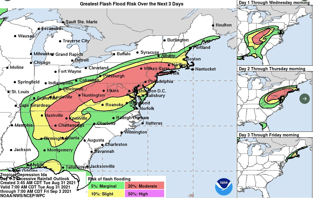
As Ida tracks northeast, it will pull tropical moisture into the eastern parts of the country. The tropical moisture and associated lift with the remnants of Ida, paired with a cold front and terrain induced precipitation will lead to a significant flood threat from northern Alabama, northern Georgia, Tennessee, Kentucky, southern Ohio, western North Carolina, West Virginia, Virginia, Pennsylvania, the Hudson Valley and NYC, New Jersey, Connecticut, Rhode Island, and Massachusetts.
This is where a widespread 2 to 6 inches of rain will fall with areas receiving up to 10 inches of rain.
Rain forecast
Rain this heavy will create a significant flash flood threat for the aforementioned areas. The flood threat will shift from southwest to northeast from today through Thursday. Get the video forecast for this event and other exclusive weather content in our Supporter Group.
Flash flood risk
There is a tornado risk today and Wednesday as the remnants of Ida track northeast. Today’s tornado risk exists from northern Florida into the Southeast and Mid-Atlantic. Wednesday’s tornado risk is across the Carolinas and Mid-Atlantic.
Get the video forecast for this event and other exclusive weather content in our Supporter Group.