A strong system to bring snow to much of the East Coast
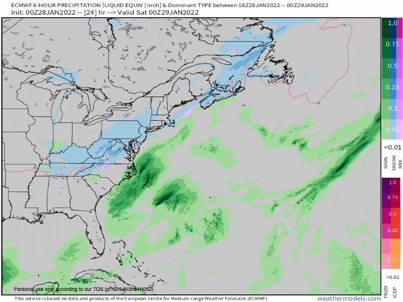
A high-impact winter storm looks to impact many areas along the East Coast this weekend. An area of low pressure will develop and track just off the East Coast this weekend, rapidly intensifying as it does so. This track will spread impacts into many areas from the Carolinas, to the Mid-Atlantic, Northeast & New England from Saturday through Sunday as the low pressure moves north-northeast.
The low pressure will start to get its act together Saturday off the coast of the Carolinas then rapidly strengthening overnight Saturday into Sunday off the coast of New England. While there are some questions about the track (i.e. how close or how far from the coast the low will track), models are starting to come into an agreement of the track of the low and that agreement suggests impacts will be felt from the Carolinas to Maine with significant impacts possible for some areas.
Right now, it appears the low will track in the “sweet spot” in which the low will track close enough to the coast for precipitation coastal areas and far enough off the coast for cold air to be pulled into the system for wintry precipitation. Initially, some rain is possible for coastal parts of the Carolinas overnight Friday into Saturday with snow wrapping into those areas and other parts of the Carolinas, and most areas farther north seeing all snow along the coast from Saturday through Sunday as the low tracks northeast.
While it’s too early to focus on the exact snowfall numbers, we have moderate confidence in which areas will be favored to see what type of precipitation and a general idea of how much. Right now, it appears this will mainly be a snow event for coastal areas from the Mid-Atlantic, and New England with some snow extending down into the Carolinas. At this time, half a foot to a foot of snow looks to fall for coastal areas of the East Coast from Virginia to Maine. Isolated higher amounts are possible for Southern New England into Maine. Extending farther, inland amounts will be significantly less with a tight snowfall accumulation gradient from the coast to inland areas. Farther south into the Carolinas, it appears some areas will see up to two inches of snow with the favored upslope areas of higher terrain seeing higher amounts. The higher terrain of North Carolina and South Carolina could see a few inches fall. Even far northeastern Georgia could see a few flakes. (Keep in mind, a slight shift in the track of the low pressure would cause significant changes in the current forecast)
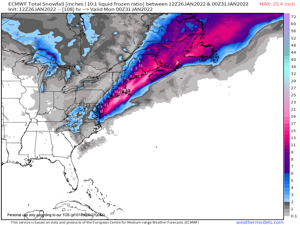
As this system strengthens off the coast of New England, expect the winds to really ramp up for coastal parts of New England. Gusts higher than 60 mph are possible along with the heavy snow.

Travel issues and power outages are a concern!