Arctic cold front to shatter records & aid in wintry precipitation
A large dip in the jet stream will send an Arctic cold front deep into southern parts of the country by early this upcoming week (Fig. 1). The cold front will move through the Southern Plains late Sunday night (tonight) into Monday; followed by the front rapidly advancing into the South & Southeast Monday night through Tuesday. The airmass behind this front is extremely cold for this time of the year and will be the coldest air of the season. Millions of people will experience below-freezing temperatures, including down the the Gulf of Mexico, and many records are at risk of being shattered (see Fig. 2). Temperatures will be 10-30 degrees below average.
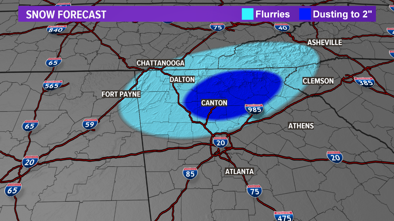
Fig. 1: Big dip in jet stream early week
Fig. 2: Record cold temperatures for millions possible
Southern Plains
The Arctic cold front will push south Sunday night (tonight) into early Monday morning for Oklahoma and northern Texas. Temperatures will rapidly fall below freezing behind the cold front as northerly winds of 30-45 mph usher in the cold air. Wind chills by Tuesday morning will fall into the teens & 20s for a good part of Oklahoma and Texas (see Fig. 3). High temperatures will struggle in the 30s & 40s with lows in the teens & 20s through mid-week. Along with the cold temperatures & wind, post-frontal precipitation will occur. Some of this post-frontal precipitation will fall in the form of freezing drizzle & sleet Sunday night, and eventually some light snow by Monday across the Texas Panhandle, central & northern Oklahoma and northern Arkansas (see Fig. 4 & 5). Minimal accumulations are expected but a few slick spots may develop along I-40 from the Texas Panhandle east into northern Arkansas.
Fig. 3: Wind chills Tuesday morning
Fig. 4: Future radar 10:30 am Monday
Fig. 5: Future radar 1:30 pm Monday
As the cold airmass moves south & east late Monday into early Tuesday, some of the post-frontal precipitation may briefly change into a wintry mixture for parts of central Texas & the Texas Hill County (see Fig. 6 & 7). Right now, minor accumulations are expected but a few slick spots may develop.
Fig. 6: Future radar 12:00 am Tuesday
Fig. 7: Future radar 8:00 am Tuesday
Southeast
The South & Southeast will get in on the cold airmass by Tuesday. This will knock high temperatures into the 30s & 40s through mid-week with lows in the 20s & 30s. A very brief period for light freezing drizzle or sleet may occur late Monday night into early Tuesday morning across northern Mississippi, northern Alabama and northwest Georgia (see Fig. 8, 9 & 10). The window for freezing/frozen precipitation is short for Mississippi, Alabama and Georgia and most areas should not see accumulations. Farther north into Tennessee, a longer duration & colder temperatures will allow for light to moderate snow accumulations (see Fig. 11). By Wednesday morning, wind chills will be in the teens & 20s for a large part of the South & Southeast (see Fig. 12).
Fig. 8: Future radar 11:30 pm Monday
Fig. 9: Future radar 3:00 am Tuesday
Fig. 10: Future radar 5:00 am Tuesday
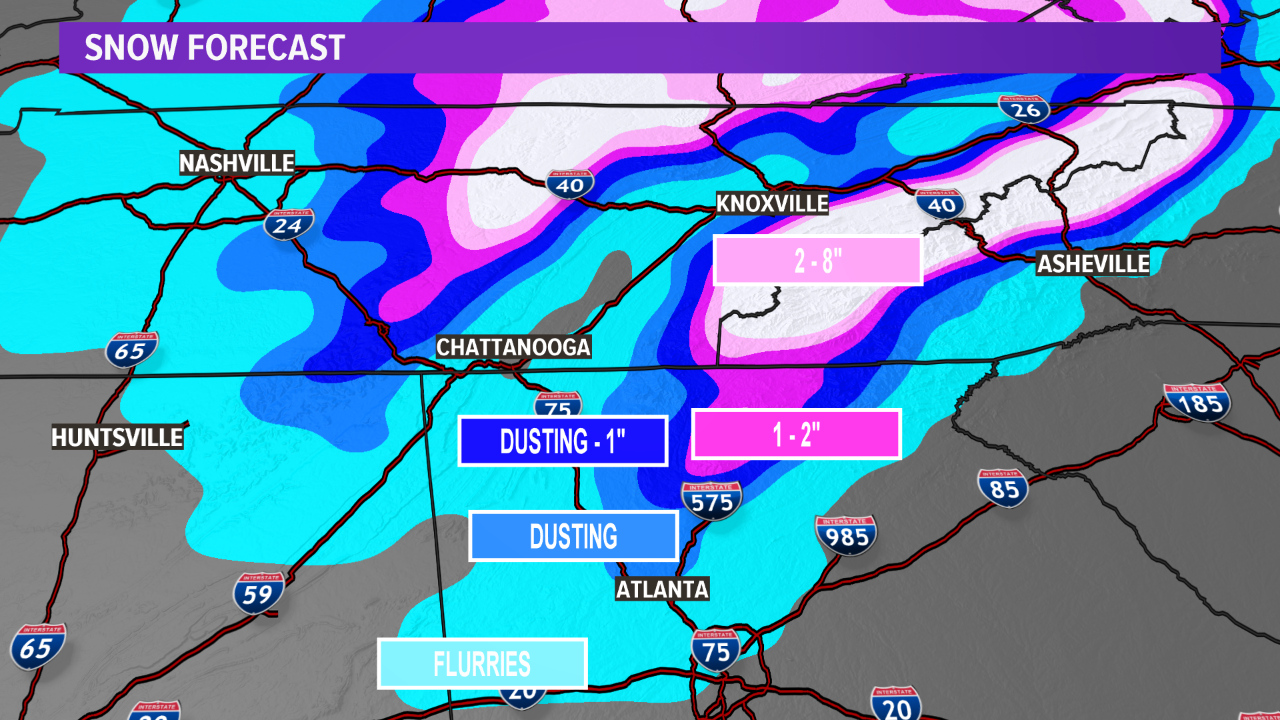
Fig. 11: Snow accumulation forecast through Tuesday
Fig. 12: Wind chills Wednesday morning