Severe storms & tornadoes are likely today with strong tornadoes possible
Today will be an active severe weather tornado for parts of the South, Mid-South, Tennessee Valley, Ohio Valley, Southeast, Carolinas, and Mid-Atlantic. Thunderstorms have already developed this morning west of the Mississippi River. These storms are expected to become severe and advance east throughout the late morning and into the afternoon & evening hours. There is the possibility for thunderstorms to produce tornadoes, damaging winds, and large hail. Watch a video on this severe event.
Because of the thunderstorm potential, risk areas have been included for the aforementioned areas by the Storm Prediction Center. The risk area extends from eastern Texas/Oklahoma east to the Carolinas/Virginia. There’s a low risk (dark green), medium risk (yellow), and high risk (orange). If you live in a risk area, you need to take the thunderstorm risk seriously, even if you’re “just” in a low-risk area–severe storms will still be possible, possibly just in more of an isolated nature.
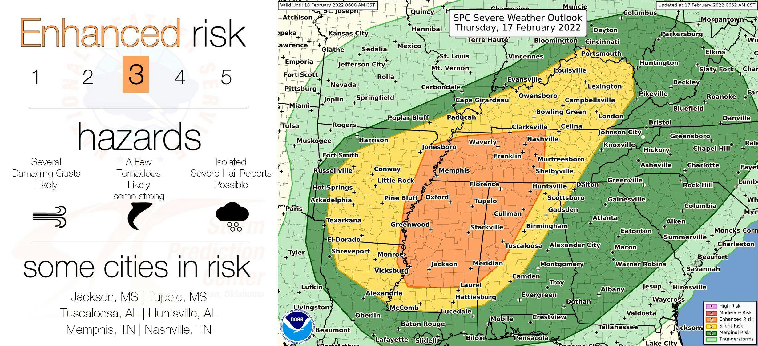
Thursday’s severe risk area
All modes of severe weather are possible including tornadoes, damaging winds, and large hail. It’s possible a couple of strong tornadoes will occur too. The greatest concern for tornadoes, including strong tornadoes, will be within the high-risk area extending into the medium-risk area. The severe risk will start early in the day west of the Mississippi River and advance east throughout the day into the afternoon and evening hours.
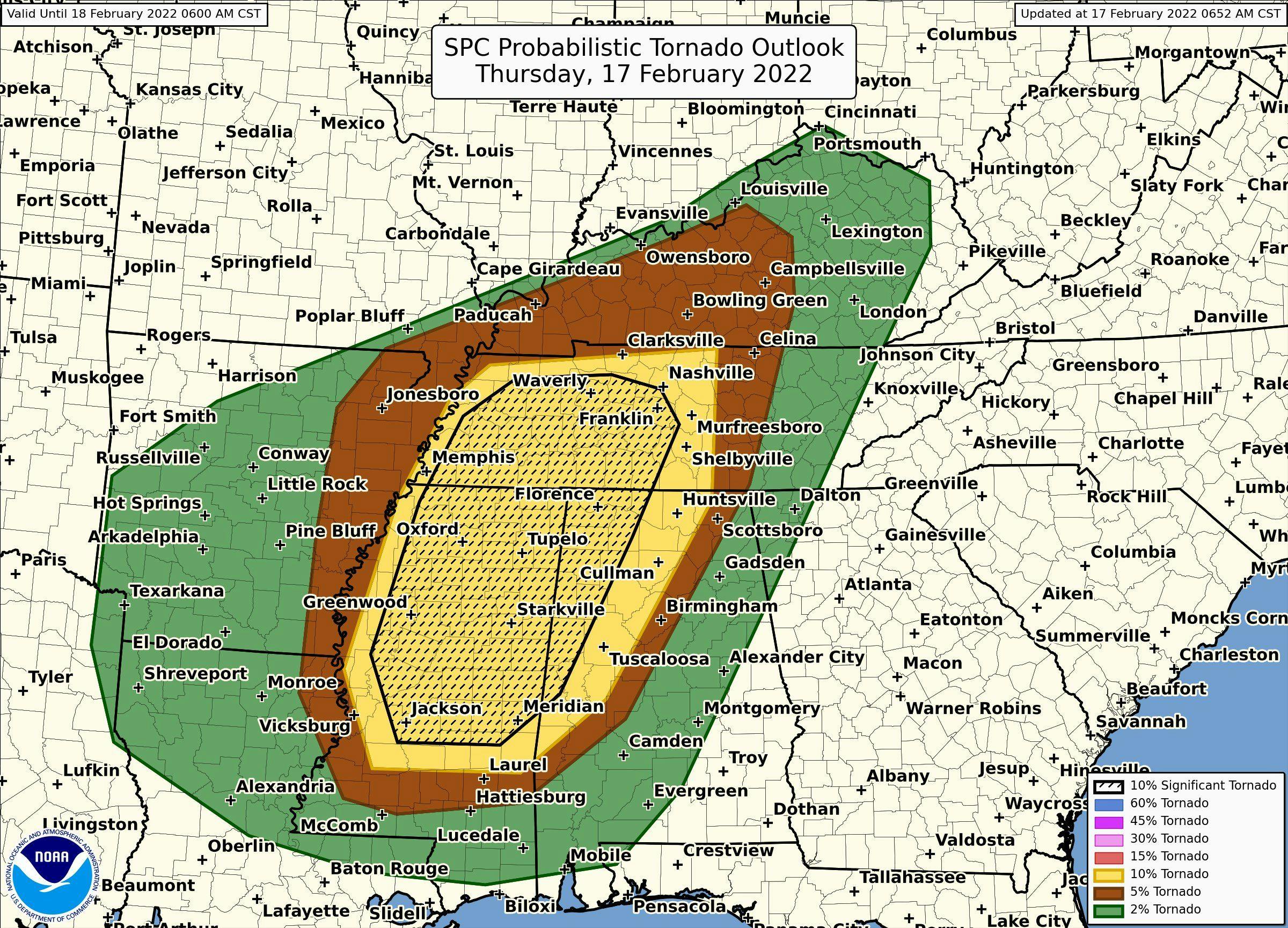
Tornado probability
If you live in a risk area, please have a plan in place in case a warning is issued. Know what to do and where to go in your home. Don’t forget about the pets!