Get your latest weather forecast and alerts.
Winter Weather

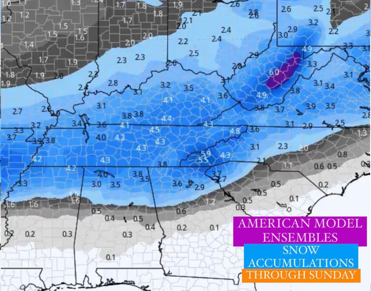
Winter storm to impact parts of the South and Southeast
Tuesday, January 7, 2025 12:26 AM
Winter storm to impact parts of the South and Southeast this week
Weather Highlights

Saturday, August 3, 2024 3:34 PM
- Hello
Winter Weather
Winter storm to impact parts of the South and Southeast
Tuesday, January 7, 2025 12:26 AM
Winter storm to impact parts of the South and Southeast this week

Winter Weather
Southeast winter storm later this week
Sunday, January 5, 2025 5:06 PM
Southeast winter storm later this week into the weekend

Winter Weather
Growing concern and increasing confidence in winter storm next week
Saturday, January 4, 2025 9:03 PM
Growing concern and increasing confidence in winter storm next week

Winter Weather
Winter storm to bring heavy snow, ice to a large swath of the country
Wednesday, January 1, 2025 11:19 PM
Winter storm to bring heavy snow, ice to a large swath of the country this weekend into early next week.

Winter Weather
Dangerous Arctic Outbreak In January
Sunday, December 29, 2024 1:05 AM
Dangerous Arctic Outbreak In January for areas east of the Rockies

Severe Weather
PDS Tornado Watch issued: large violent, long-track tornadoes possible
Saturday, December 28, 2024 8:55 PM
PDS Tornado Watch issued: large violent, long-track tornadoes possible