Category 4 Hurricane Joaquin continues to hit the Bahamas.
Hurricane Joaquin became a category 4 Hurricane earlier today and continues to batter the Bahamas with very dangerous conditions. High winds and flooding have caused severe problems for the islands and those conditions look to continue for several more hours. Joaquin is beginning to press up against the trough in the southeastern United States and will eventually begin to make the turn to the north, but it will not do so quick enough to spare the Bahamas from additional damage. Satellite images of the eye have shown westward trends throughout the day, but in the latest images Joaquin once again began a southwesterly movement. The turn to the north is expected to take place sometime this evening or overnight but the further west Joaquin goes, the more of a hazard it should pose to coastal areas of the United States. Another interesting piece of information to include now is the possible formation of yet another tropical system out of the remnants of Ida, which can be seen below to the East northeast of Joaquin. This possible development will just add yet another wrinkle into what is already a very difficult forecast.
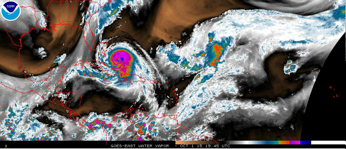
Currently, Joaquin is located at 23.0 N and 74.4 W, with maximum sustained winds of 130 mph and winds gusting to 160 mph. The minimum central pressure continues to drop and is now down to 936 millibars.
![]()
Hurricane Warnings are still in effect for the Central and Northern Bahamas with only the Islands of Bimini and Andros still under a Hurricane Watch and all Islands, including the Turks and Caicos not under a Hurricane Warning are under a Tropical Storm Warning at this time.
While the long range models continue to fluctuate with the forecast track beyond 3 days, what is certain is that Joaquin will turn to the North sometime this evening or tonight and begins to track in the direction of the Outer Banks, the forecast calls for Joaquin to remain off the coast from the Outer Banks but heavy surf, rain from the Outer Bands, and gusty winds during tropical thunderstorms are likely in that area over the weekend. A track closer to the coast is still possible but less likely, but interests in that region should continue to monitor Joaquin in future forecasts. Interests in the Mid-Atlantic and New England should closely monitor Joaquin, as the long range models have Joaquin making his closest pass to land near Cape Cod.
Stay here with Firsthand Weather for all your news on Joaquin as we nail down this track and keep you advised of the latest information at all times.
Forecaster Robert Millette