Multiple rounds of severe weather to impact central parts of the country over the next several days
Multiple round of severe thunderstorms will impact central parts of the lower-48 late this week through the weekend. Damaging winds, large hail, and isolated tornadoes are all possible with the intense thunderstorms.
A favorable spring-like pattern has setup across the lower-48, which will allow for multiple rounds of thunderstorms over the coming days. Deep gulf moisture has surged north into the Plains. This warm, moist air mass will help feed storms that develop across the region. Several “triggers” for storms will approach the region as the upper-levels of the atmosphere are ripe for thunderstorm initiation.
A potent storm system is out over the West Coast with a strong heat ridge over southeastern parts of the lower-48. This will allow areas of lift, which lead to thunderstorm development, to move out of southwestern parts of the country into the Plains. Each area of lift will lead to thunderstorm development each afternoon.
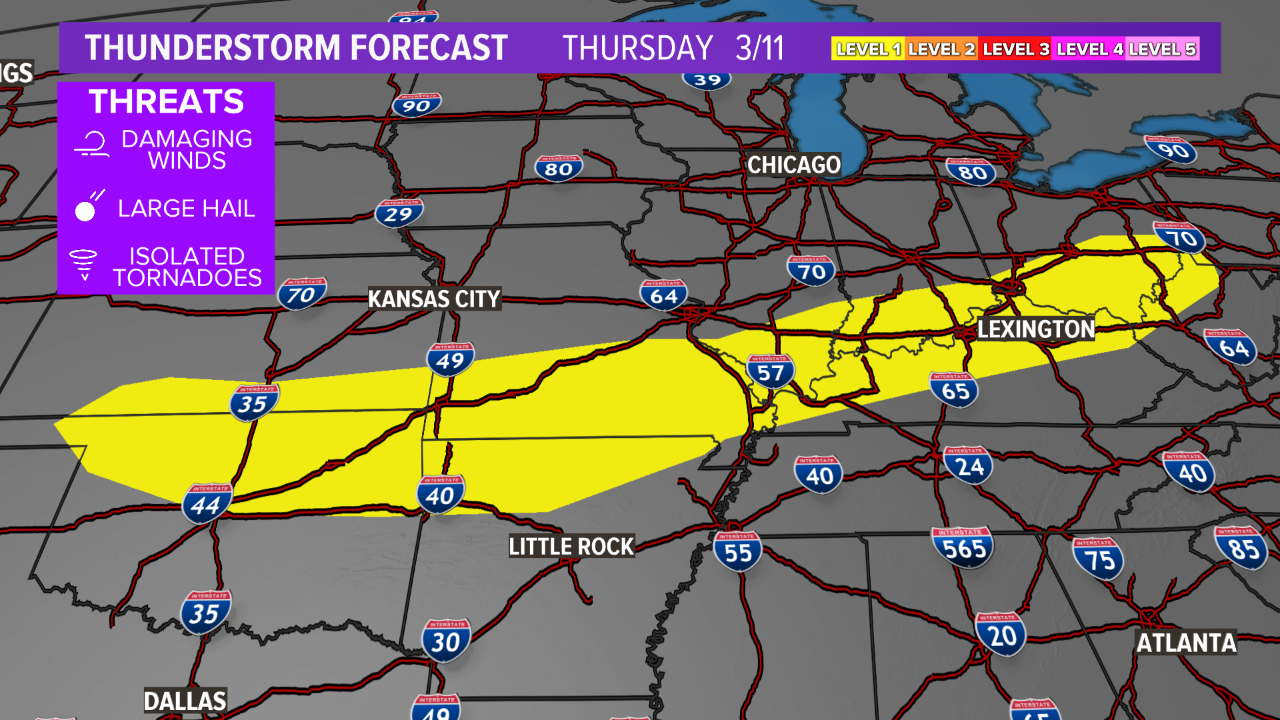
Thursday
Severe thunderstorms are possible Thursday. A Level 1 risk for severe thunderstorms exists from the Ohio Valley, southwest into northern Oklahoma. The main hazards are gusty winds and hail, but an isolated tornado cannot be completely ruled out. This risk area includes Oklahoma City, Tulsa, Louisville, Cincinnati, and Columbus.
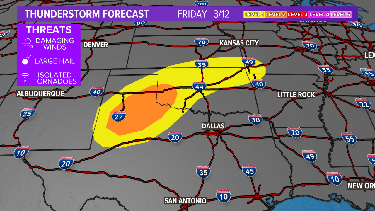
Friday
A higher risk for severe thunderstorms arrives Friday afternoon as the storm system over the West Coast moves east into the Desert Southwest. A Level 2 risk extends from central Oklahoma down into northwestern Texas and the Texas Panhandle. A Level 1 risk surrounds the Level 2 risk. All modes of severe weather are possible. This includes tornadoes, hail, and wind. Oklahoma City, Tulsa, Amarillo, Wichita Falls, Lubbock, and Tulsa are included in the risk area.
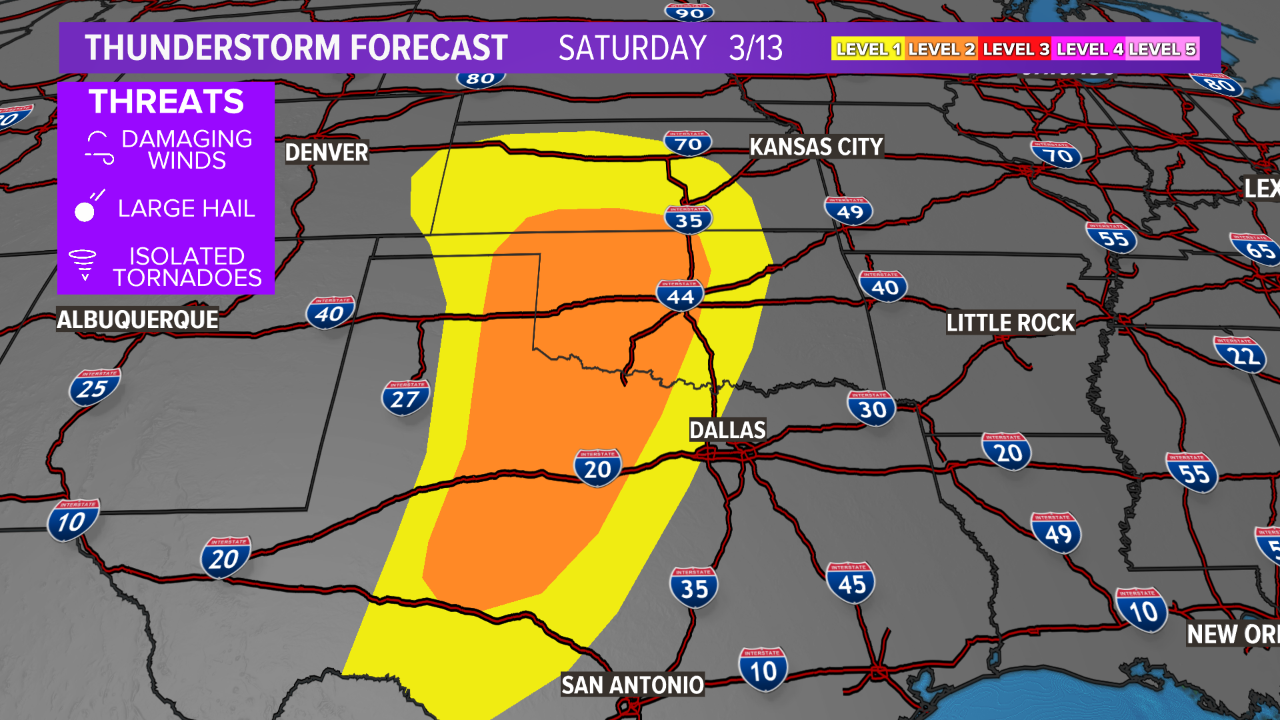
Saturday
The severe risk increases over the weekend as the storm system moves toward the Plains. This will elevate the severe risk on Saturday with a Level 2 extending from western Texas, north into south-central Kansas. Tornadoes, hail, and wind are possible late-Saturday. The risk area includes Wichita Falls, Oklahoma City, Tulsa, and the western-half of the Dallas-Fort Worth Metroplex.
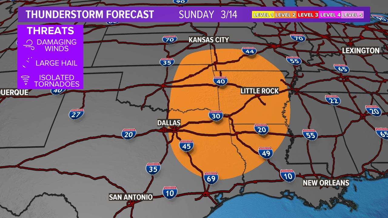
Sunday
The storm system moves into the Plains on Sunday, shifting the severe threat farther south and east. It is likely severe storms will continue overnight into Sunday morning just east of I-35, slightly weakening, before regaining strength Sunday afternoon, east of I-45. There is a Level 2 risk for eastern Texas, eastern Oklahoma, northern Louisiana, Arkansas, southern Missouri, and far western Mississippi. The main hazard is wind but an isolated tornado and hail cannot be ruled out. The risk area includes Little Rock, Shreveport, Tulsa, and the eastern-half of the Dallas-Fort Worth Metroplex.
It does appear a severe threat will shift east into Dixie Alley and the Tennessee Valley to start the work week but the details are still being ironed out.