A blizzard will dump a foot of snow for some areas
A high-impact winter storm will deliver areas of snow, some of it heavy, to parts of the Northern Plains this evening, tonight, and Friday. The winter storm’s snow will be paired with strong, gusty winds as the system begins to intensify. The strong winds with the snow will greatly reduce visibility, making travel tricky. Because of the expected impacts, there are Blizzard Warnings, Winter Storm Warnings, and Winter Weather Advisories in effect for parts of the region. If you’re in or near the winter weather alerts, please be extremely cautious if you must get on the roads.
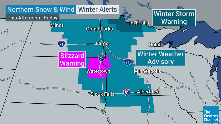
Current winter weather alerts (graphic courtesy of the Weather Channel)
The areas under the winter weather alerts will see several inches of snow. This includes eastern parts of the Dakotas, Minnesota, northern Iowa, and western and northern Wisconsin. Close to a foot of snow is expected in northeastern South Dakota, northeastern North Dakota, and northern Minnesota. Some parts of northern Minnesota could actually see a foot and a half of snow.
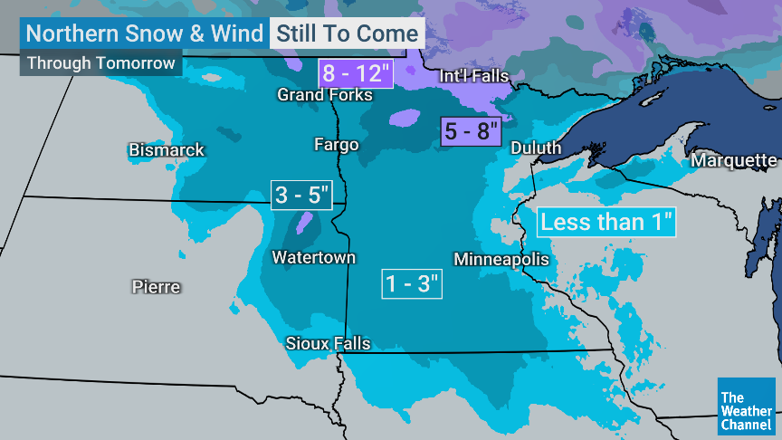
Snowfall accumulation forecast (graphic courtesy of the Weather Channel)
Another round of snow is on the way to this area over the weekend! Winter is here. See the latest winter outlooks below.
Read the NOAA Winter Outlook here.
Read the AccuWeather Winter Outlook here.