A few tornadoes and damaging winds expected for the Southeast and Mid-Atlantic today
Another round of active weather and severe thunderstorms is expected today for parts of the Southeast and Mid-Atlantic as a cold front clashes with a warm, moist airmass across the region. Storms are ongoing early in the day today across western parts of the risk area. These storms will gradually shift east throughout the day and grow in intensity and coverage. Severe storms are likely from late morning into the afternoon and evening hours. Because of the severe threat, the Storm Prediction Center has highlighted a region from the Southeast, Carolinas, Mid-Atlantic, and Ohio Valley within an enhanced (orange – level 3/5), slight (yellow – level 2/5), and marginal (dark green – level 1/5) severe risk.
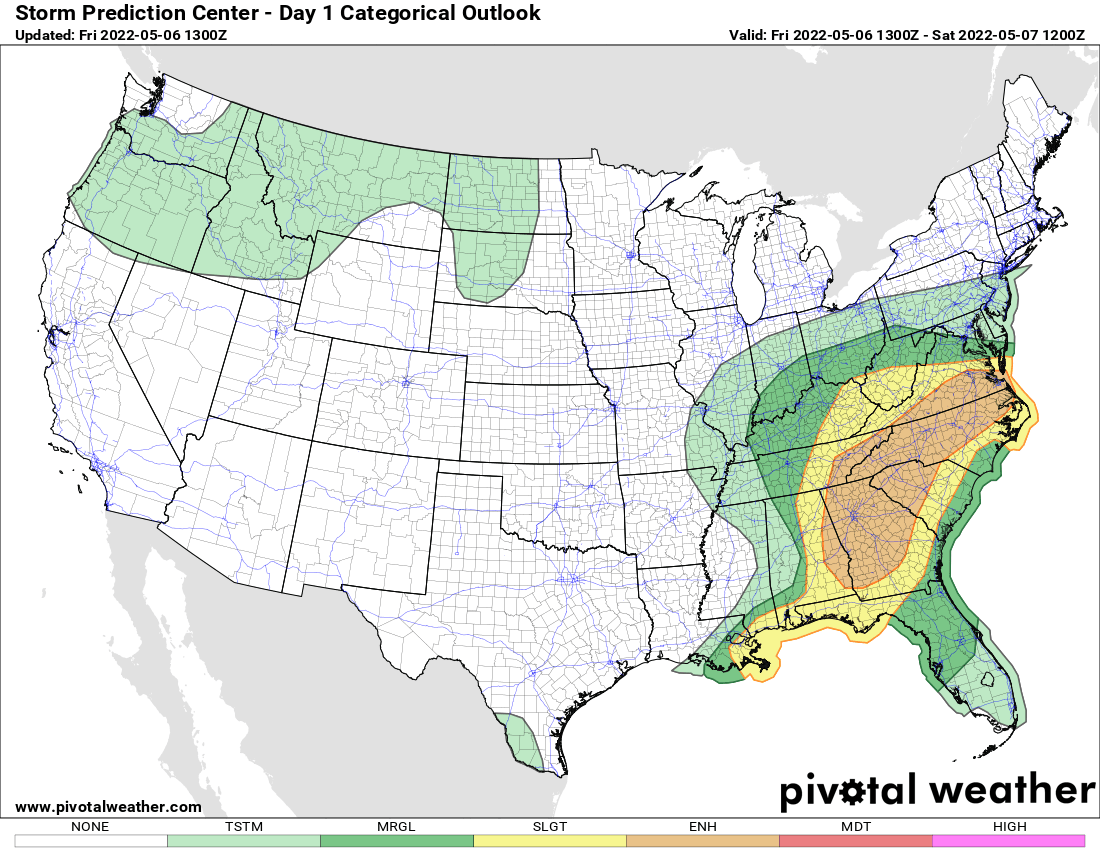
Today’s (Friday) thunderstorm outlook
All modes of severe weather are possible. This includes tornadoes, damaging winds, and hail. The main concern is damaging winds with a secondary threat of a few tornadoes along with hail. Thunderstorms will have the capability to produce winds between 60 to 75 mph with the strongest storms that develop this afternoon. The greatest concern for damaging winds exists from eastern Alabama into Georgia, eastern Tennessee, South Carolina, North Carolina, and Virginia.
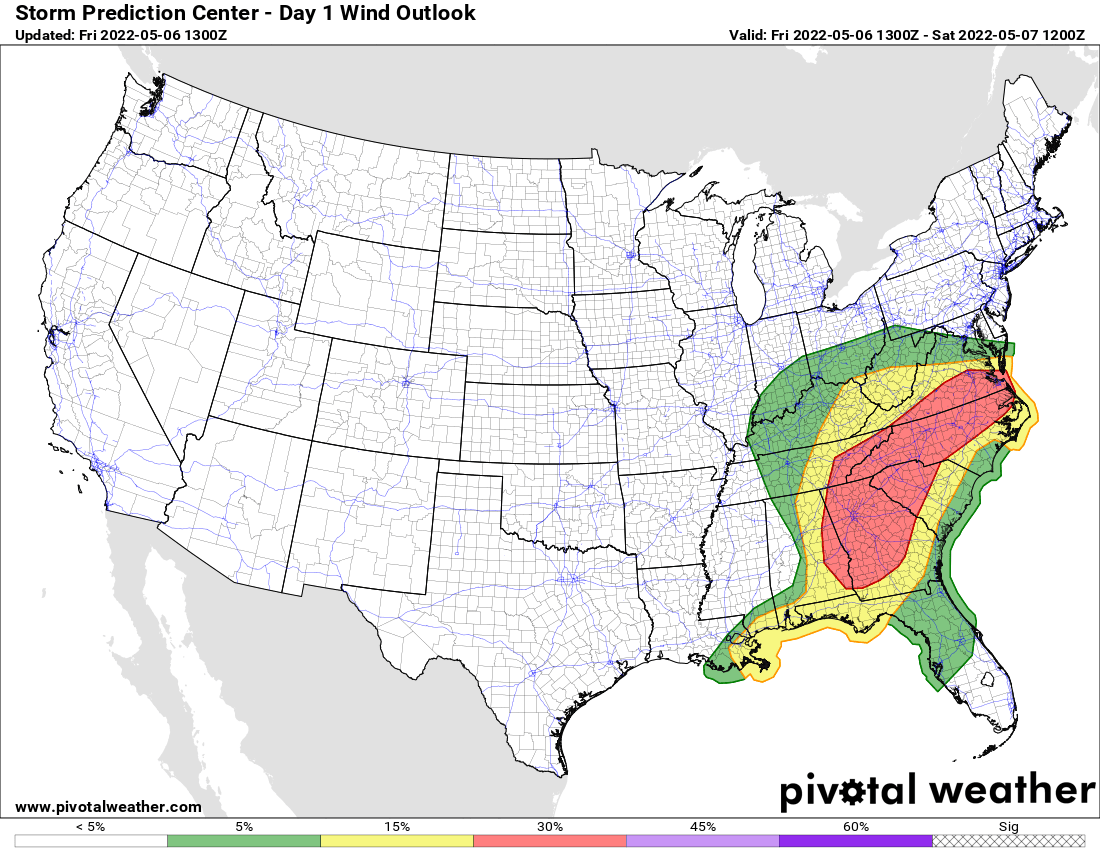
Today’s (Friday) wind threat
A few tornadoes are also a concern this afternoon and evening. Any storm will have the capability to produce tornadoes this afternoon with a higher concern near a warm front that will lie across North Carolina and Virginia. Because of the warm front and favorable tornadic environment near the warm front, there is an elevated tornado risk from northern North Carolina into southern Virginia. There is another elevated tornado risk across eastern Alabma and Georgia.
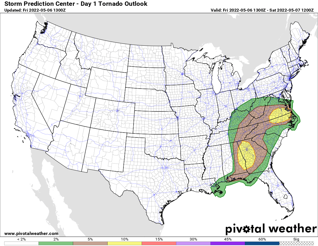
Today’s (Friday) tornado threat
If you live in or near the risk areas, please have a plan in place in case a warning is issued, and have a couple of reliable sources to receive weather warnings from.