A first look at the upcoming winter storm
All eyes are on the upcoming possible winter storm that could impact parts of the Northern Plains, South, Southeast, and East Coast late this week, weekend, and early next week. See more details on the winter storm.
Confidence is growing that there will be high-impact storm system tracking across the eastern half of the lower-48 during this timeframe. While confidence is growing in this system, there are still some big finer-detail questions that need to be ironed out that will allow for quite a bit of change in this forecast over the coming days. With that said, here is a first look at the preliminary snow & ice forecast with this storm system. Watch the latest video on this system in the Firsthand Weather Supporter Group.
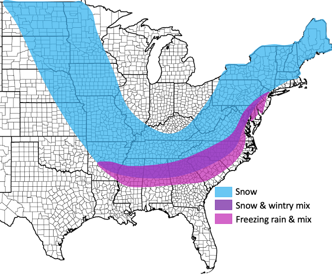
Areas in and around the blue area have the best chance to see accumulating snowfall. Areas in and around the purple area have the best chance to see a wintry mix of freezing rain & sleet, followed by snow. Areas within in around the pink area have the best chance to see freezing rain. Keep in mind, this will be fine-tuned with more detail over the coming days, and not all areas within the shaded area will see wintry precipitation. This is a broad look at which areas *could* see the wintry impacts and the areas will continue to be narrowed down and fine-tuned as confidence increases. Once the confidence increases enough, eventual accumulations will be added.
Please keep checking back for updates over the coming days.