A high-impact system to bring the potential of severe weather and snow to parts of the South & Southeast late week into the weekend
Firsthand Weather is monitoring the potential for severe thunderstorms and wintry weather for parts of the South & Southeast this Friday and Saturday as an upper-level system sends a batch of Arctic air south into the lower-48. Ahead of this Arctic air mass, a warm, moist, unstable air mass will build across the South & Southeast later this week. As this cold front clashes with the unstable spring-like air mass, it will trigger a line of thunderstorms on Friday across the South. While early and with still some questions to be ironed out, it appears favorable wind shear and a developing surface area of low pressure could allow for thunderstorms to become strong, possibly severe on Friday including the possibility of isolated tornadoes.
The favored areas appear to be from eastern Texas, southern Arkansas, Louisiana, and Mississippi Friday afternoon and spreading east into Alabama, Georgia, and north Florida during the evening and overnight hours. It’s possible the severe threat continues on Saturday for eastern parts of Georgia, northern Florida, and the Carolinas. Currently, there is no severe risk area outlined by the Storm Prediction Center but this could change over the coming days. If you live in the aforementioned area, make sure you keep a close eye on the forecast and have a plan in place in case a warning is issued on Friday.
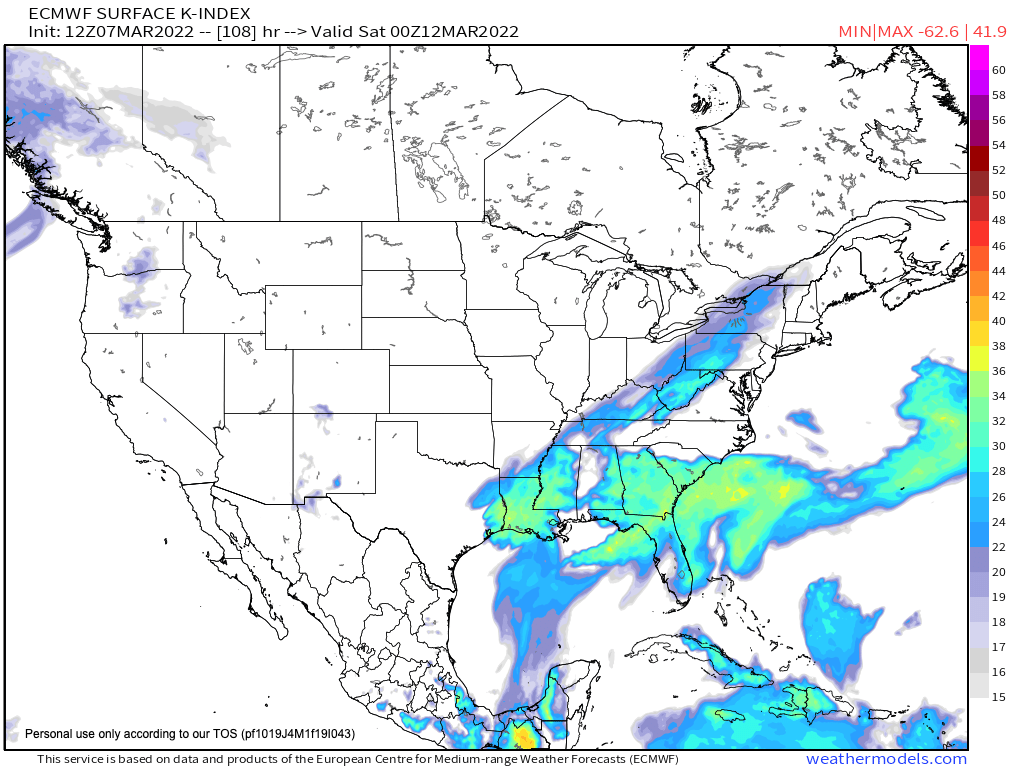
Favored areas for thunderstorms are within the blue, green, and yellow shaded areas across the South & Southeast late Friday (this image is from the European model courtesy weathermodels.com)
The next concern is the cold, Arctic air rushing into the South & Southeast late Friday into Saturday. This air will be quite chilly and subfreezing. This is important because it appears the developing surface area of low pressure could help pull in enough moisture into the colder, subfreezing air for a quick changeover to wet snow for parts of the South & Southeast late Friday into Saturday. It needs to be mentioned that there are a lot of questions with this set up and this is a low confidence forecast but the guidance does support the cold air and moisture to overlap long enough for wet snow for some areas during this timeframe. The favored areas are Oklahoma, northern Texas, Arkansas, and central & southern Missouri Friday; eventually spreading into northern Mississippi & western Tennessee overnight Friday; and eventually into the rest of central & eastern Tennesee, northern Alabama, northern Georgia, Kentucky, the mountains of North Carolina, and potentially Upstate South Carolina on Saturday morning. Join the Firsthand Weather Supporter Group.
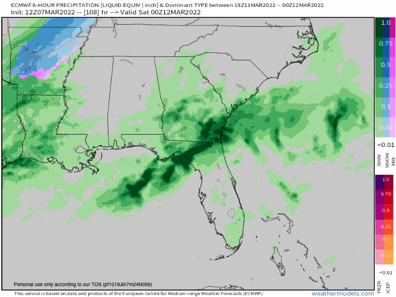
Future radar late Friday into Saturday. Green and dark green show rain & storms while blue shows snow (this GIF is from the European model courtesy weathermodels.com)
It needs to reiterated that there are a lot of questions with this forecast, it’s low confidence, and snow is not a guarantee for the aforementioned areas, but models are suggesting this is a possibility and while confidence is low at this time, confidence is increasing some areas will see snow late Friday and Saturday. It’s too far out for accumulation forecasts but this will be monitored over the coming days.
Behind the cold front, quite chilly air will stick around for a couple of days with a widespread freeze for the South & Southeast this weekend so bring the pets inside and protect the plants.
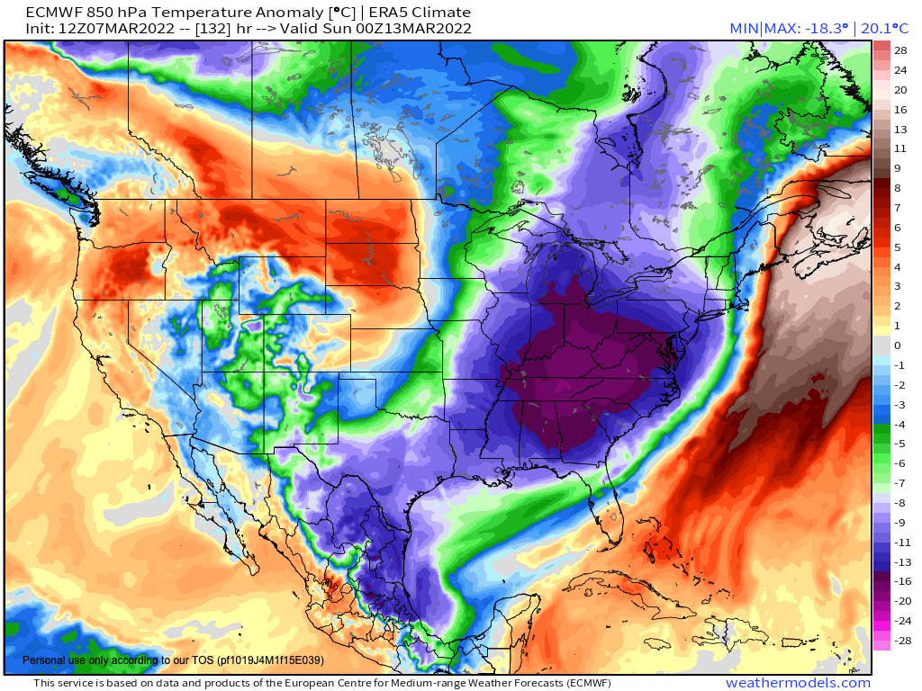
Temperature departures from average. The blue, green, and purple shaded areas across the eastern half of the country depict below-average temperatures while the orange and red colors depict above-average temperatures this weekend (this image is from the European model courtesy weathermodels.com)