A sign of the times and changing seasons: SNOW
It is a sign of the times and of the changing seasons. The storm track starts to dip farther south and becomes more active. This is when the first flakes start to fall in the higher elevations across the western states, and this is exactly what we will see over the next several days. Some of the higher peaks across the Pacific & Inland Northwest and Interior West will see light accumulations among the highest peaks. This is great news given the latest drought conditions and a promising sight for ski resorts.
Join the Firsthand Weather Supporter Group today for additional and exclusive weather content.
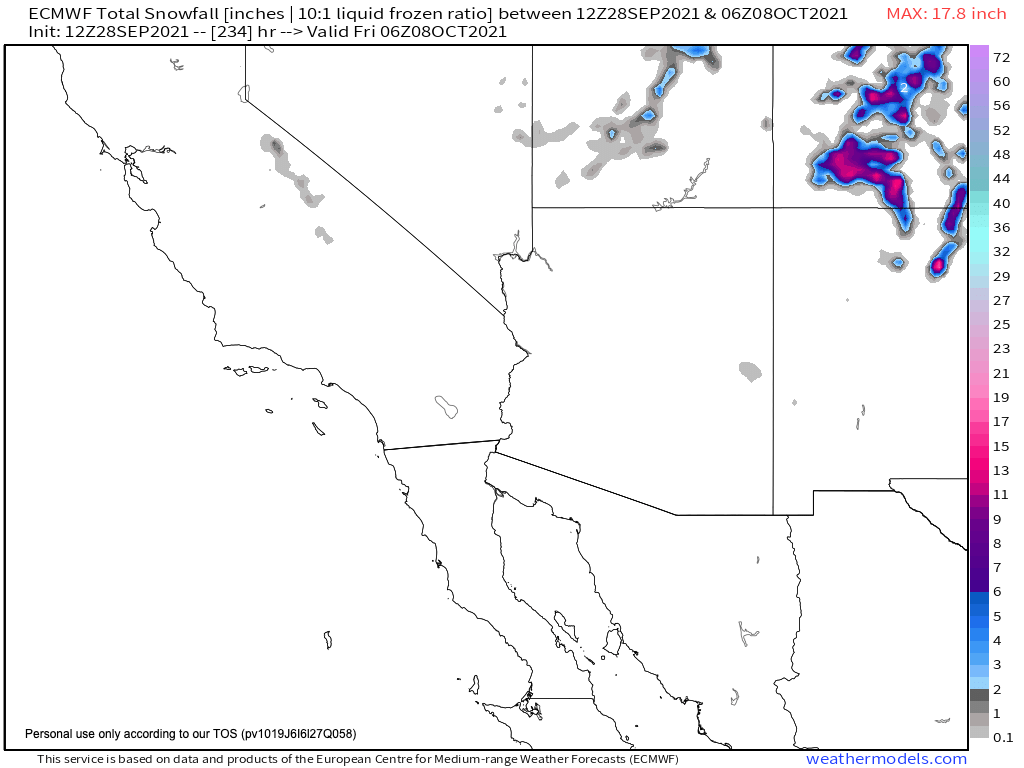
Fig. 1: Northwest snow forecast over the next several days (WeatherModels.com)
Fig. 2: Southwest snow forecast over the next several days (WeatherModels.com)
Some of the heaviest snow from mid-week through the upcoming weekend will actually fall across New Mexico and Colorado. Several inches of snow are forecast above 10,000 feet. It is possible the rain/snow line may fall down to around 9,000 feet but significant accumulations are not expected that low.
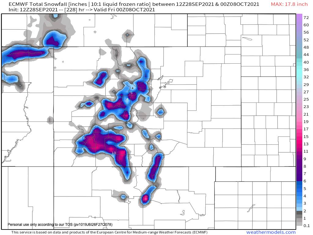
Fig. 3: Colorado & New Mexico snow forecast over the next several days (WeatherModels.com)
It’s just a matter of time before the first chance for snow arrives in most forecasts as the days grow shorter and colder!
Join the Firsthand Weather Supporter Group today for additional and exclusive weather content.