A tornado & severe outbreak is possible for the South today
A dangerous high-impact severe weather day is expected today for much of the South with the possibility of a tornado & severe outbreak. All the ingredients have come together to support a hyperactive severe weather day throughout the day today into the evening and nighttime hours. All modes of severe weather are possible including tornadoes, damaging winds, and hail. The main concern is the possibility of significant damaging winds and tornadoes and all indicators suggest some tornadoes could become strong or violent this afternoon & evening along with some enhanced damaging winds. There’s the possibility of EF3 – EF5 tornadoes from the Tennessee Valley & Mid-South into the Deep South along with severe storms producing damaging winds in excess of 75 mph. Join the Firsthand Weather Supporter Group.
Because of the substantial severe threat, the Storm Prediction Center has highlighted the entire region as a severe risk and has issued a moderate (red – level 4/5) severe risk for eastern Louisiana, eastern Arkansas, much of Mississippi, and western & central Alabama, western Tennessee, and the Florida Panhandle. Surrounding the moderate severe risk is an enhanced (orange – level 3/5), slight (yellow – level 2/5), and marginal (dark green – level 1/5) severe risk for the duration of today.
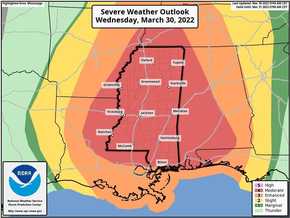
All severe risk areas have a chance to see all modes of severe weather. The greatest concern for tornadoes and widespread damaging winds is within and near the moderate and enhanced severe risk areas.
If you live in or near any of these severe risk areas, please keep a very close eye on the forecast. You want to have a plan in place to act immediately in case a warning is issued for your area, and you want to have reliable weather sources to receive timely, accurate weather warnings from.