Big jet stream changes bring big-time weather changes to the lower-48 this week
The weather has been relatively quiet for a good chunk of the lower-48 recently, especially for the southern half of the country. The culprit of the quiet weather and milder temperatures has been the jet stream being located pretty far north. Along with the northern placement of the jet stream, it has also been relatively flat. This is known as a zonal flow, which keeps the weather pretty inactive, leading to milder temperatures and less of a wintry and severe threat across most of the lower-48. Join the Firsthand Weather Supporter Group!
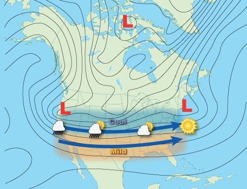
Zonal flow jet stream example (courtesy NOAA)
This flat, or zonal flow, will begin to break down this upcoming week. The jet stream will start to get “kinky”, which will lead to a more active weather pattern. This active weather pattern means more rain and storms, more wintery precipitation, and colder temperatures for parts of the country that have been relatively quiet as of late. Join the Firsthand Weather Supporter Group!
Notice the animated graphic below shows a few different storm systems delivering a plethora of weather to the lower-48 over the coming days and most areas will get in on the action. From showers and storms across the Southern Plains, South, and Southeast (some of which could be severe Sunday-Tuesday) along with snow for much of the West, Plains, Great Lakes, Ohio Valley, and Northeast.
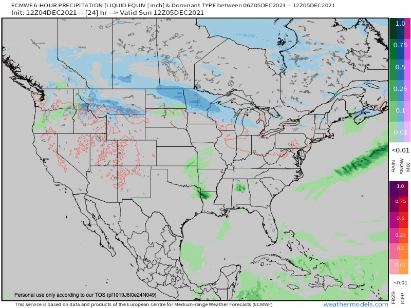
Simulated radar for this upcoming week (courtesy WeatherModels.com)
Areas of heavy precipitation are expected for the Pacific Northwest, central Rockies, and the eastern half of the country. The graphic below shows the precipitation totals through this upcoming week. Notice the Pacific Northwest will see 2-8 inches of precipitation. The valleys and lowlands will see this fall as rain while the mountains receive feet of snow. Even California, Arizona, Utah, Nevada, and New Mexico will get in on the rain with mountain snow. And yes, Colorado and Denver, you’re getting snow too! Farther east, good rain accumulations are expected for the South, Southeast, Carolinas, and Tennessee Valley. This is great news given the recent fires in the Southeast and Carolinas. Farther north, wintry precipitation is expected.
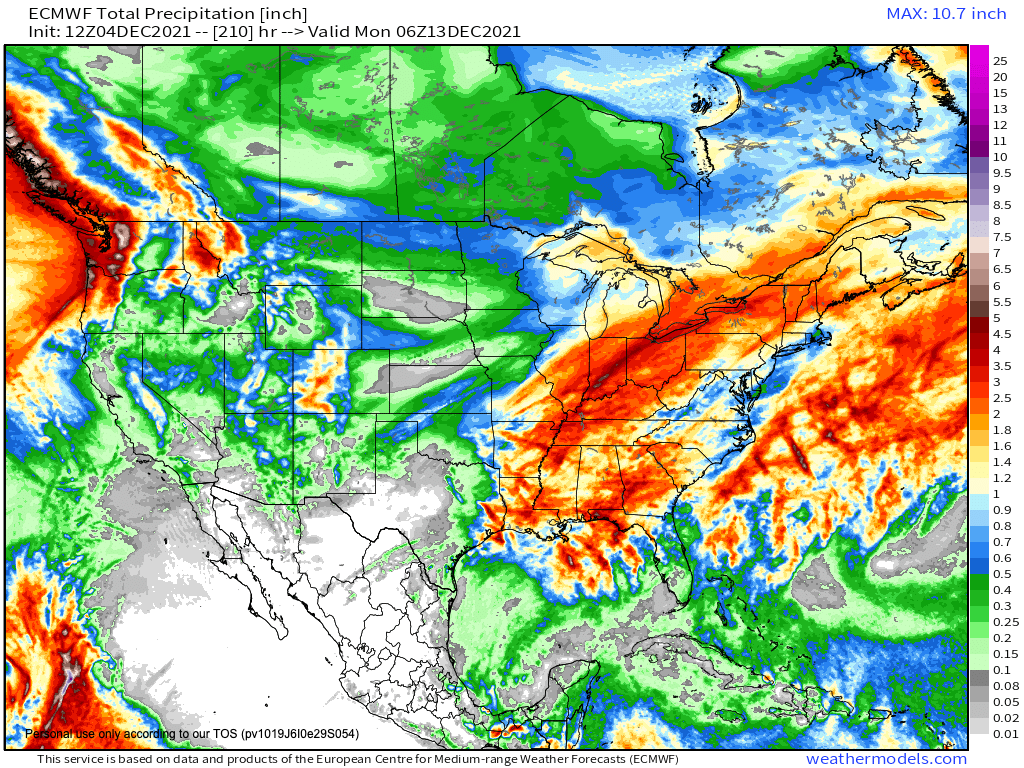
Precipitaiton accumulation forecast (courtesy WeatherModels.com)
Areas of heavy snow are expected for all the mountains out west. This is wonderful news for the snowpack and ski lovers. Feet of snow is expected. Even the mountains in southern California, and southern Arizona, and New Mexico will see inches of snow. The Great Lakes will get in on the action too with heavy snow. It’s possible some of the heavy snow extends into the Midwest and Plains with a developing winter storm later in the week but these details will be ironed out over the coming days.
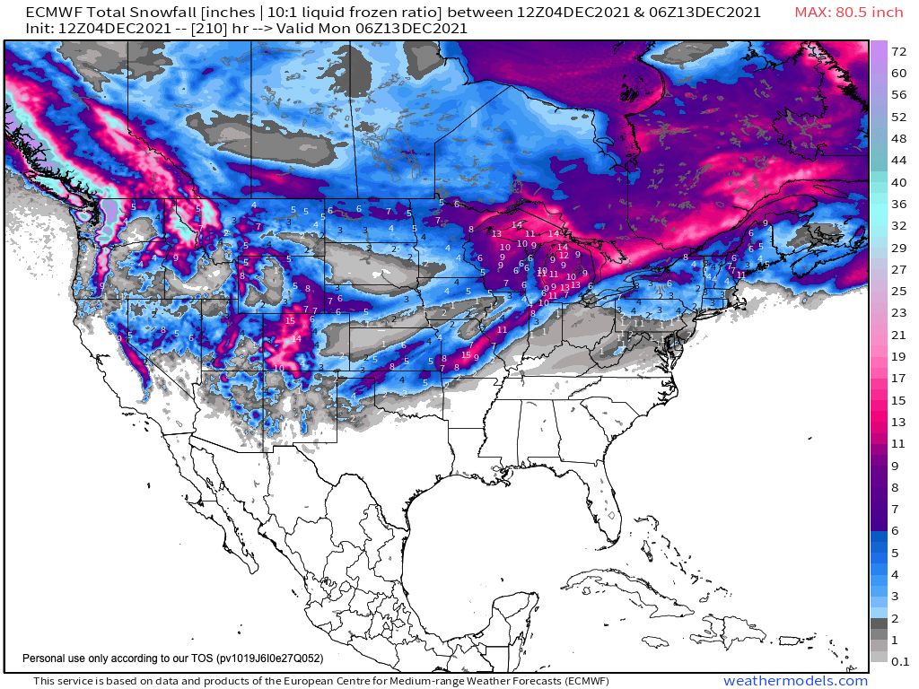
Snow accumulation forecast for this week (courtesy WeatherModels.com)
Each system will have a reinforcing shot of colder air with a potentially very strong cold front late this upcoming week into the weekend!
See the latest winter outlooks below.
Read the NOAA Winter Outlook here.
Read the AccuWeather Winter Outlook here.