Coastal low to impact parts of the Southeast and Carolinas
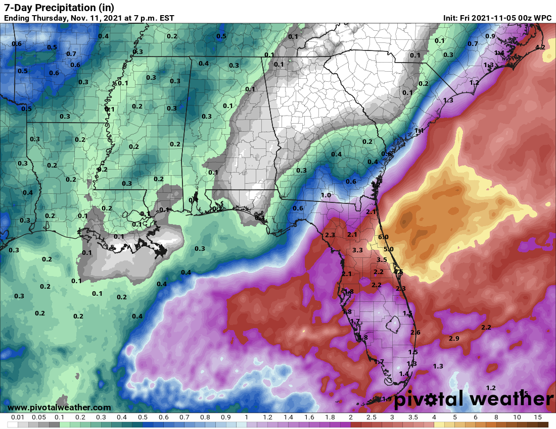
A non-tropical area of low pressure is developing in the Gulf of Mexico. This low will race east tonight and will move across Florida Friday. The area of low pressure will bring wind and rain to Florida with a low-end risk for tornadoes. By the weekend, the low will move off the Southeast Coast, bringing areas of heavy rain and gusty winds to southern and coastal Georgia, and coastal South Carolina and North Carolina this weekend. Join the Firsthand Weather Supporter Group today!
2-5 inches of rain is expected for Florida with parts of Georgia and the Carolinas receiving 1-3 inches of rain, leading to areas of flash flooding. This could change depending on the intensity and track of the low.
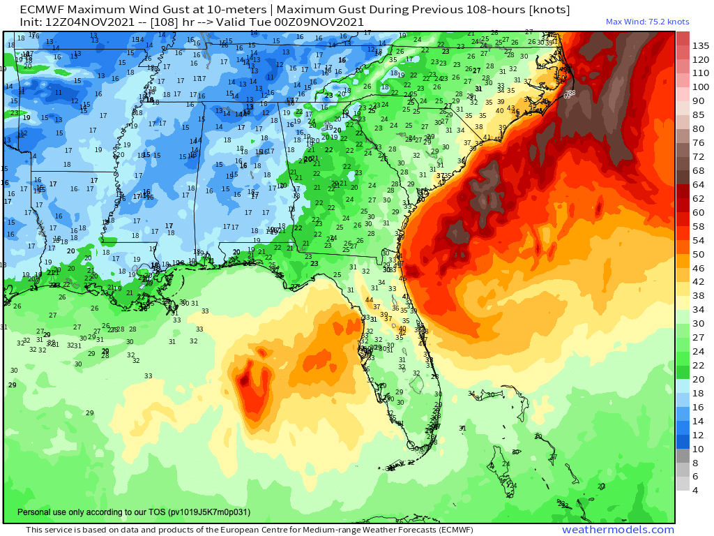
Gusty winds are also expected for these areas. Winds will gust up to 35 or 40 mph near the coast. Join the Firsthand Weather Supporter Group today!
Once the low pressure moves off the Southeast Coast this weekend, it’ll tap into some energy with the warm Gulf Stream, allowing it to intensify and possibly acquire some tropical characteristics. This window is small but will be monitored. Join the Firsthand Weather Supporter Group today!
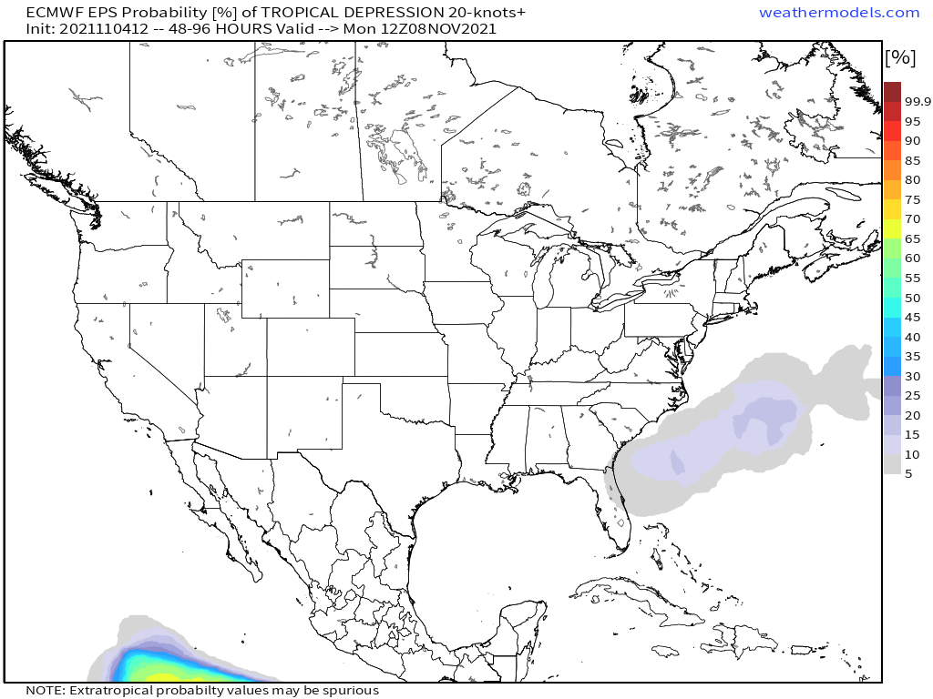
There are still some questions about the intensity and track of this low. If the low tracks closer to the coast of the Carolinas, impacts will be realized farther inland for the Southeast. If the low is farther out-to-sea, then only Florida and coastal areas of the Southeast will see impacts. Join the Firsthand Weather Supporter Group today!