Eyeing the potential for an Arctic air mass to move into the lower-48 in December
There is growing noise around the possibility of cold, Arctic air moving into parts of the lower-48 in December. Before we dive into the discussion, please keep in mind that this is a low confidence scenario and changes are likely over the coming days as the finer details are ironed out. Join the Firsthand Weather Supporter Group today.
Numerical guidance continues to hint at a pattern that could favor the movement of some very chilly air into parts of the lower-48 sometime around mid-December (give or take a few days). There has been a signal of this for the past few days, and the latest run from the American model (GFS) is showing some bigtime cold sneaking into the lower-48 just after December 10 (again, don’t look too much into the specifics–i.e. exact numbers and time—those will change). Despite the low confidence, it is important to take a mental note that the odds of a cold air mass working its way into the lower-48 are increasing sometime near or just beyond the second week of December. Join the Firsthand Weather Supporter Group today.
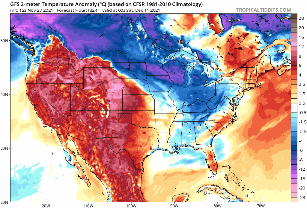
American model’s forecast temperature (surface) departure from average Saturday, December 11 – Monday, December 13
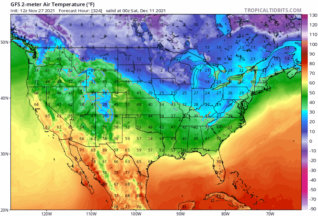
American model’s forecast temperatures (surface) Saturday, December 11 – Monday, December 13
At this time, it appears the favored areas to see the coldest temperatures will reside across central and western parts of the U.S., mainly west of the Mississippi River (it is possible this could change so keep that in mind) where a deep trough will establish itself. Even if the coldest air resides west of the Mississippi initially, it is possible some of the colder air could gradually sneak east beyond mid-month depending on the evolution of upper-air ridging farther east. Join the Firsthand Weather Supporter Group today.
Until then, areas west of the Mississippi, enjoy the warmth over the next couple of weeks. Areas east of the Mississippi over the next couple of weeks will experience temperatures near to a touch below average. We will continue to monitor the latest trends. Keep checking back for updates as this forecast will likely significantly change over the coming days. Join the Firsthand Weather Supporter Group today.
See the latest winter outlooks below.
Read the NOAA Winter Outlook here.
Read the AccuWeather Winter Outlook here.