Flash flooding likely
A wet weather pattern will develop across parts of the Southeast, South, Carolinas, Tennessee Valley, and Mid-Atlantic. Expect scattered to numerous thunderstorms each day beginning this weekend, continuing into the upcoming week.
A persistent southerly flow has allowed deep tropical moisture to ooze into the region. The tropical moisture will allow for thunderstorms to produce heavy rainfall. There are also weak storm steering currents allowing for slow-moving storms. The trigger for the storms this weekend is a cold front that has stalled over the region, and Fred next week. Fred will enhance the rainfall late Monday, Tuesday, and Wednesday.
This weather setup will allow for several inches of rain to fall across much of the region. Rainfall this heavy will raise a flash flood concern each day from this weekend through mid-week. Florida can expect to see 2 to 5 inches of rain from Fred with the heaviest rain favoring the west coast and panhandle. Isolated 8 inches are possible this weekend. Parts of the South, Southeast, Tennessee Valley, Carolinas, and Mid-Atlantic can expect to see 2 to 6 inches of rain due to the cold front and Fred. Isolated higher amounts, up to 8 inches, are possible, especially where the front stalls and due to terrain enhanced precipitation. The favored areas for the heavier rainfall totals are expected for northeastern Georgia, eastern Tennessee, western North Carolina, Upstate South Carolina, western Virginia, and eastern West Virginia.
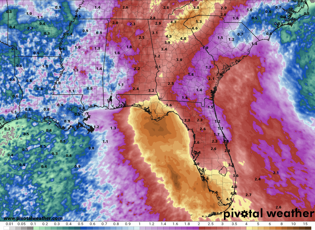
7-day rainfall forecast for the South and Southeast
7-day rainfall forecast for the Tennessee and Ohio Valleys
7-day rainfall forecast for the Carolinas and Mid-Atlantic
The timing for flooding in Florida is over the weekend with the timing for flooding in the Southeast, South, Carolinas, Tennessee Valley, and Mid-Atlantic occurring this weekend but ramping up early to mid-week.