Flooding is possible this week across the South & Southeast
A slow-moving cold front will deliver rounds of showers and storms to the South & Southeast this week, extending into the Tennessee Valley & Carolinas. The heavy rain threat will slowly shift from west to east from Monday through Wednesday as the cold front seeps eastward.
Join the Firsthand Weather Supporter Group today!
Over the next 72-hours, a widespread 2-4 inches of rain can be expected from eastern Mississippi, the Florida Panhandle, Alabama, central and eastern Tennessee, central and northern Georgia, and the western half of South and North Carolina. Isolated 5-8 inches cannot be ruled out across northern Georgia, the southwestern mountains of North Carolina, and Upstate South Carolina.
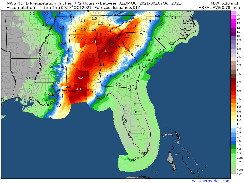
72-hour Southeast rainfall forecast (WeatherModels.com)
Rainfall this heavy may lead to areas of flooding. Flash Flood Watches have been issued for most of Alabama, southern Tennessee, the Florida Panhandle, and the northern half of Georgia. The Flash Flood Watch will likely get extended into the Carolinas later today. If you live in a flood-prone area, keep a close eye on the forecast over the coming days. Never attempt to cross a roadway covered by water.
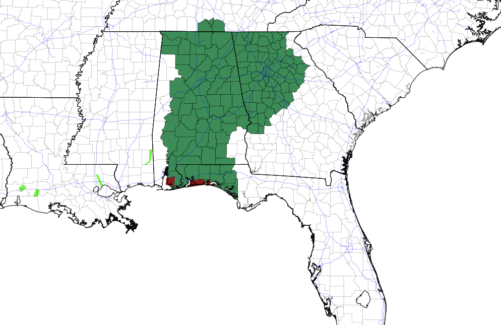
Flash Flood Watches (PivotalWeather.com)
Get more details and hyper-local rainfall maps here.
Firsthand Weather is also monitoring the possibility of a tropical system developing off the Southeast coast. Read more about this system.