Increasing chances for tropical development in Gulf
The 2022 Atlantic Hurricane Season begins June 1. Unlike the previous past several Mays, this May has yet to feature a named storm. In fact, there’s only been one system that was given a chance to develop. This system failed to develop into an organized tropical system before making landfall. Despite the lack of May activity this year, NOAA is still predicting an above-average Atlantic Hurricane Season.
It’s possible the first official week of the 2022 Atlantic Hurricane Season gets off to a quick start. Models are suggesting increased odds of some type of tropical development in the Gulf of Mexico sometime around the middle to end of next week/weekend. To be precise, this is sometime around June 1-5.
There is a strong likelihood that a tropical system will develop in the Eastern Pacific later this week/weekend. The National Hurricane Center gives this system an 80% chance, or a high chance, to develop over the next 5 days in the Eastern Pacific.

As this system develops and organizes, it appears it’ll make landfall in south Mexico/Central America before crossing over into the Bay of Campeche. As this system crosses the higher terrain of this region, it’ll likely dissipate becoming a non-organized, non-tropical system but some of the energy and structure will remain intact.
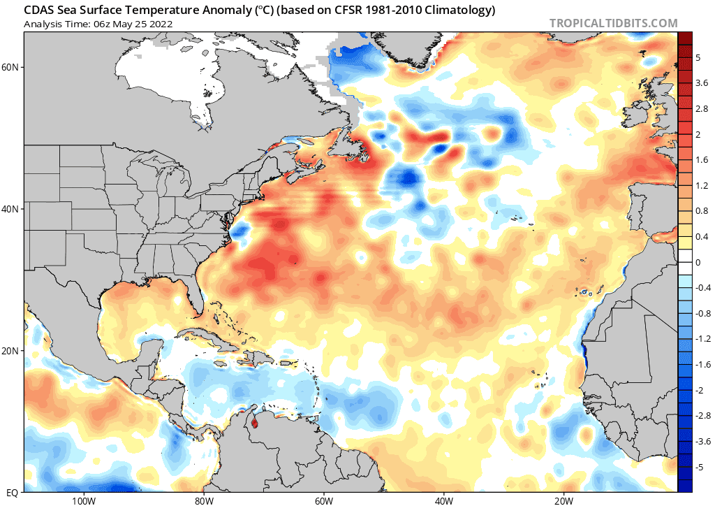
At that point, the system could develop back onto a tropical cyclone, possibly a Tropical Depression or Tropical Storm. It’s too early for specifics but wind shear at the time looks light enough to favor development and the sea surface temperatures are quite warm in the region. In fact, the entire Gulf of Mexico is running above average right now.
Because of this, models have started honing in on the possibility of development in the Southwestern Gulf of Mexico late next week. The reliable European ensembles are showing a greater than 50% chance for development near the Bay of Campeche late next week.
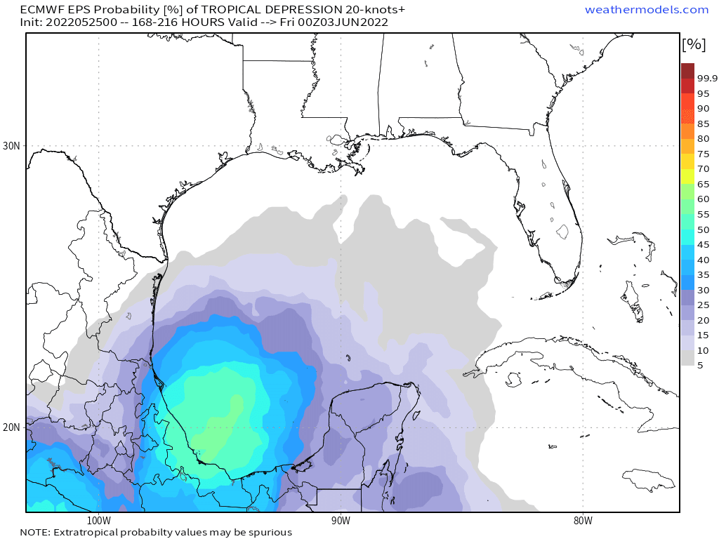
If this system develops, there are a lot of questions as to where it would move. A lot of times, these systems can make landfall in Mexico but some also have impacted the U.S. While it’s too early to make this call if this system even develops, the European guidance is suggesting the system could potentially meander in the Central Gulf of Mexico, possibly to eventually be picked up by a trough which will pull the system northeast toward possibly the Gulf States.
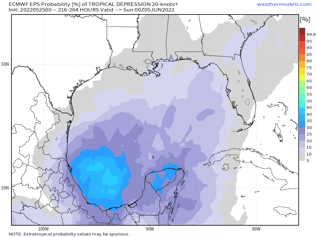
Again, a lot of questions to be ironed out. This system could not even develop and U.S. impacts are far from a given. At this point, keep checking back frequently for updates if you live along the Gulf Coast and/or Southeast Coast.
Climatologically favored areas for tropical development during June are the Gulf of Mexico and the western Caribbean so it bears watching. Stay tuned!