Live Blog: Tornado Outbreak Continuous Coverage
This live blog provides a one-stop shop for our users to get the latest forecasts during the current tornado outbreak. In addition to descriptive graphics, we will also share footage as this event unfolds, along with periodic forecast discussions.
Update: Wednesday, March 17, 2021 at 6:08pm ET (5:08pm CT)
Some pics sent to me by a longtime friend from Rosser Road in Tuscaloosa. He says there is about a mile of tree damage and that his aunt ran out of her mobile home as it hit and held onto a tree as the storm passed over.
‘Didn’t have a scratch on her’ #alwx @NWSBirmingham pic.twitter.com/xbeCzNBFD8
— Ryan Phillips (@JournoRyan) March 17, 2021
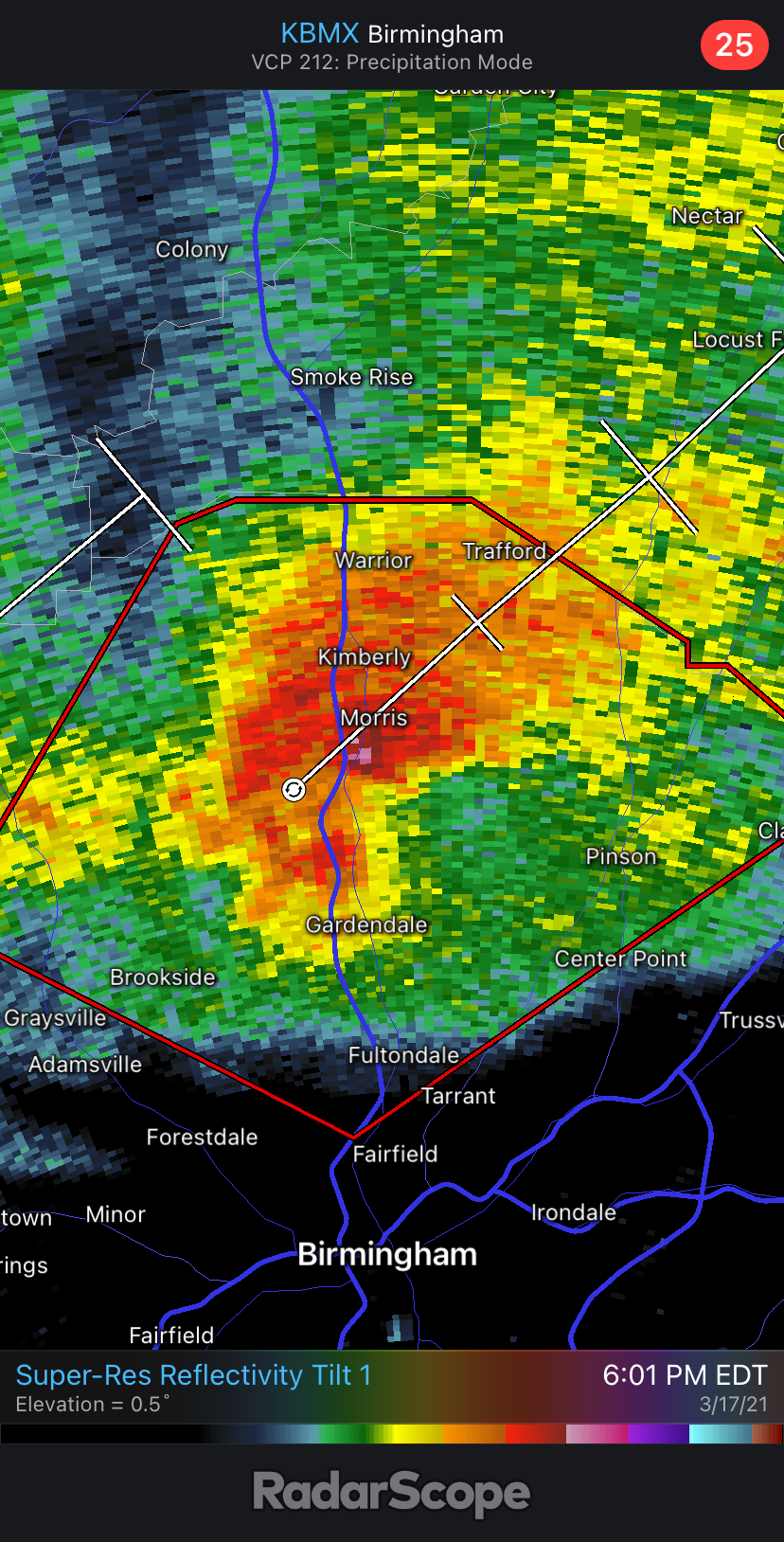
Update: Wednesday, March 17, 2021 at 6:04pm ET (5:04pm CT)
A dangerous tornado is currently passing across I-65, north of Birmingham, between Gardendale and Morris.
Update: Wednesday, March 17, 2021 at 5:04pm ET (4:04pm CT)
As of 3:58pm CT, a confirmed tornado was located near Bull City, moving northeast at 30 mph. This tornado-producing storm will soon begin in infringe on northwestern portions of the Birmingham metro region.
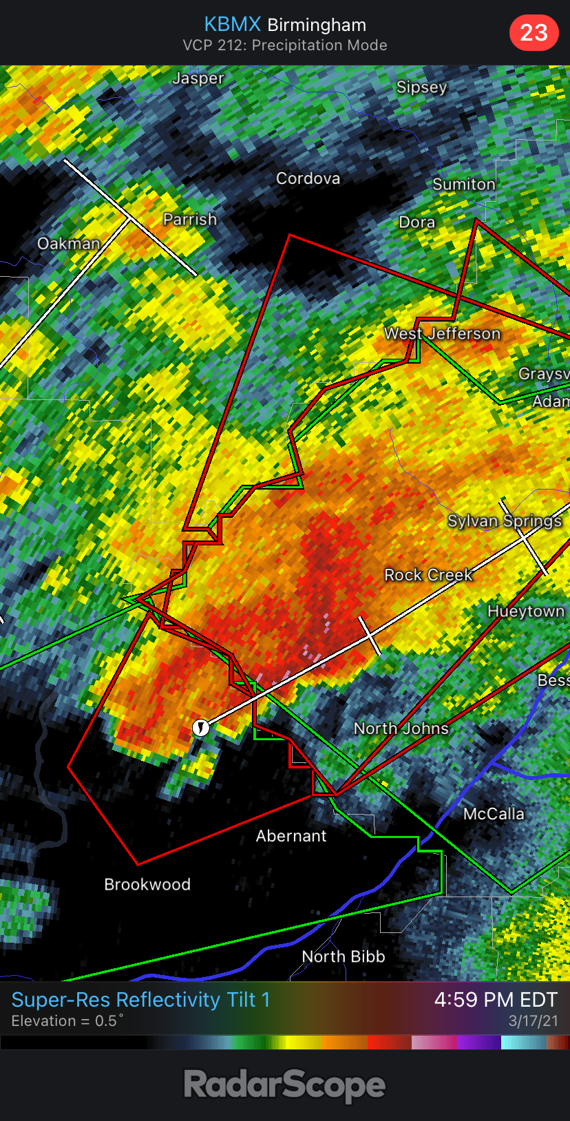
Confirmed tornado heading northeastward toward northwestern portions of the Birmingham, Alabama metro.
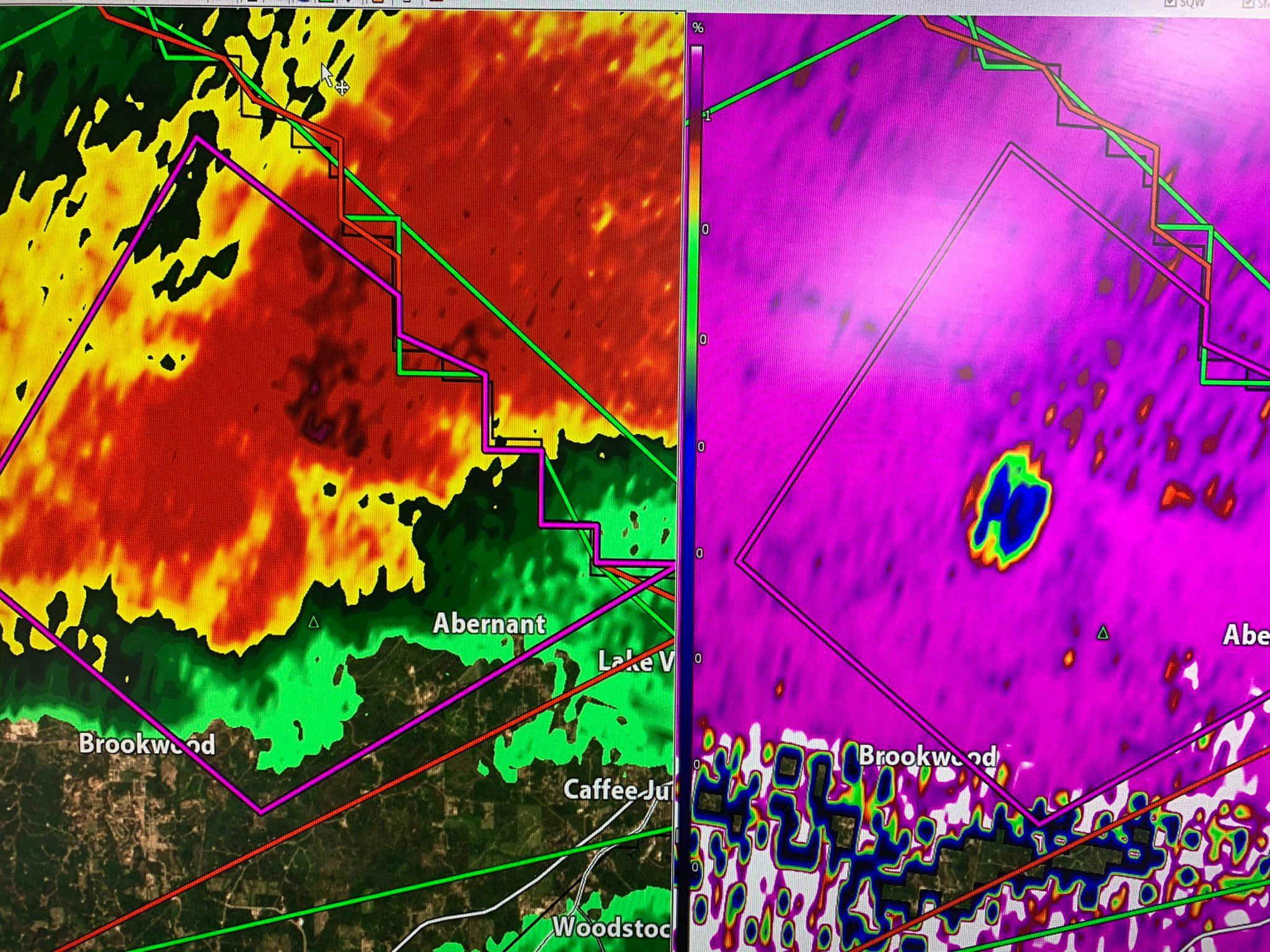
Update: Wednesday, March 17, 2021 at 4:43pm ET (3:43pm CT)
That blue dot on the right image indicates that debris is being lofted into the atmosphere by a strong tornado. This is the tornado that was near Brookwood, Alabama around 3:31 pm CT. It’s moving northeast at 20 mph. Radar imagery shared by chief meteorologist Marc Weinberg.
Update: Wednesday, March 17, 2021 at 4:33pm ET (3:33pm CT)
Extensive tornado damage over chicken houses in Wayne County, Mississippi from earlier this afternoon. Photo shared by Brian Emfinger (@brianemfinger on Twitter)
Tornado wiped out some chicken houses in Wayne County Mississippi (about 14 miles east of Laurel). #mswx #tornado pic.twitter.com/A8tMz39jEQ
— Brian Emfinger (@brianemfinger) March 17, 2021
Update: Wednesday, March 17, 2021 at 4:12pm ET (3:12pm CT)
A confirmed and strong tornado remains on the ground with a storm that is now east of downtown Tuscaloosa, Alabama. The tornado is now just north of I-20, moving northeastward toward Brookwood.
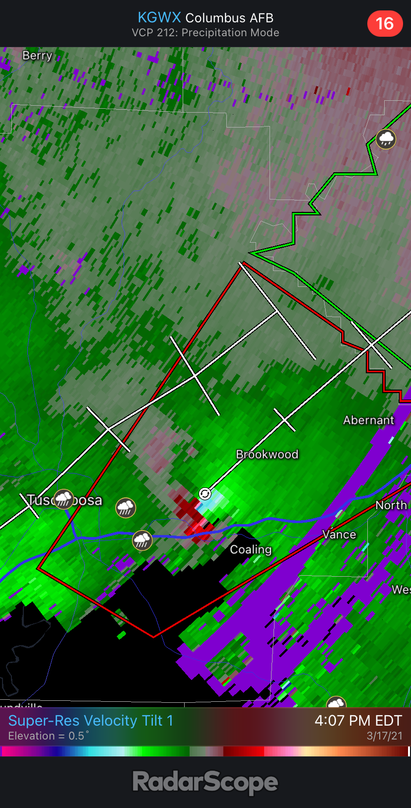
Strong tornado moving in Tuscaloosa County, Alabama
Update: Wednesday, March 17, 2021 at 3:54pm ET (2:54pm CT)
A confirmed large and extremely dangerous tornado is 7 miles south of Tuscaloosa, Alabama as of 2:45pm CT. The storm is moving northeast at 30 mph. The National Weather Service has designated this as a particularly dangerous situation.
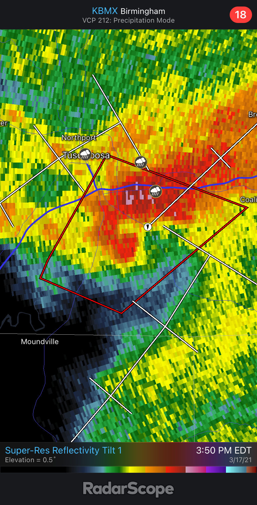
Radar over Tuscaloosa, Alabama as of 2:50pm CT
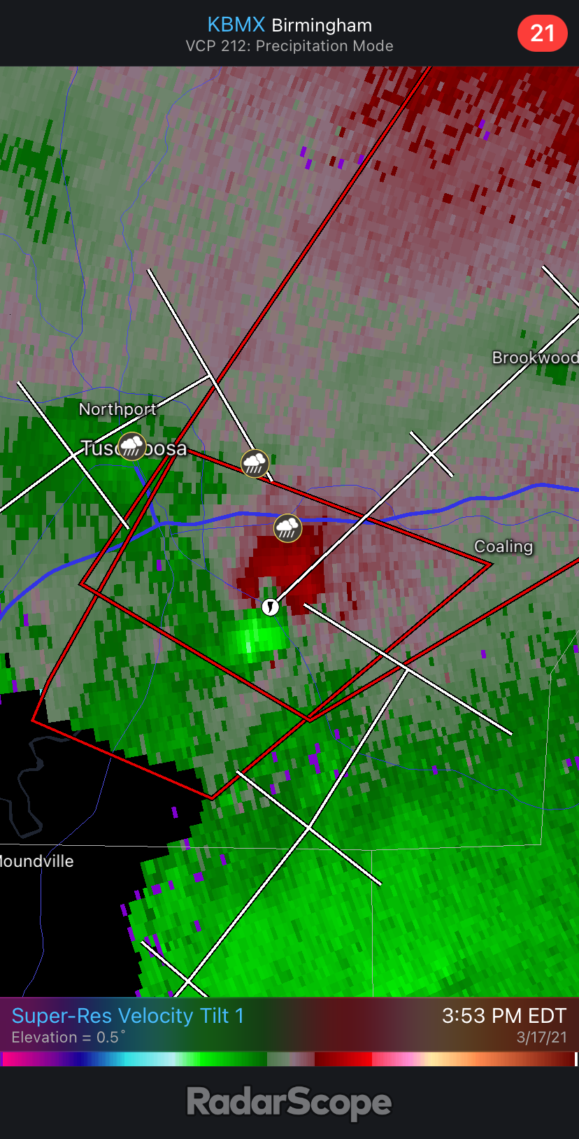
Strong velocity couplet on Radar southeast of Tuscaloosa as of 2:53pm CT
Update: Wednesday, March 17, 2021 at 3:40pm ET (2:40pm CT)
Clusters of supercells continue to head northeastward across the outlined region. Though surface temperatures may be slightly lower relative to areas nearby, vertical wind shear is very favorable for strong, potentially long-track tornadoes.
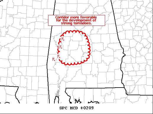
Latest region favorable for strong tornadoes in the near future.
Update: Wednesday, March 17, 2021 at 2:30pm ET (1:30pm CT)
PDS tornado watch for much of western MS and across parts of northern/northeastern LA and southeastern AR until 7pm CT
Update: Wednesday, March 17, 2021 at 2:22pm ET (1:22pm CT)
The SPC has outlined a region across south-central Mississippi that has rapidly become favorable for the development of strong tornadoes.
An area very close to McComb and all of our southwest MS counties has been highlighted by @NWSSPC as very favorable for the development of strong tornadoes. Please continue to stay alert and be prepared to take action if a warning is issued for you. #MSwx https://t.co/FMkymyg3Nn
— NWS New Orleans (@NWSNewOrleans) March 17, 2021
Update: Wednesday, March 17, 2021 at 2:16pm ET (1:16pm CT)
From earlier in Wayne County, MS. . .
Shana Hodge just sent me this video of the tornado that happened in Wayne County, MS along the U.S. Highway 84 corridor. 12:10PM. Lots of debris! @NWSMobile @spann @NWSJacksonMS pic.twitter.com/ejgi0KUVy0
— Spinks Megginson (@rzweather) March 17, 2021
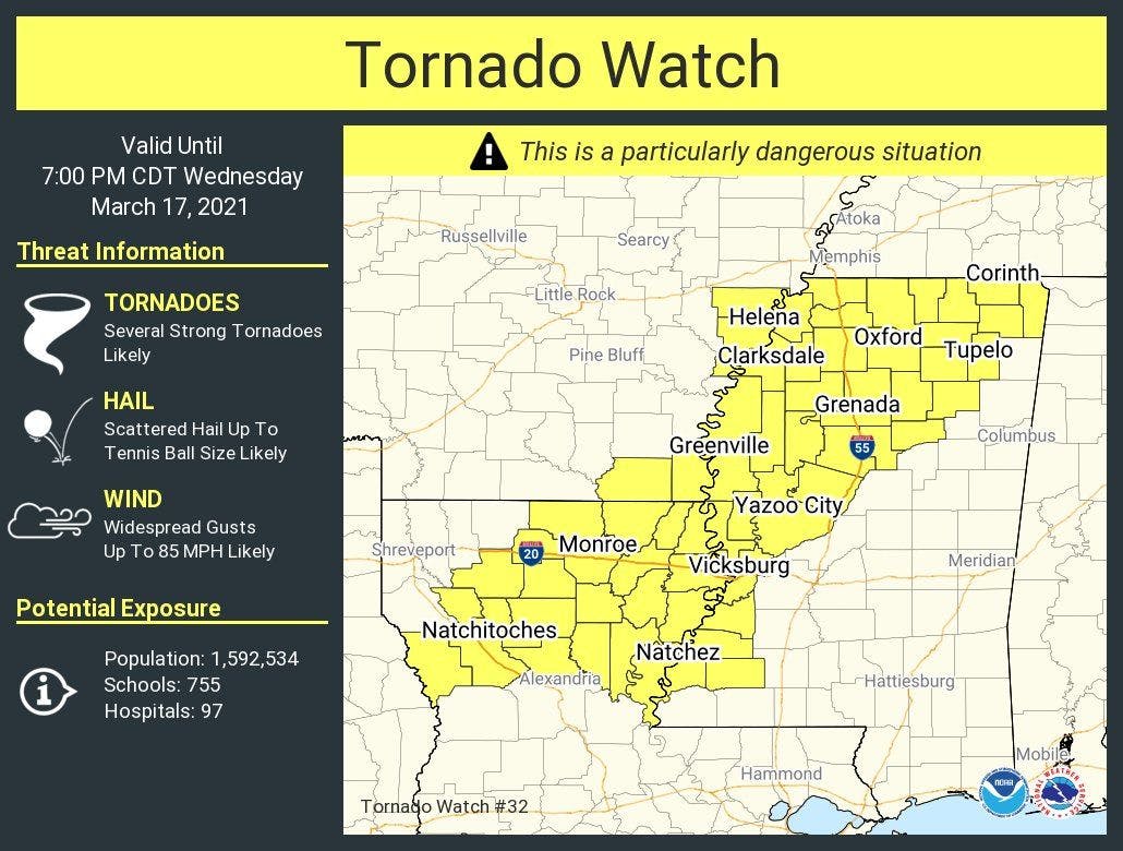
Update: Wednesday, March 17, 2021 at 1:43pm ET (12:43pm CT)
Another PDS tornado will shortly be issued across parts of western Mississippi, southeastern Arkansas, and northeastern/eastern Louisiana.
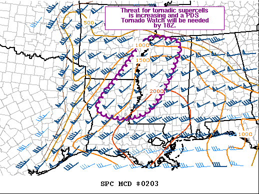
Outlined region expected to go under PDS tornado watch shortly.
Update: Wednesday, March 17, 2021 at 1:33pm ET (12:33pm CT)
Analogs indicate strong tornado potentially ongoing in Mississippi currently.
Already a probable significant tornado ongoing in MS based on a TDS height of 12,000 feet already #mswx pic.twitter.com/Q7tsM1J9NZ
— Sam Emmerson (@ou_sams) March 17, 2021
1220 pm – CONFIRMED TORNADO MOVING THROUGH WAYNE COUNTY MS. DAMAGE CONFIRMED TO HOMES VIA EMA. #mswx
— NWS Mobile (@NWSMobile) March 17, 2021
Update: Wednesday, March 17, 2021 at 1:27pm ET (12:27pm CT)
A confirmed tornado has already been detected 10 miles south of Goodwater, Mississippi and will cross over the Mississippi/Alabama state line. The Storm Prediction Center has outlined a region that could face impacts from a strong tornado within the next 1-2 hours or less.
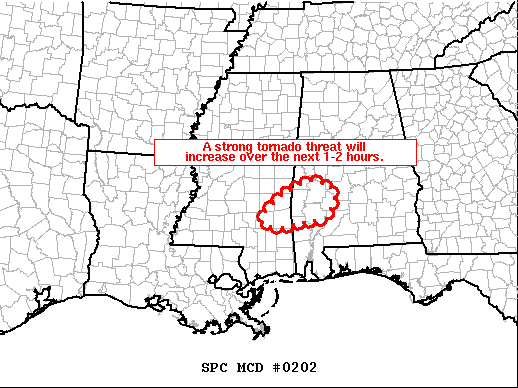
Strong tornado threat exists across parts of the MS/AL border
Update: Wednesday, March 17, 2021 at 12:47pm ET (11:47pm CT)
A PDS tornado watch has now gone live across parts of Mississippi and Alabama until 7pm CT. We will make a better graphic in a bit.
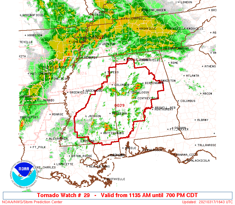
A PDS tornado watch has gone live across parts of Mississippi and Alabama until 7pm CT.
Update: Wednesday, March 17, 2021 at 12:40pm ET (11:40pm CT)
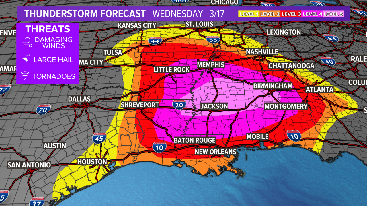
Parts of Mississippi and Alabama now sit under a rare 45% tornado risk. These high probabilities have only been used a handful of times in the past. This means that there’s a 45% chance that a tornado will hit within 25 miles of a given point within the outlined region.
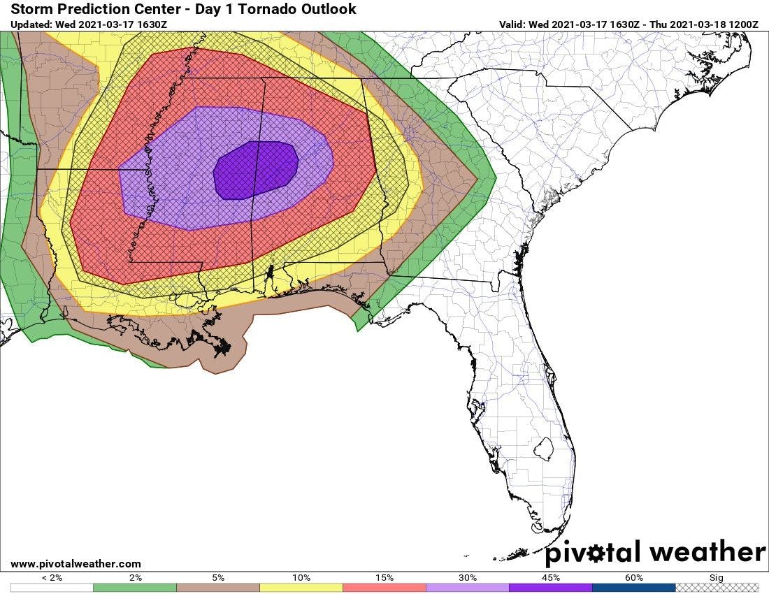
The probability that a tornado will hit within 25 miles of a given point in the outlined regions.
Only a handful of 45% tornado risks have ever been issued, making up outlooks on 4/7/2006, 4/27/2011, 5/24/2011, 4/14/2012, 5/20/2019, and now 3/17/2021. A terrifying situation.
— Jacob Feuerstein (@Jacob_Feuer) March 17, 2021
Update: Wednesday, March 17, 2021 at 12:20pm ET (11:20pm CT)
The Storm Prediction will issue a PDS (particularly dangerous situation) tornado watch shortly across parts of Mississippi and Alabama. Breaks in cloud coverage, along with strong, low-level transport of moist air from the Gulf of Mexico, have quickly allowed for the atmosphere to become unstable. Temperatures have already surged well into the 70s to near 80 across central and southern Mississippi.
PDS tornado watch coming shortly for outlined region
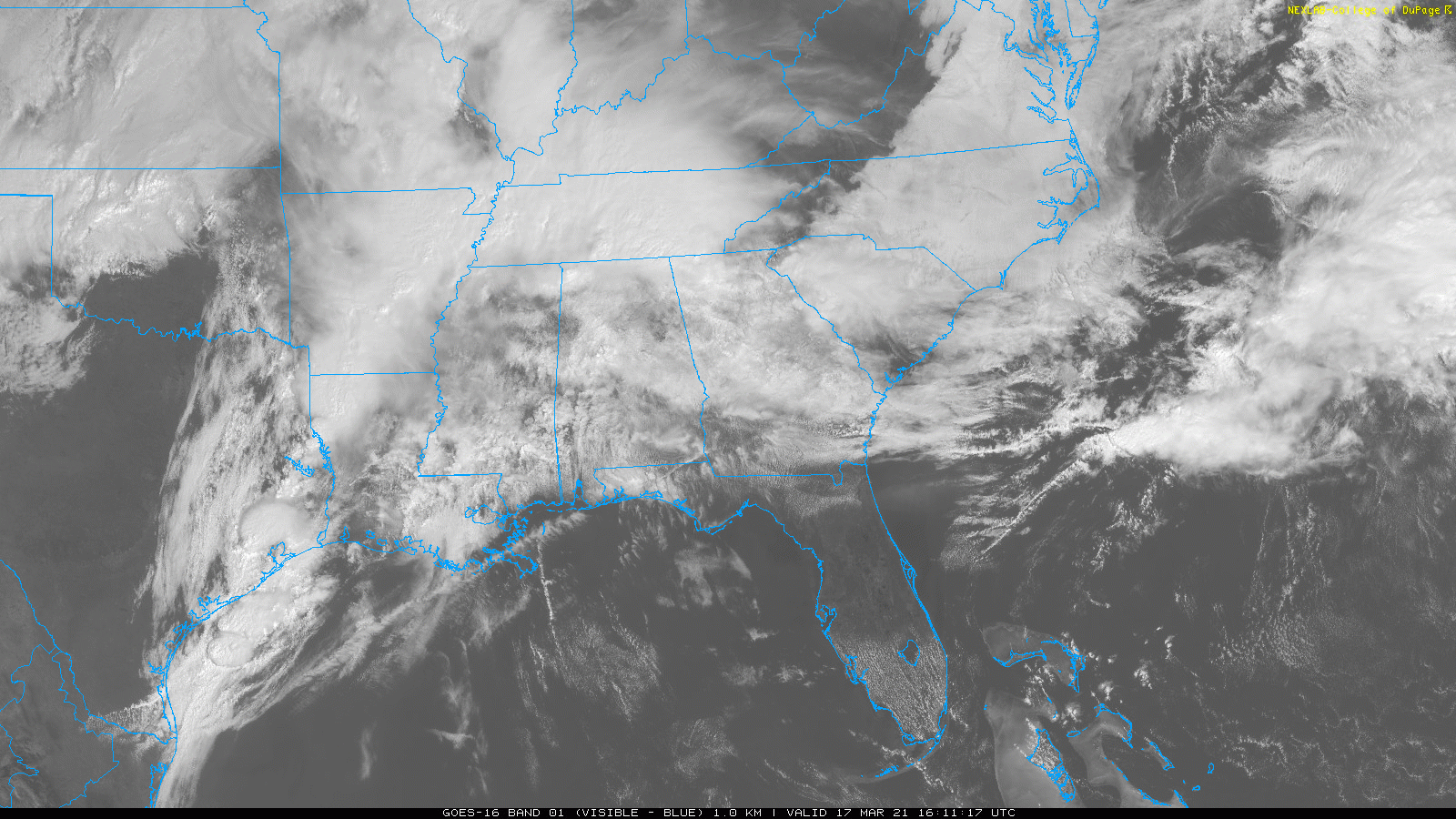
Breaks in cloud coverage have allowed for quick destabilization.
Update: Wednesday, March 17, 2021 at 12:00pm ET (11:00pm CT)
Severe weather outlook for Wednesday, March 17.
Severe weather outlook for Thursday, March 18.