Colder temperatures surge into Southeast Easter Weekend
It's been quite toasty so far this spring across the Southeast but cooler weather arrives this weekend.
A big area of high pressure has been centered over the Southeast bringing above average temperatures. Most of the region has experienced several days of high temperatures in the 80s and even 90s.
This area of high pressure that has been vacationing over the region is breaking down and shifting out of the region and a big dip in the jet stream stream is sneaking in. This is pushing a cold front in to end the week sending in a surge of colder air by the weekend.
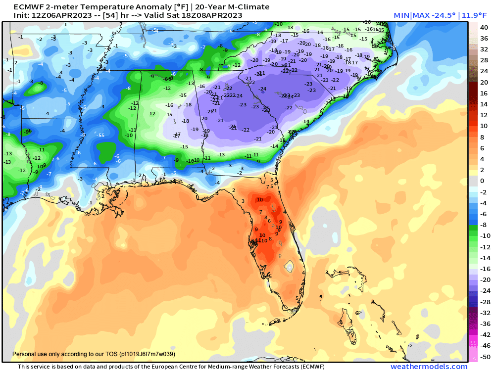
The colder air will be well below average with high temperatures possibly staying in the 40s for some area on Saturday. This temperature swing will be 30 to 40 degrees compared to what some areas saw this week. In fact, temperatures will be so cool, that daily record low high temperatures (or the coldest high temperatures for a day) could be set on Saturday.
Temperature departure from average Saturday afternoon
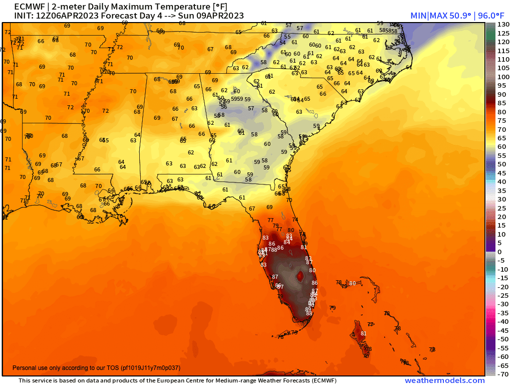
High temperature forecast Saturday

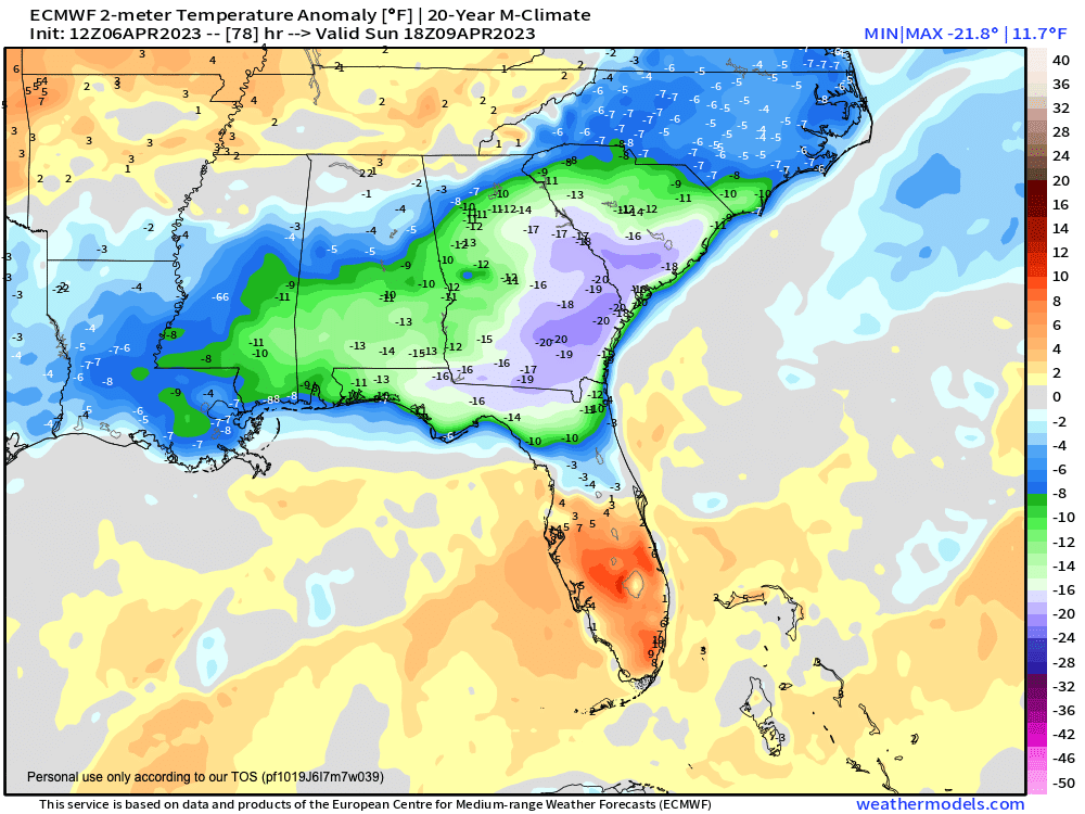
Sunday stays cooler as well but temperatures do "warm" a few degrees over Saturday but still stay below the seasonal average. Highs look to stay below average into mid next week as cold air damming stays in place.
Temperature departure from average Sunday afternoon
High temperature forecast Sunday
The cold front will stall near the north Gulf Coast with pieces of energy riding along the stalled front, which should allow for good rain chances across the Southeast over the weekend. A widespread inch or two of rain can be expected with isolated higher amounts approaching a few inches is possible. A minor flood risk will develop but should remain isolated in nature.
Precipitation forecast
