Pineapple express to slam California bringing severe impacts
California cannot catch a break as another potent storm system arrives later today with impacts continuing into the weekend for parts of the state.
After the state received feet of mountain snow, with a rare Blizzard Warning for the mountains in Los Angeles County, and inches of rain closer to sea level, another threat emerges today as an atmospheric river brings buckets of moisture and rain to the state to end the week.
The impacts begin today across NorCal, gradually shifting south through central parts of the state and into SoCal overnight into Friday with additional impacts staying around on Saturday. While snow is possible, the big concern is the heavy rain as this storm system is different than the cold storm system that dropped snow levels down below 1,000 feet a couple of weeks ago and even produced icy precipitation in Los Angeles and Long Beach.
This system is warmer as it taps into a big feed of atmospheric moisture coming off the Pacific Ocean. Big feeds of moisture off the ocean typically bring milder temperatures and that is the case with this feed of moisture, which is known as an atmospheric river. This atmospheric moisture has origins near Hawaii so it's the warmer "Pineapple Express" that you've probably heard about.
The Pineapple Express event is expected to send snow levels upwards of 8,000 to 9,000 feet in the SoCal mountains with snow levels soaring to over 5,000 feet farther north in the state. Snow levels this high paired with the heavy rain and recent feet of snow brings numerous hazards to the mountains in California. One big hazard is flooding as heavy rain falls on top of the snow. This creates a more rapid runoff into area creeks and rivers, increasing the flood risk, and also melting some of the snow creating more flooding concerns. An additional hazard is the weight of the feet of snow on structures in the mountains getting heavier with falling rain on the snow. This drastically increases the weight of the snow, which could collapse the roofs of structures that still have snow on the roofs.
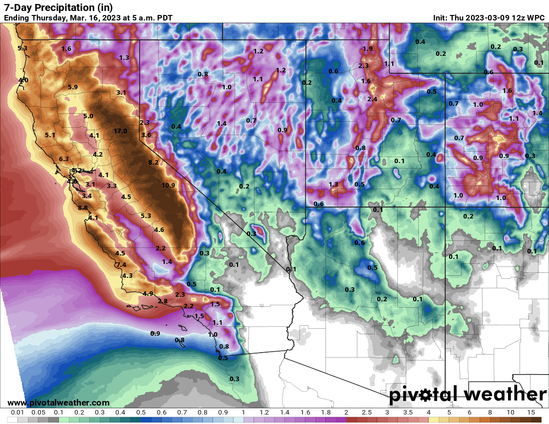
Precipitation (liquid) forecast
There's also the concern of increased avalanche danger as the snow becomes unstable. Above 8,000 feet, heavy snow is likely with feet of snow expected to fall by the weekend.
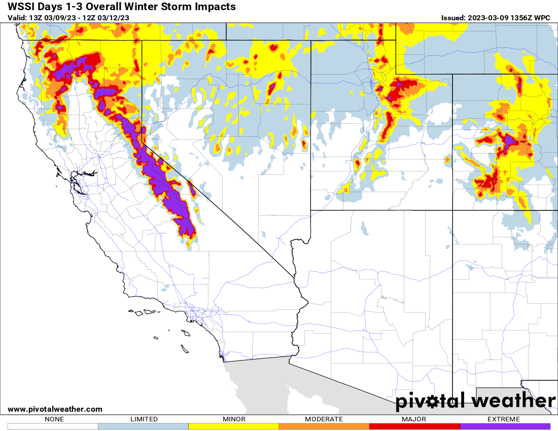
Winter storm impacts today (Thursday) through Saturday
For the valleys, foothills, and lowlands, heavy rain will lead to areas of flooding with inches of rain possible at times. This will increase the flood risk and create an increased risk of land and mudslides.
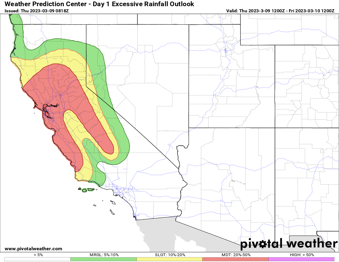
Today's (Thursday) excessive rainfall outlook WPC
Friday's excessive rainfall outlook WPC
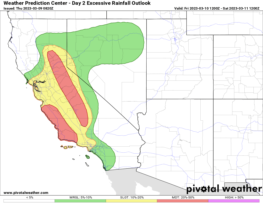
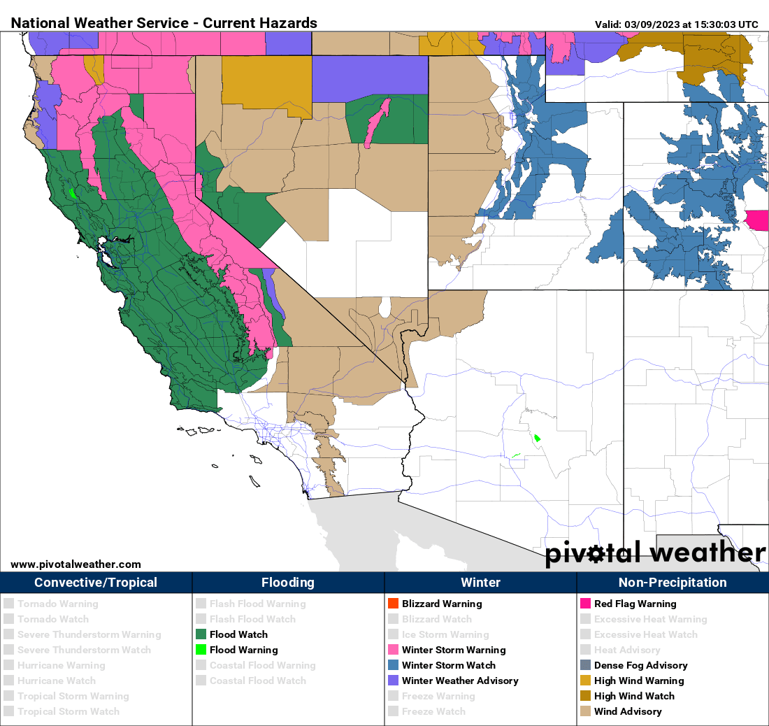
Because of the flood hazards associated with this strong atmospheric river, local National Weather Service offices in California have issued numerous flood alerts across the state along with winter weather alerts for the highest elevations from today into this upcoming weekend.
Current flood and winter weather alerts from the NWS