Weather headlines: Another California atmospheric river, a winter Noreaster, and severe storms for the South
The battle of the season continues with winter and spring dueling one another and this will bring high-impact weather to millions across the United States over the coming days.
Another atmospheric river to slam California bringing more flooding
California cannot catch a break. Another atmospheric river is set to bring heavy rain to the state early this upcoming week which will lead to additional flooding in areas that are already under a state of emergency.
Additional spotty precipitation is expected for the remainder of this weekend with the heaviest activity focused on central and northern parts of the state but the next atmospheric river is already setting up near Hawaii and will move toward California Monday, Tuesday, and Wednesday of this upcoming week.
Despite a brief decrease in the intensity and coverage of the precipitation this weekend, flooding is still expected as runoff and snowmelt continue. Because of the risk, flood alerts continue for millions in California. Additional flood alerts are expected to be issued for most of California from late Monday through Wednesday.
Early week atmospheric river key takeaways
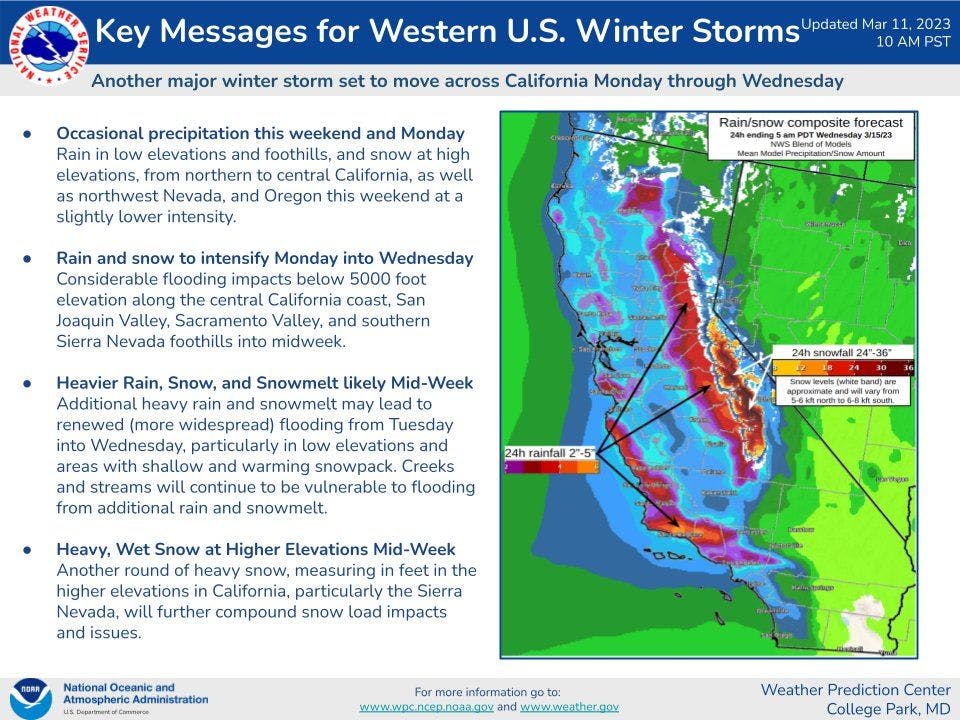
The biggest impacts from the developing atmospheric river will arrive Monday night continuing into early Wednesday, shifting from northern California to southern California during this timeframe. Heavy rain will be the biggest concern with a couple to several inches of rain falling from Los Angeles County north. The foothills communities will see 3-6 inches of rain with isolated higher amounts favoring the southwest-facing slopes of the foothills and mountains. Los Angeles, San Francisco, and Sacramento can expect 1-3 inches of rain with 1/2 - 1 inch for San Diego. The snow level will be above 7,000 feet in southern California and 5,000 feet in northern and central California where feet of snow are expected for the highest peaks.
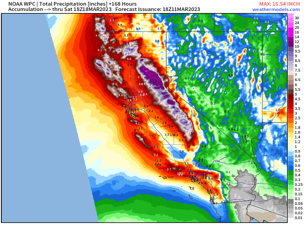
Precipitation (liquid) forecast next 7 days
With the additional heavy rain, there's an increased risk of flooding, landslides, and mudslides. Never cross a road covered by water.
Say it ain't snow! Heavy snow is expected with a Nor'easter
A potent storm system is expected to bring heavy precipitation and strong winds to the Northeast early this upcoming week a system in the Midwest races toward the East Coast spinning up a surface area of low pressure that'll intensify into a nor'easter late Monday and Tuesday.
There are some questions regarding the exact track of the low pressure and just how strong this system gets, which will impact the precipitation and wind forecast but confidence is growing in a significant winter storm for parts of the Northeast Monday and Tuesday.
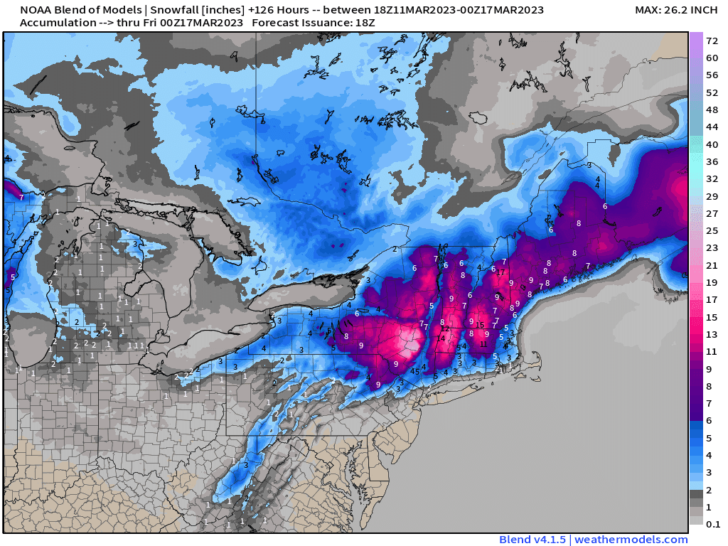
The current track suggests the heaviest snow is expected to fall just west of the I-95 corridor as the cold airmass is marginal for wintry precipitation with this system, which means D.C. and Philadelphia will mainly see a cold, wind-blown rain but the rain will change to snow in Philadelphia. New York City will also see rain as will Boston initially on Monday but the rain will change to snow as the system pulls in colder air.
New York City is expected to see a slushy inch of snow with a couple inches for Boston. Farther inland, a foot or more is possible for the higher terrain of New England and upstate New York. Keep in mind, a slightly different track could significantly impact the accumulation forecast, especially for the major cities along I-95 for the Mid-Atlantic and Northeast.
Modeled snow accumulation forecast
The system will also bring strong winds that could disrupt travel, reduce visibility, cause power outages, and lead to areas of coastal flooding.
It should also be noted that the higher terrain of western Virginia and northwestern North Carolina will also see wintry precipitation a little earlier beginning early Sunday for the possibility of light icing.
** Severe storms and isolated tornadoes for the South **
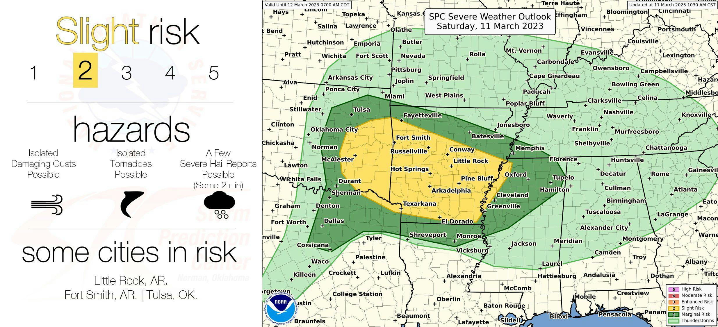
On the warm side of the winter storm, severe weather will erupt this afternoon and evening and again on Sunday from Arkansas to South Carolina.
The severe threat begins Saturday afternoon and evening across eastern Oklahoma, Arkansas, northern Texas, western Tennesee, and northern Mississippi where damaging winds and large hail are possible. Very large hail cannot be ruled out for parts of Oklahoma and Arkansas. There is also a low-end tornado risk Saturday afternoon.
Because of the severe risk, there's a Level 1 and Level 2 severe risk for these areas (the risk is out of a Level 5).
Saturday afternoon/evening severe risk
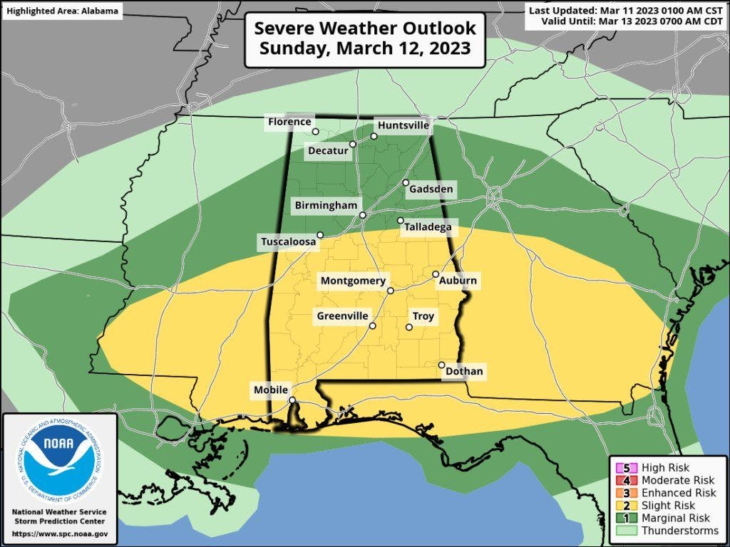
The severe risk shifts east overnight into Sunday with a higher severe risk Sunday afternoon and evening across parts of the Deep South and Southeast from Mississippi to Georgia with the severe risk also extending into southern Louisiana and southern South Carolina.
Damaging winds, large hail, and tornadoes are possible within this region. The highest severe risk is along the I-10 corridor where there is the highest chance for very large hail and tornadoes. Because of the severe risk, there's a Level 1 and Level 2 severe risk for these areas (the risk is out of a Level 5).
Sunday afternoon/evening severe risk
If you live in the severe risk area, make sure you have reliable sources for weather warnings and have a shelter plan in place.