Early December Long-Range Forecast
Pattern Overview
A large-scale ridge will build across the northeastern Pacific and will become amplified into the Bering Sea. Downstream, a trough will dig southward into western and central Canada and extend down into the southwestern U.S. The placement of these two large-scale features will favor moderate to strong ridging across the southeastern U.S.
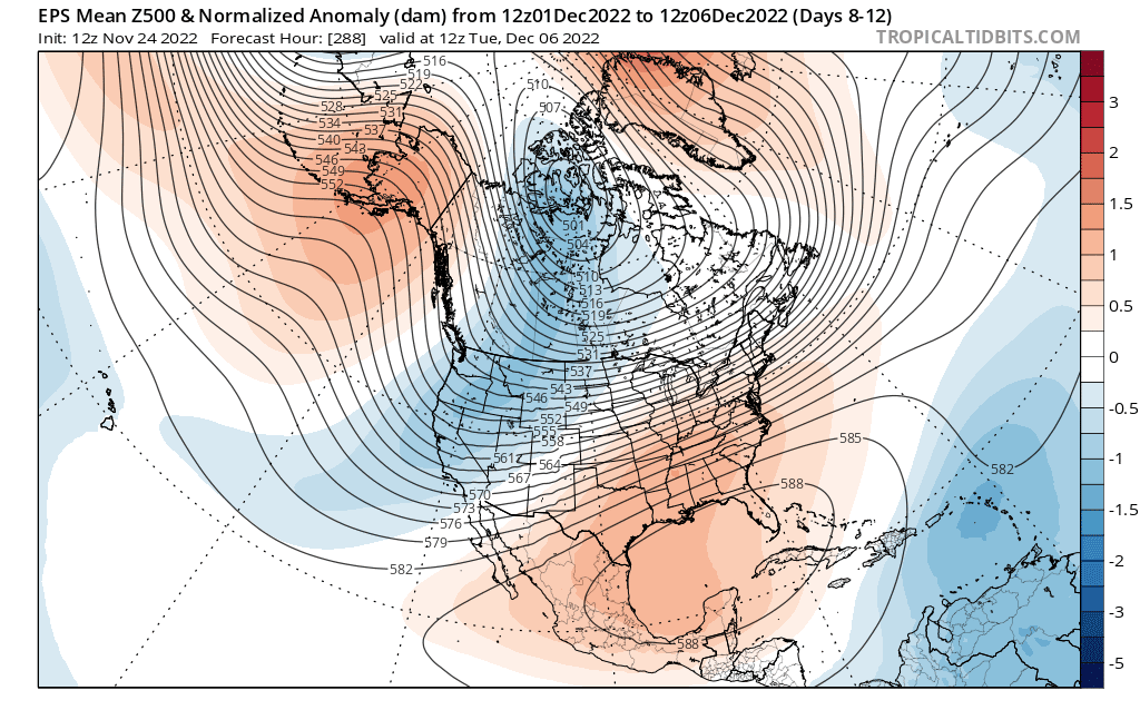
This pattern configuration will likely persist from the end of November into the first 5-7 days of December before we see any major pattern change. Model guidance continues to demonstrate agreement and consistency in this forecast.
Weather Temperature and Precipitation Forecast (~November 30–December 6-8, 2022)
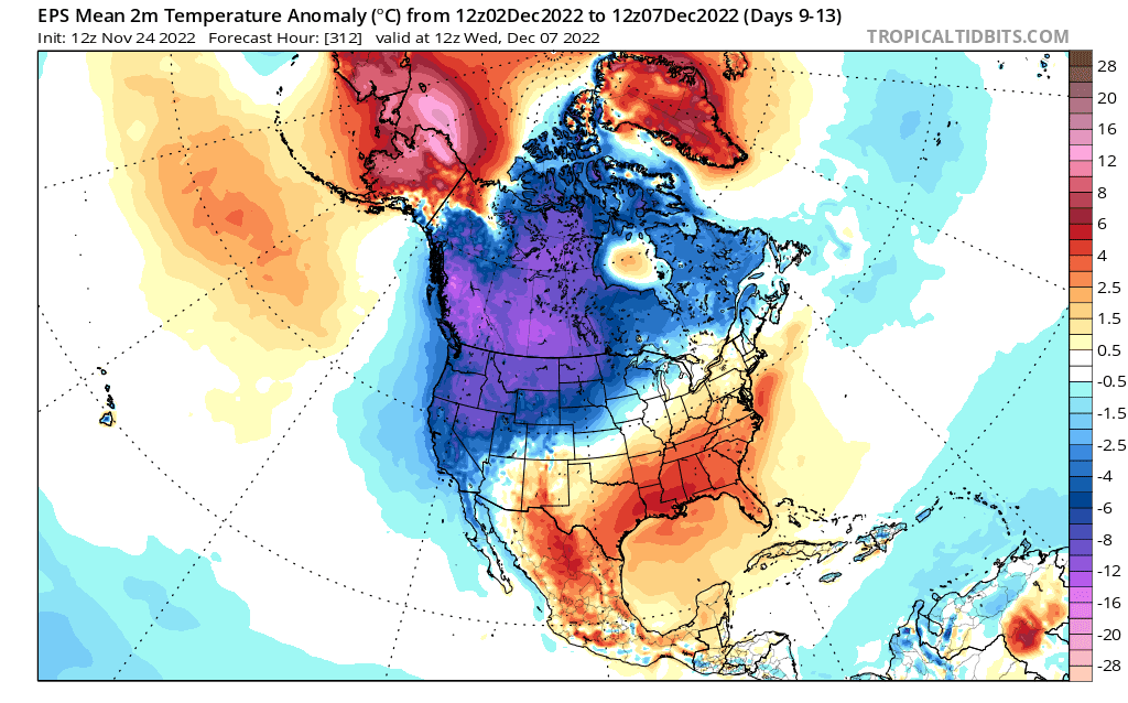
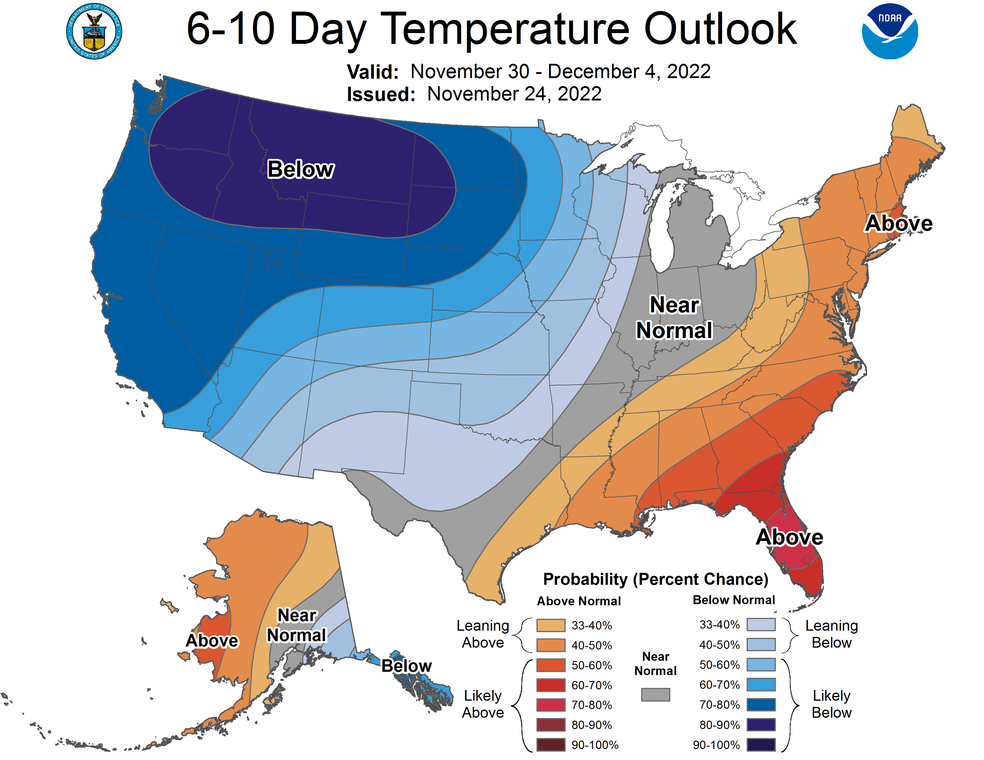
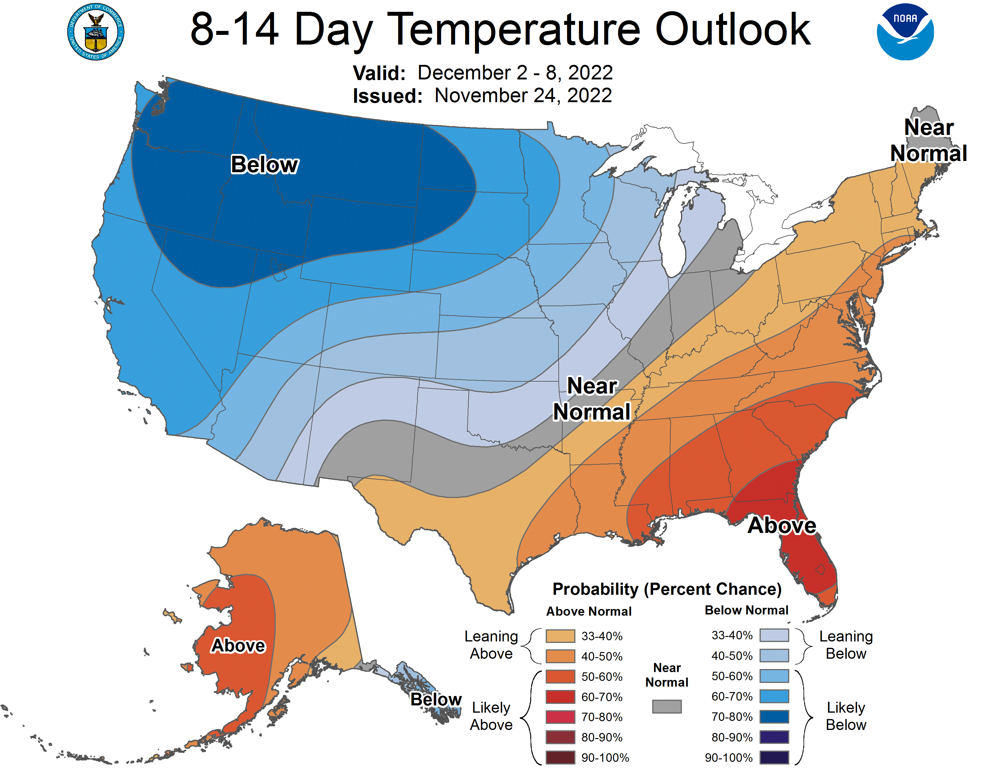
Well below-average, and at times extreme cold will plague the Pacific Northwest, northern Rockies, and western parts of the northern Great Plains. Below-average temperatures will extend down into the southwest, including over much of California and the Four Corners region. The remainder of the Plains will experience much more variability in their temperatures, going back and forth between bouts of well-below-average and well-above-average temperatures over the forecast period.
Above average, and at times, well-above-average temperatures will generally extend from the Mid-South, Southeast, Tennessee Valley, and up the eastern seaboard into the Mid-Atlantic and New England. An active storm track oriented from the Plains northeastward toward the Ohio Valley, Midwest, and Great Lakes region will likely ensure a cold front or two sweeps through most of these regions over the forecast period. However, it should be emphasized that temperatures will likely rebound into above-average territory a couple of days after each frontal passage.
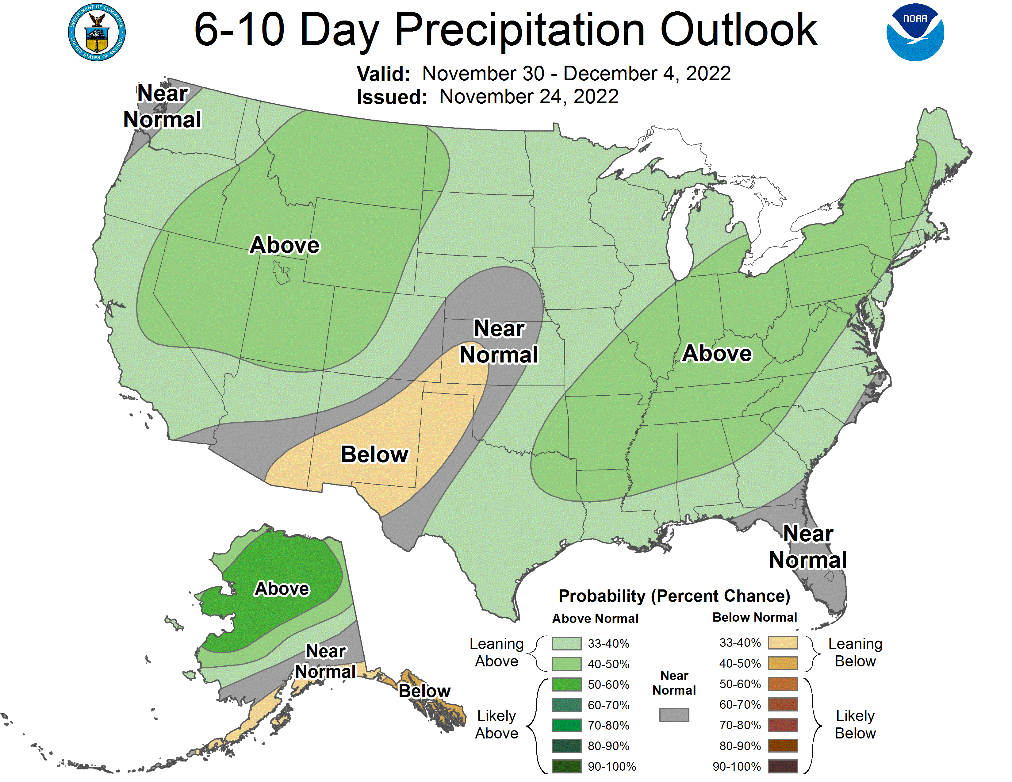
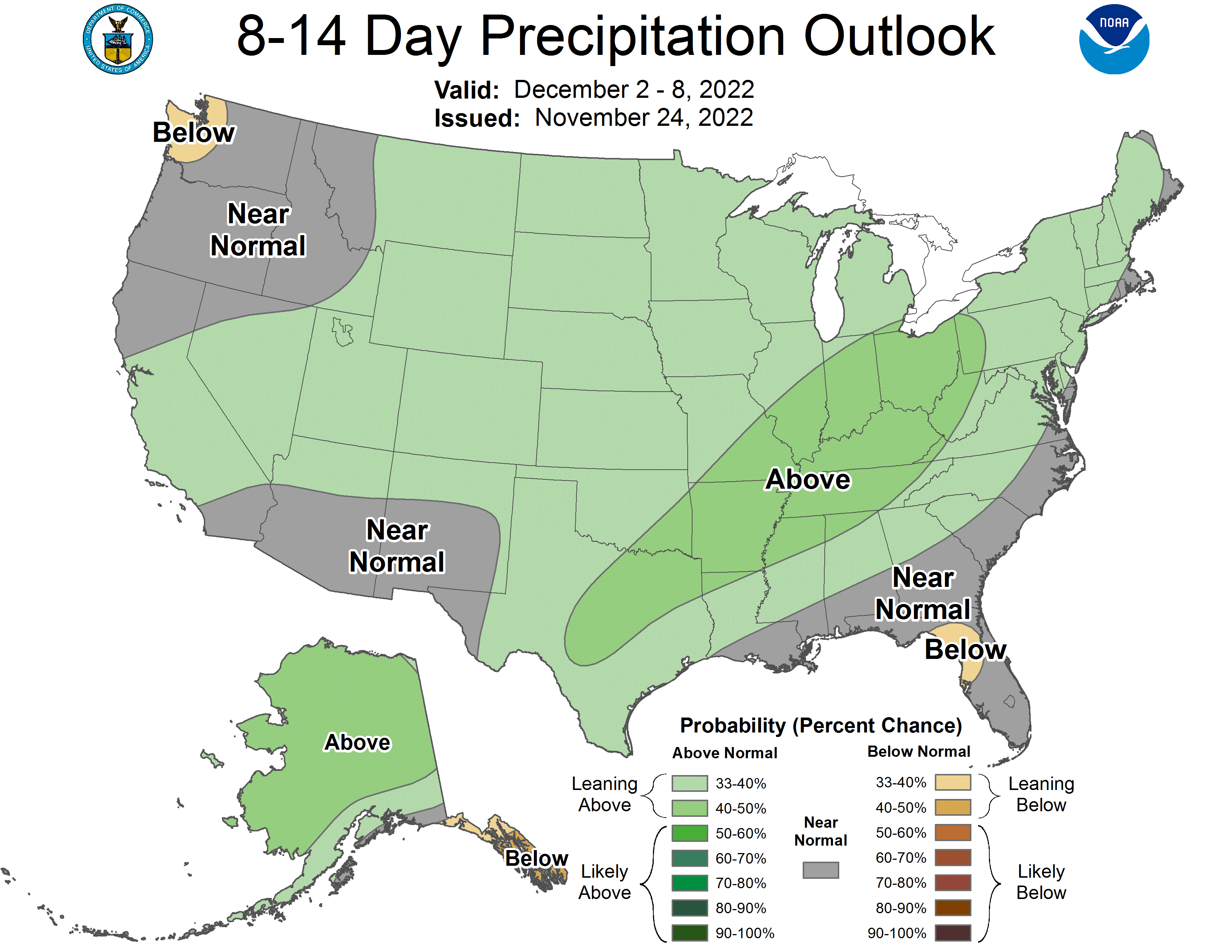
A series of shortwaves will enter from the Pacific Northwest, drop into the Rockies, dig into the Plains, and then trek northeastward through the Midwest, Ohio Valley, and Great Lakes region. This particular storm track will favor periods of rain and even severe weather across the Mid-South, and eastern parts of the Southern Plains, potentially extending along and south of the Ohio River. Areas to the north of this zone, located between the very cold and very warm air masses, could have some increased risk of icy conditions due to overrunning. The Cascades, Rockies, and Sierra Nevada will have several good chances for snowfall. We will address these wintry weather and severe weather concerns on a system-by-system basis.
Highlights (~November 30–December 6-8, 2022)
Mostly mild conditions across the Southeast, Mid-South, Mid-Atlantic, and coastal New England, with intermittent cold, only lasting a couple of days each. Dominant precipitation type: rain
Severe weather chances across the eastern Southern Plains and Mid-South, extending northeastward into areas along and/or south of the Ohio River.
Active Pacific Northwest pattern with several snow chances in the Rockies, Cascades, and Sierra Nevada.
Wintry weather possible from Central Plains, Midwest, Great Lakes, and inland New England. Possible that overrunning issues bring icy conditions farther south into the Southern Plains, mid-Mississippi Valley, and maybe Ohio Valley.