More tornadoes and severe weather are possible for the Southeast today
Yesterday was a hyperactive severe weather day for the Southeast with numerous reports of severe weather and tornadoes. Numerous tornado reports occurred across Mississippi, Alabama, Georgia, and South Carolina.
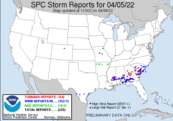
Yesterday’s severe weather reports
Today is shaping up to be another high-impact severe weather day for some of the same areas. There is an enhanced (orange – level 3/5) severe risk for most of Alabama, Georgia, eastern & central Tennessee, western North Carolina, and southern South Carolina. This is where there is a great concern for numerous severe thunderstorms and some of those severe storms could produce tornadoes. Surrounding the enhanced severe risk area is a slight (yellow – level 2/5) and marginal (dark green – level 1/5) severe risk that encompasses most of the Southeast.
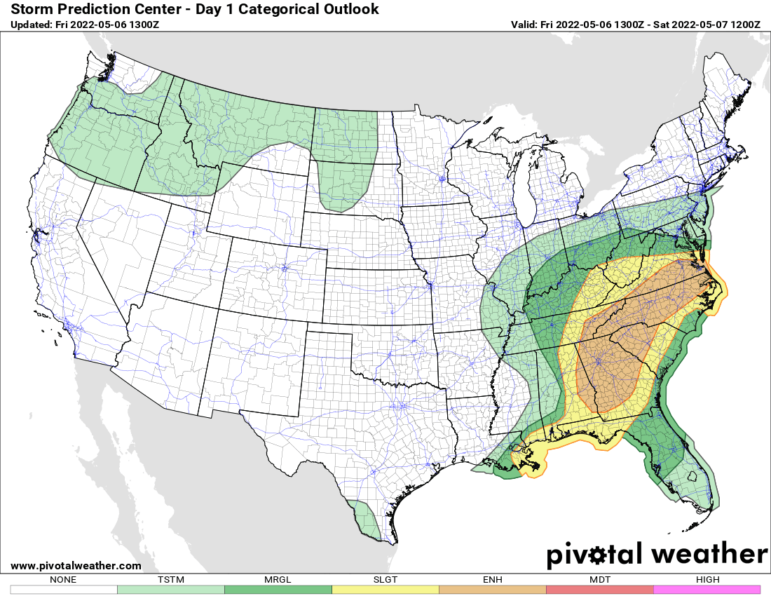
Today’s thunderstorm forecast
Today’s thunderstorm forecast: Southeast
All severe risk areas have a chance for damaging winds, hail, and tornadoes. As aforementioned, the greatest tornado concern is within the enhanced severe risk areas with central & southern Georgia and southern South Carolina being the area with the highest probability of seeing tornadoes today. Severe storms are expected to fire up late this morning into the early afternoon hours and continue into the evening hours. Storms will move from west to east throughout the day.
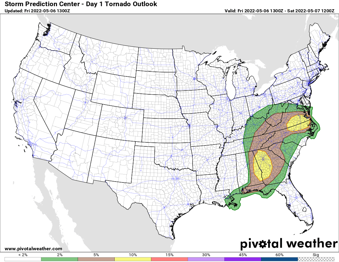
Today’s tornado probability forecast: Southeast
If you live in or near the severe risk areas, please have a couple of reliable sources to receive weather warnings from, and have a plan in place in case a warning is issued for your area.