Severe storms & tornadoes possible for the Southeast Friday & Saturday
Firsthand Weather has talked about the wintry threat for parts of the South over the past few days but there’s also a severe thunderstorm and tornado risk Friday & Saturday for parts of the Southeast. Read more about the winter storm.
The Storm Prediction Center (SPC) has outlined an area of a marginal (level 1 of 5 – dark green), slight (level 2 of 5 – yellow), and enhanced (level 3 of 5 – orange) severe risk on Friday for parts of the Southeast. The area extends from Louisiana east to the Carolinas. Friday will be quite active for this region with several rounds of thunderstorms throughout the day. Severe weather is possible at any point Friday with an increasingly severe risk Friday evening into the overnight hours. All modes of severe weather are possible including tornadoes, damaging winds, and large hail. The tornado risk will be highest Friday night.
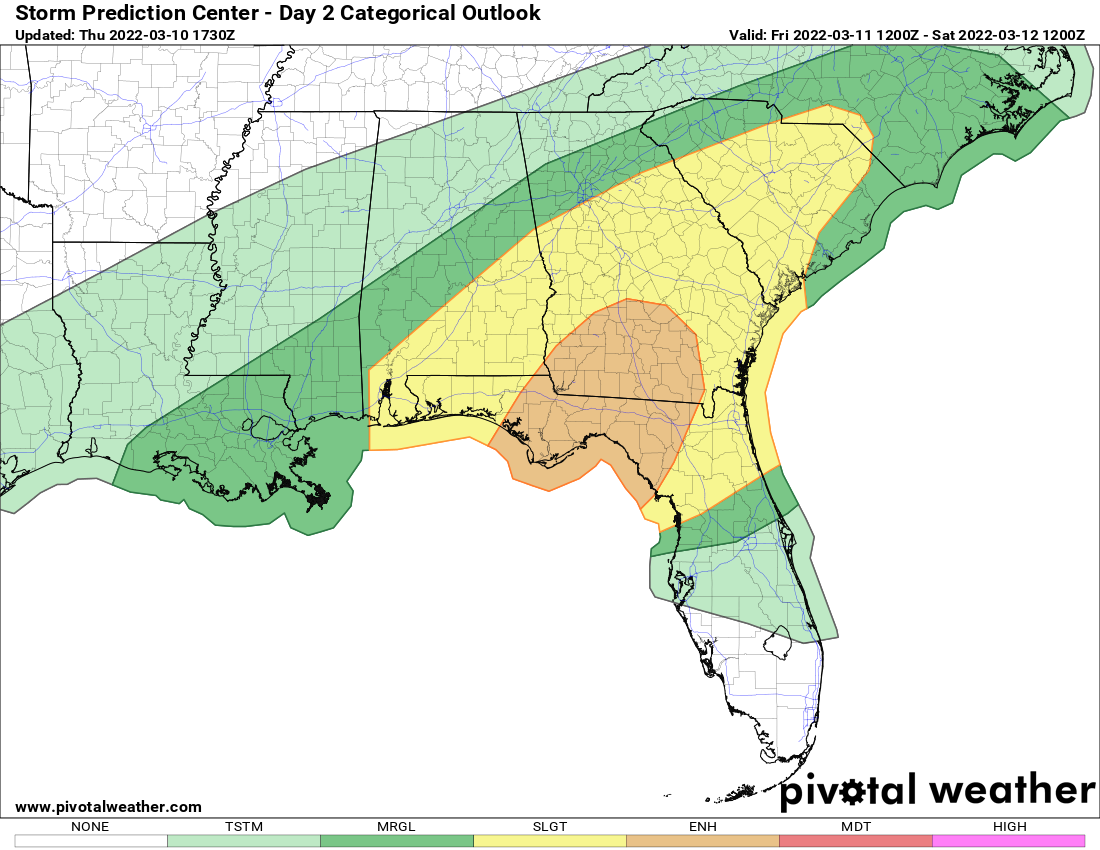
Friday’s severe risk area
All areas within the risk areas will see a tornado potential but the highest potential for tornadoes will exist from the Florida Panhandle, southeastern Alabama, southern Georgia, northern Florida, and south-central South Carolina.
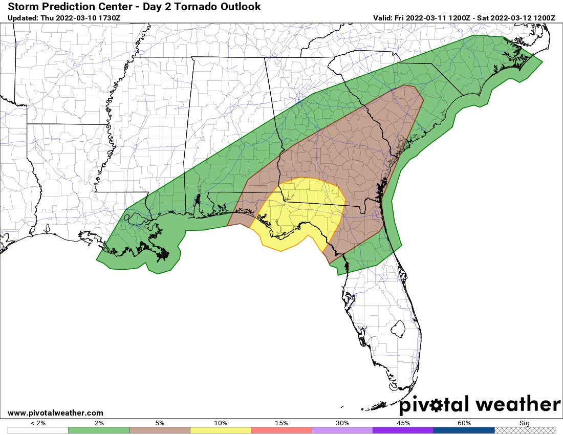
Friday’s tornado probability
The severe risk will shift east overnight Friday into Saturday, thus, the SPC has outlined an area of a marginal (level 1 of 5 – dark green) and slight (level 2 of 5 – yellow) severe risk on Saturday for coastal parts of the Southeast. The area extends from Florida north to the Carolinas. Again, similar to Friday, all modes of severe weather are possible including tornadoes, damaging winds, and large hail.
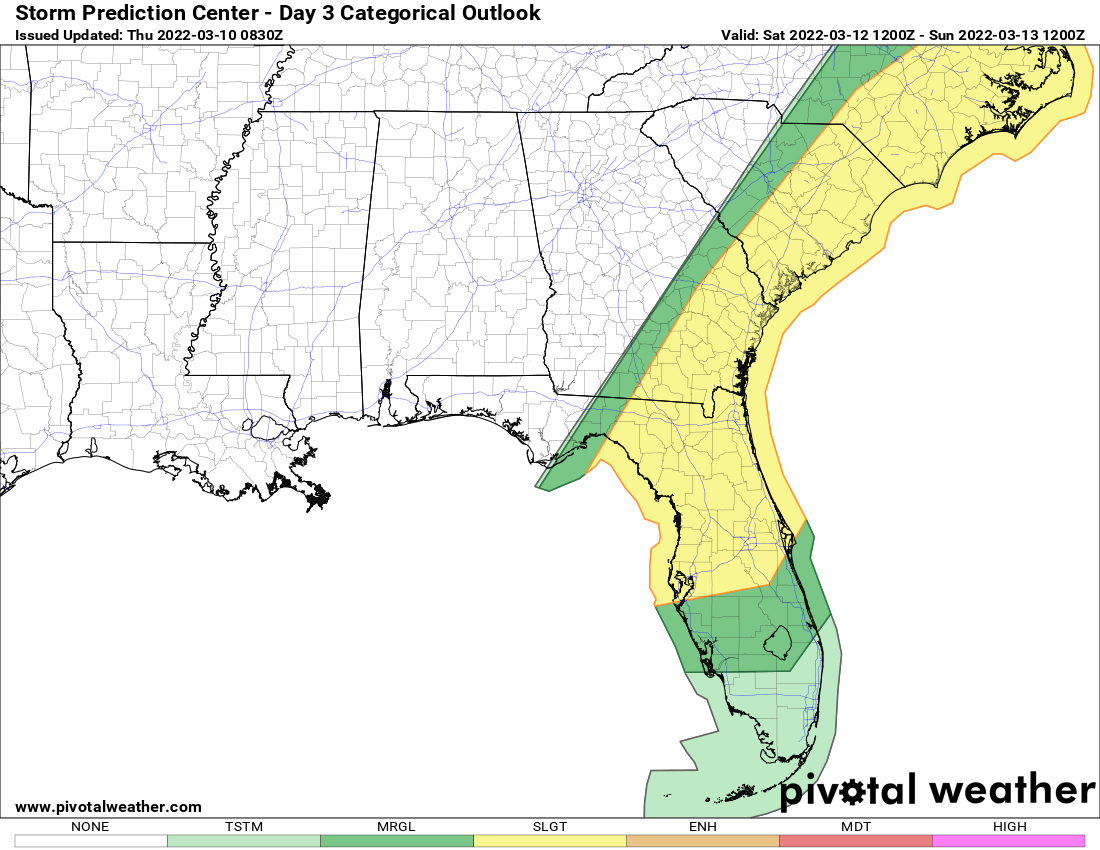
Saturday’s severe risk area
If you live within the severe risk area, please keep a close eye on the forecast, have reliable sources to receive weather warnings from, and have a plan in place in case a warning is issued for your area.