Severe weather outbreak possible today
A dangerous severe weather day is expected for parts of the Southern Plains with several tornadoes and hurricane-force winds possible this afternoon and evening. The Storm Prediction Center has highlighted an area within a moderate (level 4/5) and enhanced (level 3/5) severe risk from central and northern Oklahoma into southern Kansas east into southwestern Missouri, and northwestern Arkansas.
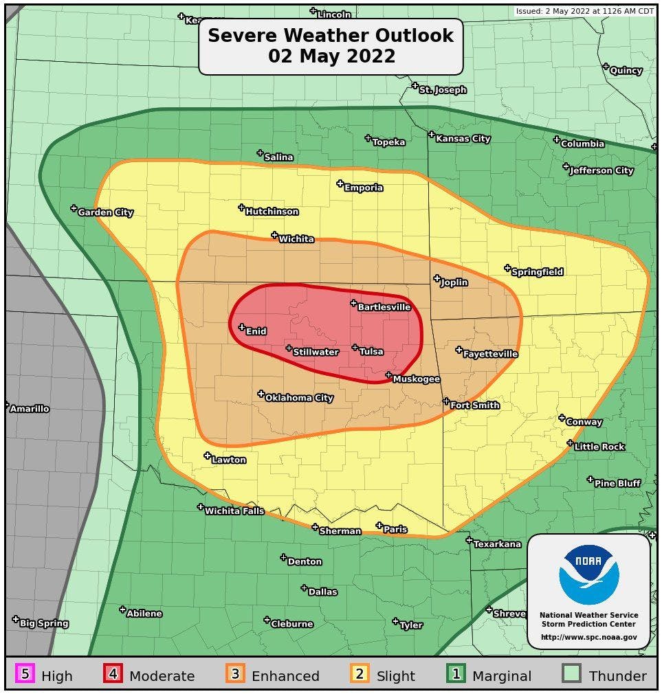
These risk areas include Tulsa, OK; Stillwater, OK; Norman, OK; Oklahoma City, OK; Wichita, KS; Joplin, MO; Fort Smith, AR; and Fayetteville, AR. This is where there is the greatest concern for the most widespread damaging winds, large hail, and tornadoes.
Surrounding the high, moderate, and enhanced severe risk area is a slight (level 2/5) and marginal (level 1/5) severe risk area which extends down into northern Texas and east into the Mid-South. Within all the severe risk areas, there is the possibility of damaging winds, large hail, and tornadoes.
Severe storms will fire up early this afternoon west of I-35 in Kansas and Oklahoma and eventually move east through the afternoon into the evening hours.
If you live in this area, please have a couple of reliable sources to receive weather information from, and have a plan in place in case a warning is issued for your area.