A severe outbreak is possible with strong tornadoes, damaging winds, and large hail over the next two days
Key takeaways
I. Severe storms are possible for the South and Deep South Monday and Tuesday
II. Severe storms will be capable of producing strong tornadoes, damaging winds, large hail, and isolated flooding
III. Several major Metro areas are under fire, including Dallas, Houston, Tulsa, Little Rock, Memphis, Jackson, Birmingham, and Atlanta
A severe outbreak is possible Monday and Tuesday that could bring widespread severe weather to parts of the South. The potential hazards are tornadoes (a few of which could be strong, and long-lived), damaging winds, large hail, and even flooding as a strong storm system sweeps through.
This storm system is bringing in a potent cold front into an almost tropical, warm, humid airmass, and paired with favorable directional and speed sheer to create a susceptible environment for dangerous thunderstorms beginning early Monday afternoon, continuing through the overnight hours Monday and throughout the day on Tuesday. During this timeframe, several major Metro areas will be included within a severe risk area.
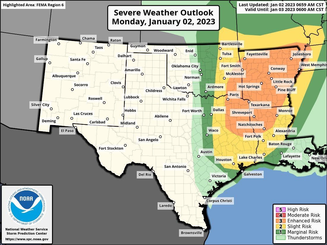
Monday
Showers and weak, isolated thunderstorms have already fired up around and east of the I-35 corridor in southern Kansas, Oklahoma, and Texas. This activity will continue to increase in coverage and intensity Monday afternoon and evening with severe storms likely across eastern Oklahoma, northern and eastern Texas, east into Arkansas, southern Missouri, Louisiana, western Mississippi, western Tennessee, and western Kentucky.
These areas are under Level 1 (out of 5), Level 2, and Level 3 severe risk Monday afternoon, evening, and night. Widespread severe weather is expected within these risk areas and nighttime tornadoes are possible Monday night, some of which could be stronger than EF 2 (out of 5).
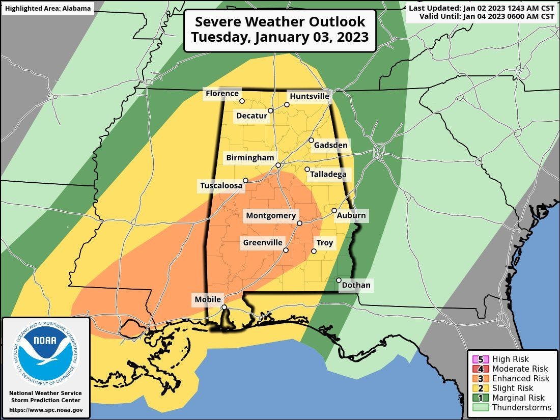
Tuesday
The severe threat continues overnight Monday into Tuesday for the Deep South and Dixie Alley, including eastern Louisiana, Mississippi, central Tennessee, Alabama, the Florida Panhandle, and western Georgia. Tuesday will yet again feature the potential for widespread severe thunderstorms that could produce tornadoes (some tornadoes could be strong), damaging winds, large hail, and isolated areas of flooding.
Beyond Monday and Tuesday
The severe threat continues into Wednesday for eastern Georgia and the Carolinas but the severe threat appears to lessen at this point with the main hazard being damaging wind gusts.
Make sure you're weather aware over the next couple of days if you live in the South of Deep South, have reliable sources to receive weather warnings from, and have a shelter plan in place in case a warning is issued for your location.