Another round of severe storms and tornadoes Saturday
Severe storms are expected this afternoon and evening from the Great Lake to the Gulf Coast as a cold front sweeps into a warm, moist, unstable airmass. All the ingredients are in place for strong storms to become severe later today producing all modes of severe weather, including tornadoes, large hail, and damaging winds. While all the ingredients are in place for all modes of severe weather, the tornado risk is not as high as it was earlier this month of these areas. There's a greater concern for damaging winds and large hail.
Saturday's severe risk
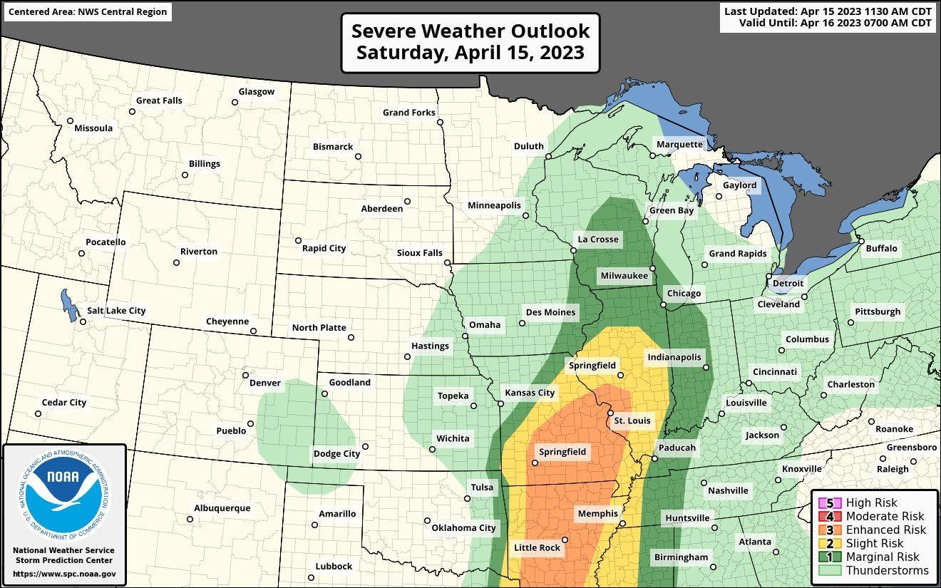
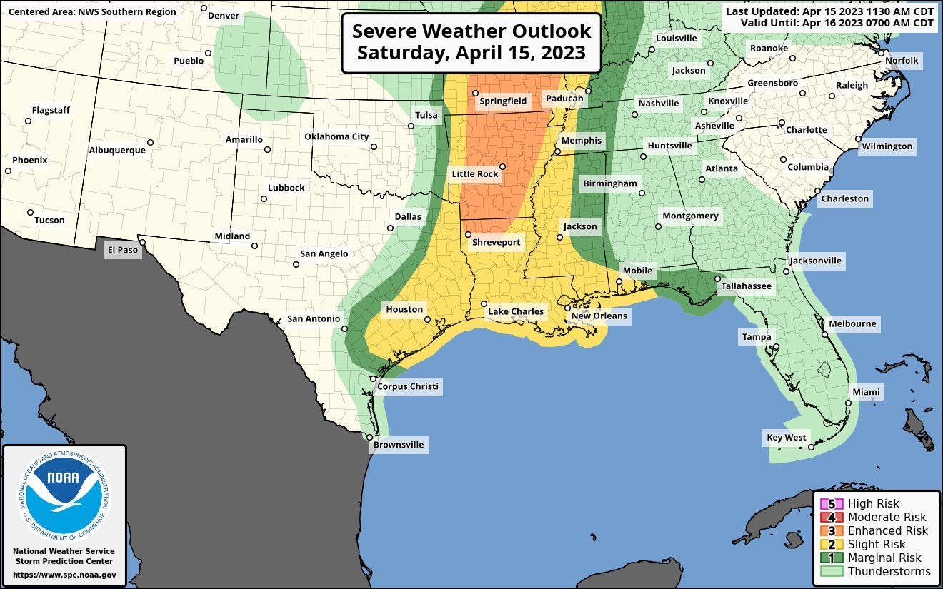
Because of the severe threat this afternoon and evening, there's a severe risk from Wisconsin to Texas. The highest sever risk extends from the mid-Mississippi Valley into the Deep South where there's a level 3 (enhanced - level 3/5) severe risk [orange shaded area] and a level 2 (slight - level 2/5) severe risk [yellow shaded area].
Sunday's severe risk
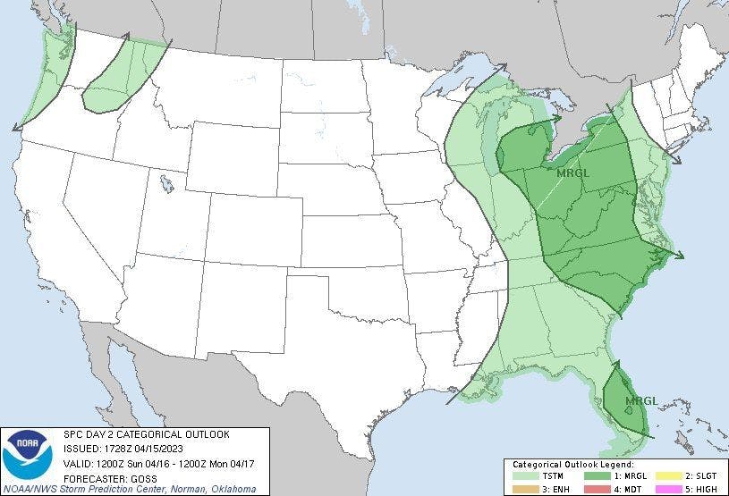
The severe threat shifts east tomorrow but begins to slowly diminish. The main concern is gusty winds from thunderstorms that could cause isolated areas of damage. There's a level 1 (marginal - level 1/5) severe risk [dark green shaded area] from the Great Lakes into the Mid-Atlantic, Carolinas, and Florida.