Dallas, north Texas could see strong tornadoes and very large hail
Another chance for high-impact severe weather today, Sunday, April 2, across north Texas including the entire Dallas-Fort Worth Metroplex.
A volatile environment will set up across north Texas this afternoon and evening as a warm, moist airmass surges north into the region. The boundary between this warm, moist air, and slightly cooler drier air to the north along with a sharpening dryline in western Texas will help trigger the storms this afternoon and evening as a strong piece of lift races into Texas.
Making the situation even more concerning is the afternoon sunshine across the severe risk area, which will only help enhance the severe potential this afternoon continuing into the evening and possibly even into the nighttime hours.
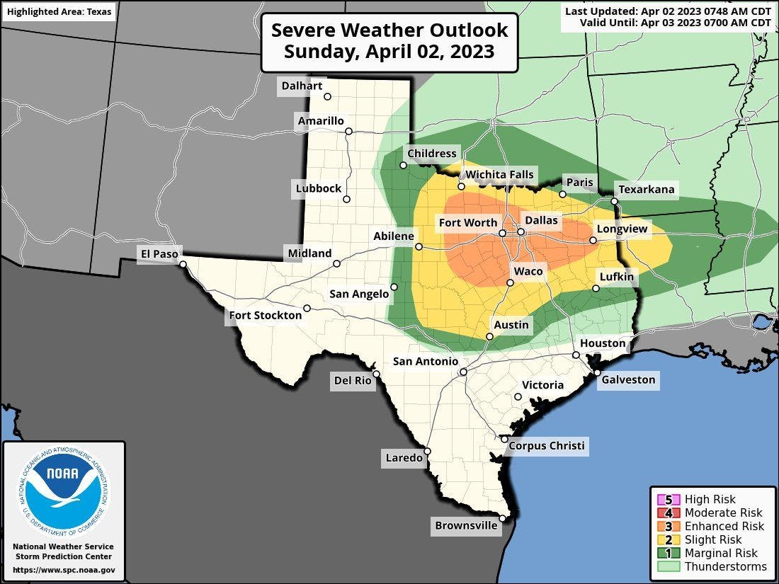
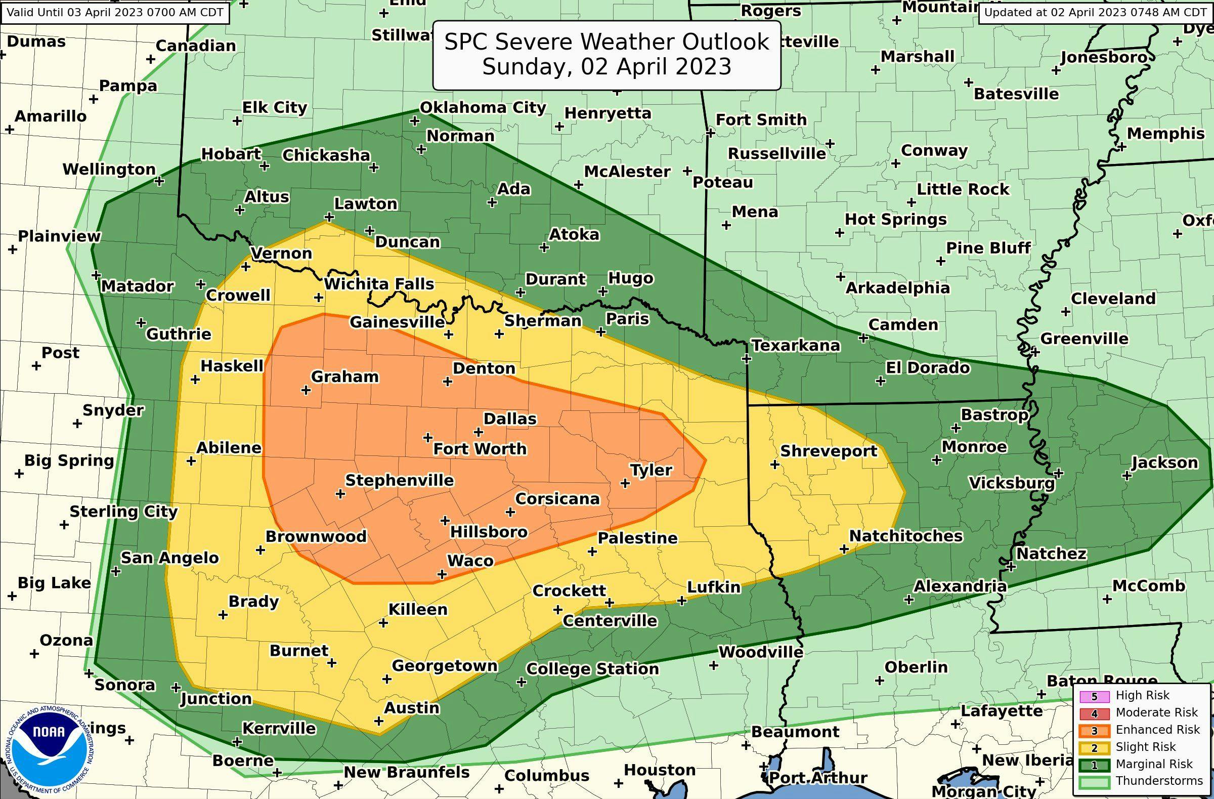
The Storm Prediction Center has a sever risk not only for northern Texas, but the severe risk extends into central and eastern Texas, southern and central Oklahoma, southern Arkansas, central and northern Louisiana and west-central Mississippi. This is where a level 1 (marginal risk—dark green), level 2 (slight risk—yellow) and level 3 (enhanced risk—orange) exists for tornadoes, large hail and damaging winds.
Today's severe risk
Today's tornado probability
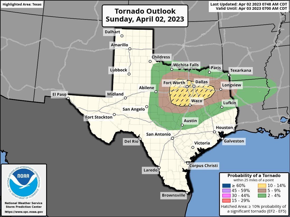
All risk areas have the potential to see severe thunderstorms but an emphasis on potentially the most significant, damaging severe storms may setup in north Texas where strong tornadoes (stronger than EF2), wind gusts to 80 mph, and very large hail (larger than golf balls) is possible.
Today's severe risk in northern Texas and DFW
If you live in this area, please be weather aware this afternoon, evening and tonight.