Severe risk continues today, shifts east
Coming off an active severe weather day Friday with numerous severe weather reports from the Plains into the Midwest and down into the Deep South, the severe threat continues Saturday.
Afternoon and evening thunderstorms are possible for the Eastern Seaboard from the Northeast down into the Southeast. While the severe weather risk is considerably lower than Friday, dangerous storms are still possible.
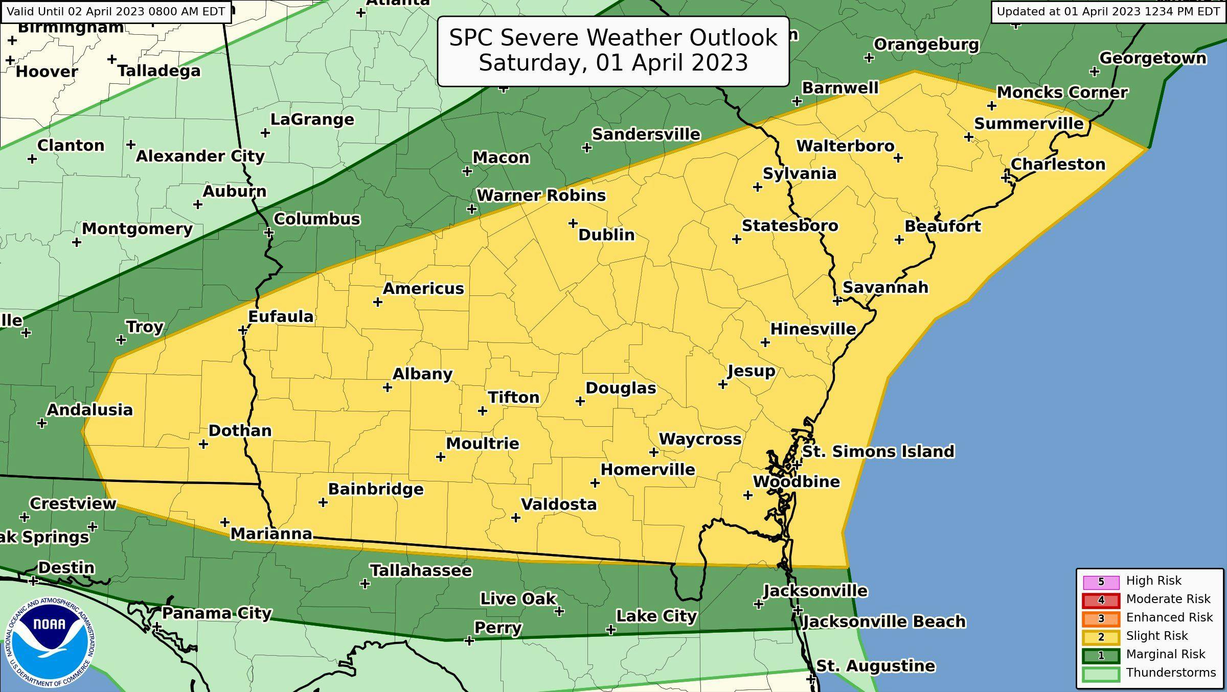
There's a marginal (level 1 of 5) severe risk [dark green] and a slight (level 2 of 5) severe risk [yellow] for the Southeast this afternoon and evening. Many storms stay below severe levels but the ones that get stronger could produce damaging winds and pocket change size hail. Damaging wind is the biggest concern for southern parts of Alabama, southern Georgia into southern coastal areas of South Carolina. There is a low-end tornado risk late this afternoon.
Southeast severe risk Saturday
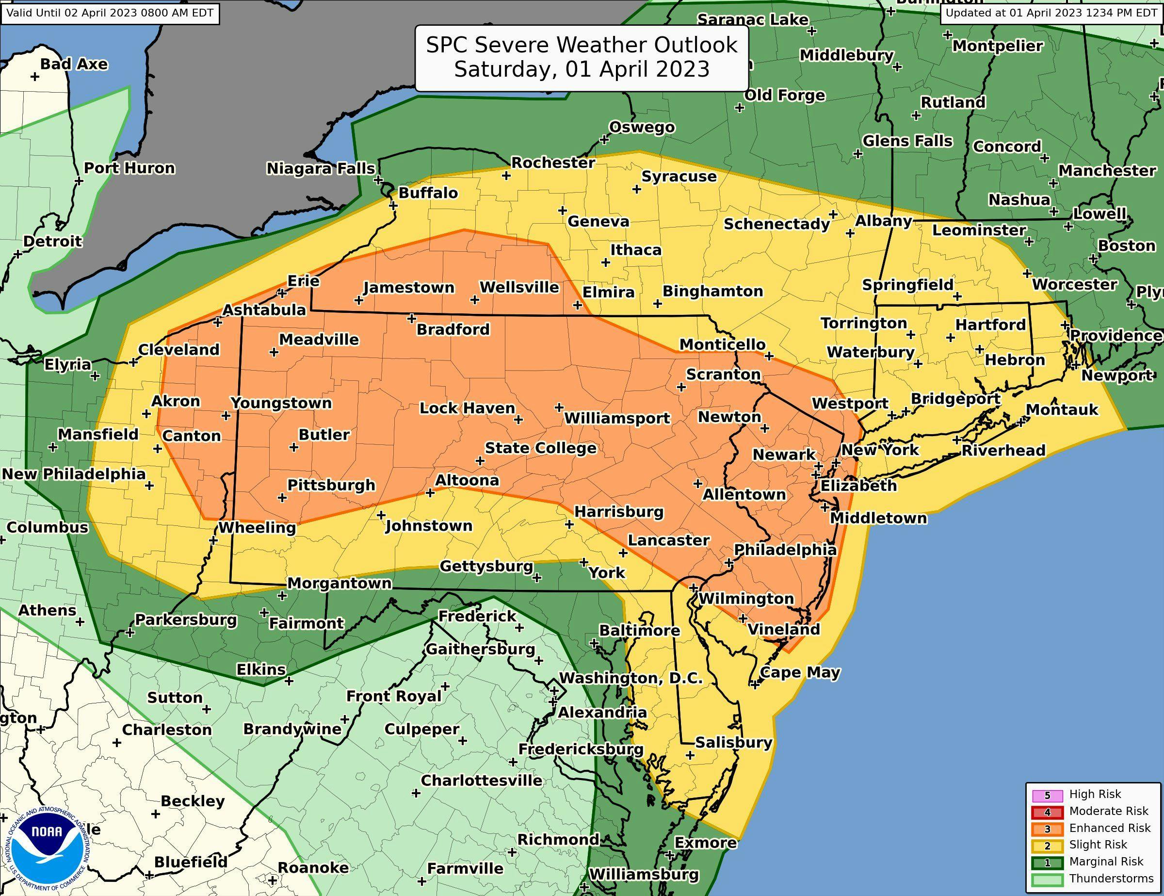
A slightly higher severe risk exists farther north across the Northeast where more widespread severe storms are expected. There's a slightly higher chance for tornadoes in this region along with larger hail sizes. Because of the increased coverage and intensity in storms, there's an enhanced (level 3 of 5) severe risk [orange] this afternoon and evening. Northeast severe risk Saturday
If you live in or near the risk area, please have a shelter plan in place in case a warning is issued for your area. Also, have a couple reliable sources to receive weather accurate, timely severe weather warnings from.