Severe storms and strong tornadoes possible for parts of the South
Ongoing storms early Thursday are expected to continue throughout the day, becoming severe, producing damaging winds, large hail, and creating the potential for strong tornadoes.
The ongoing storms are producing gusty winds and heavy rain from the Ohio Valley to the lower Mississippi River. Most of the storms are currently below severe levels but that will change later Thursday as the atmosphere become more unstable. Gulf moisture continues to feed in ahead of this storm system, paired with favorable jet stream winds and position, which will set the stage for severe storms and tornadoes, especially Thursday afternoon and evening.
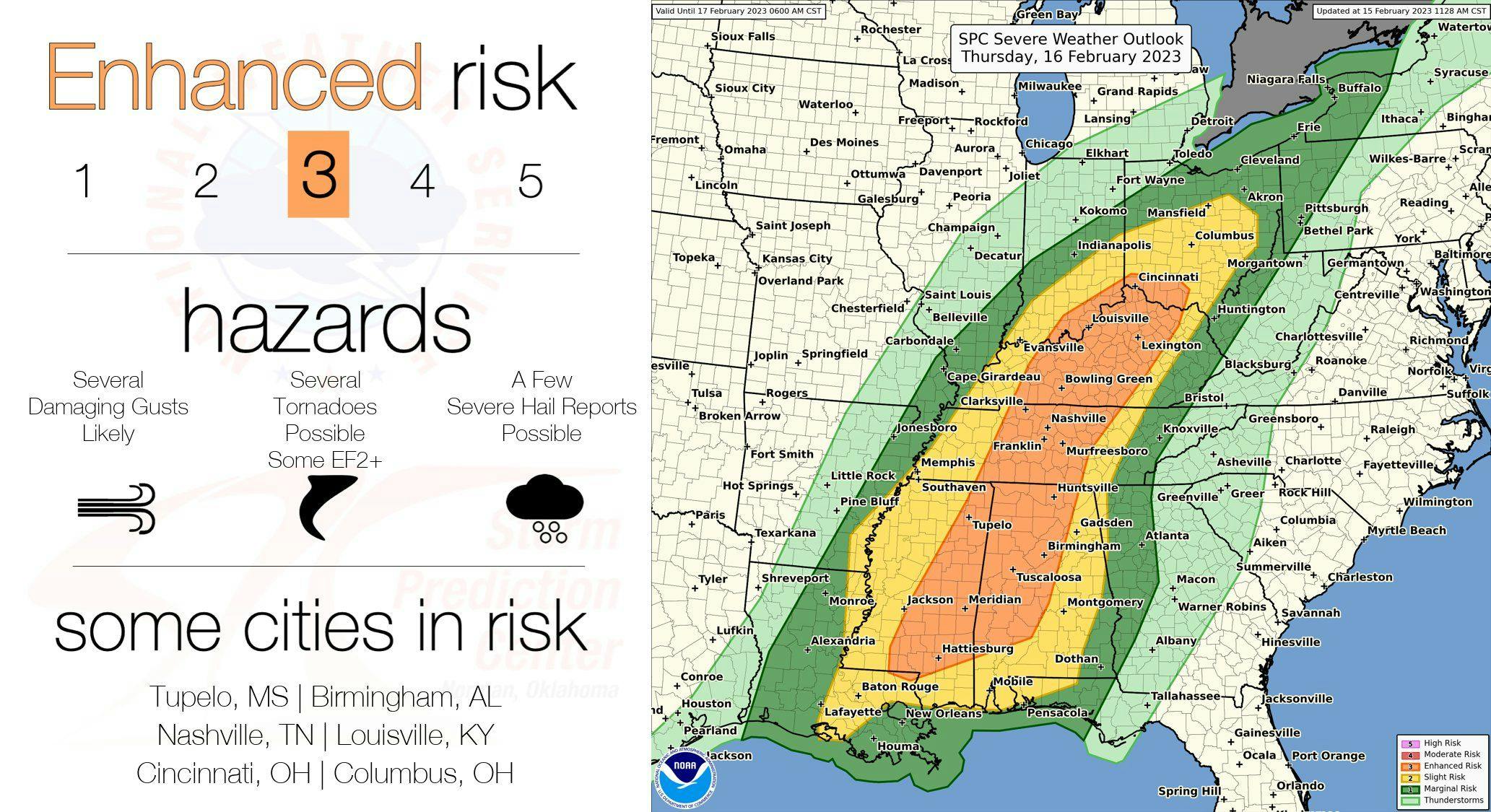
The areas of concern extend from the South to the Ohio Valley, including parts of Louisiana, Arkansas, Mississippi, Alabama, Georgia, Florida, Tennessee, Kentucky, Indiana, Ohio, Pennsylvania, and New York. The greatest threat for severe weather, including the potential for strong tornadoes, exists in central Tennessee, central and eastern Mississippi, and western Alabama Thursday afternoon and evening. This is where there's a Level 3/5 severe risk or an enhanced severe risk from the Storm Prediction Center.
If you live within the severe risk area, have a couple of reliable sources to receive weather warnings from and have a plan in place in case a warning is issued for your area.