Severe upgrade: damaging storms possible Sunday for parts of the South & Southeast
Another round of high-impact thunderstorms is expected Sunday for parts of the Deep South and Southeast. The severe risk extends form southeastern Texas across the southern half of the Gulf States and into the Carolinas throughout the day Sunday.
It appears morning thunderstorms are possible Sunday some of which could become severe producing gusty winds and pocket change size hail. Additional storms will potentially fire up Sunday afternoon and Sunday evening, which could become even stronger than the morning storms. The afternoon storms will pose a more significant severe risk as the atmosphere becomes more primed to produce high-impact severe weather.
Because of the severe risk, the Storm Prediction Center has issued a large marginal (level 1 of 5) severe risk [dark green] and a slight (level 2 of 5) severe risk [yellow] for these areas with a recent upgrade to an enhanced (level 3 of 5) severe risk [orange] for parts of Louisiana, Mississippi, and Alabama.
Sunday, March 26 severe risk from the SPC
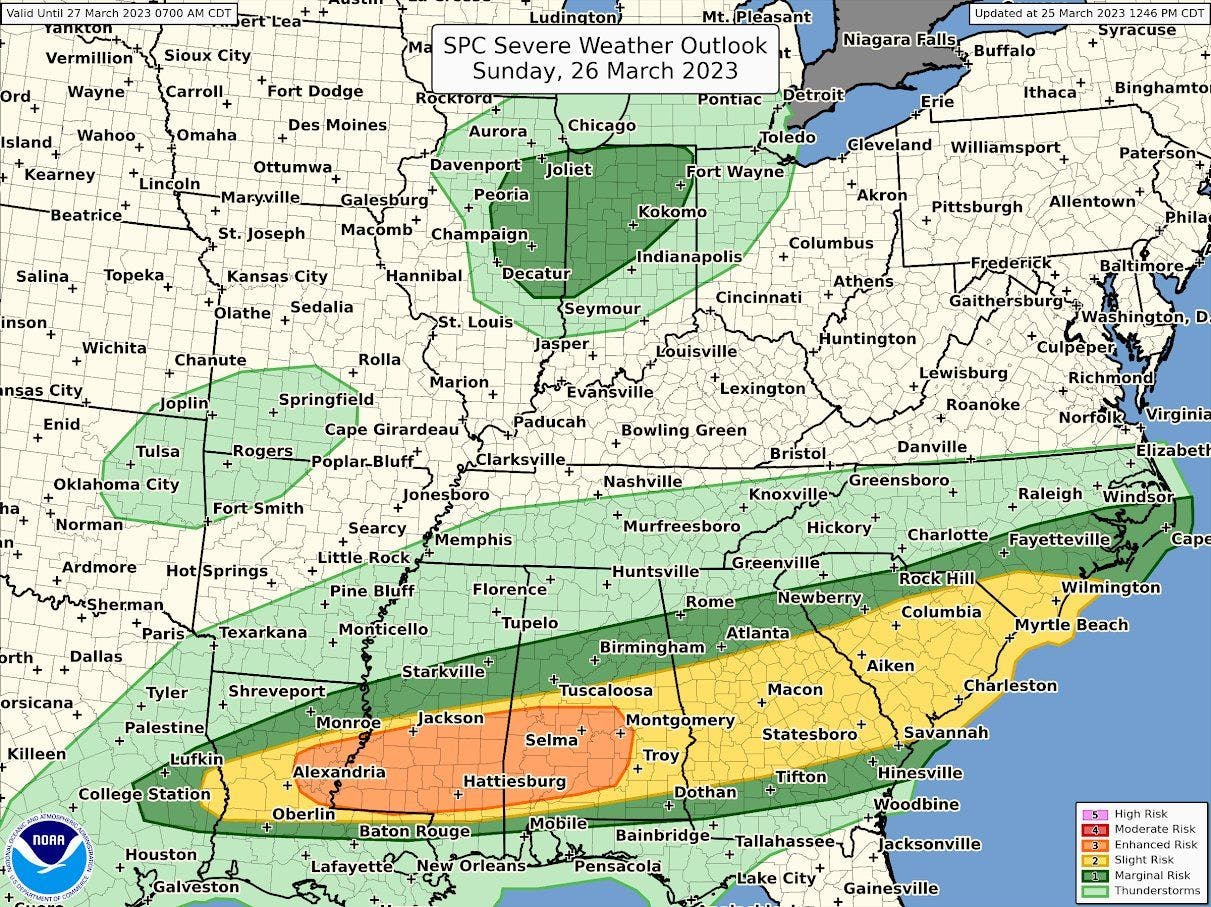
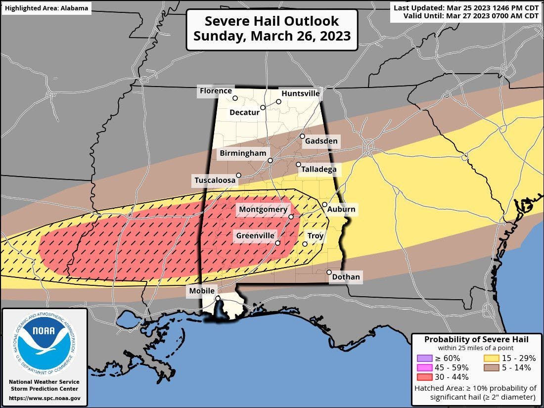
It does appear the main concern will be very large hail, potentially large than golf balls with the strongest storms, which is a big factor in the severe risk upgrade along with the coverage of storms, but there will also be a tornado and damaging wind risk as well with the storms. The highest tornado risk appears to be in-between the I-20 and I-10 corridors.
Sunday, March 26 hail risk from the SPC
If you live anywhere within this severe risk or near the severe risk, please make sure you keep a close eye on the forecast today and tomorrow. Have a plan in place in case a severe thunderstorm or tornado warning is issued for your location, and have a couple reliable sources to receive accurately, timely warnings from.