Severe weather outbreak possible this week
The spring season just started last week, and the severe weather has quickly followed the start of the season. Another round of severe storms and tornadoes looks likely from late week into the weekend as we conclude the month of March and ring in April.
A potent storm system delivering heavy rain, snow, and wind to California today will zip east across the country through the end of the week into the week, triggering intense thunderstorms. Out ahead of this storm system, rich, Gulf moisture will surge north into the Plains. This warm, moist air mass will set the stage for spring storms and the potent storm system will provide strong speed and directional wind shear. This will allow for rotating, severe thunderstorms that could produce tornadoes, large hail, and damaging winds for a big chunk of the county.
Thursday
The severe thunderstorm chances begin Thursday across the Plains from southeastern South Dakota down through northwestern Texas. Storms in South Dakota and Nebraska could produce hail whereas storms farther south from Kansas through Oklahoma into Texas have a better chance to produce gusty winds and isolated tornadoes. There's a marginal (level 1 of 5) severe risk [dark green] Thursday afternoon and evening.
Thursday's severe risk
Friday
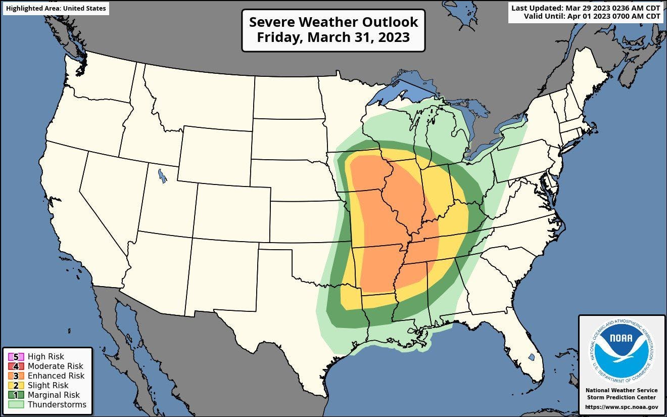
A more widespread, high-impact severe risk is expected to unfold Friday across central parts of the county from the Midwest to the Deep South. Severe storms are expected to be widespread Friday afternoon, evening and continuing into the overnight hours. These storms will have the capability to produce tornadoes, large hail, and damaging winds from Illinois/Iowa south into Mississippi. This places millions at risk for tornadoes, including parts of Mississippi that were hit last Friday by violent tornadoes. There's a widespread enhanced (level 3 of 5) severe risk [orange] from Iowa to Mississippi on Friday with a slight (level 2 of 5) severe risk [yellow] and marginal (level 1 of 5) severe risk [dark green] extending outward from the enhanced severe risk area.
Friday's severe risk
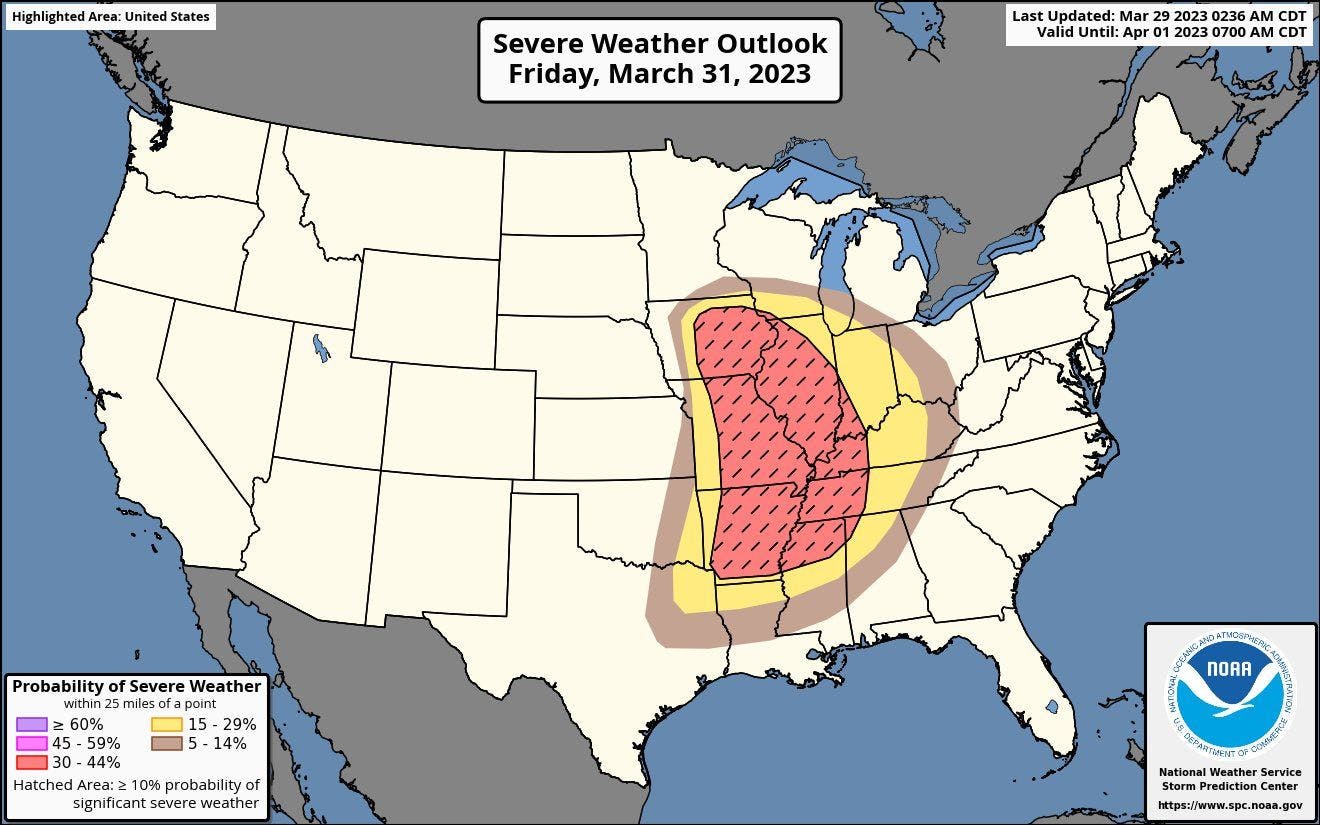
Friday's severe weather probability
Additional isolated severe storms are possible on Saturday farther east into parts of the Southeast and Mid-Atlantic. Currently there is no severe risk area outlined for these areas but that will likely change over the coming days as confidence increases in the severe risk level, area, and hazards.
Plan NOW
If you live anywhere in or near the risk areas, now is the time to plan. Have a severe weather plan in place in case a warning is issued for your area. Know where you'll shelter so you can readily activate that plan. It's also important to have a couple of reliable sources to receive quick, accurate weather alerts from.