Strong tornadoes and damaging hail possible for the South
Another round of high-impact thunderstorms is expected today for parts of the Deep South and Southeast. The severe risk extends form southeastern Texas across the southern half of the Gulf States and into the Carolinas for the day Sunday.
Storms are ongoing at this hour with additional storms expected to fire up throughout the afternoon and evening hours. Storms later today are expected to become stronger than the storms experienced earlier in the morning hours today, posing a more significant severe risk as the atmosphere becomes primed to produce high-impact severe weather. The potential for extremely large hail and long-track, strong, potentially violent, tornadoes are possible.
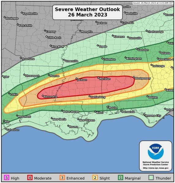
Because of the severe risk and expected coverage, the Storm Prediction Center upgraded parts of the South to a moderate (level 4 of 5) severe risk [red] in parts of Louisiana, Mississippi, and Alabama. Surrounding the moderate risk is an enhanced (level 3 of 5) severe risk [orange] for parts of Louisiana, Mississippi, Texas, and Alabama—right up to the Georgia state line. There is also a marginal (level 1 of 5) severe risk [dark green] and a slight (level 2 of 5) severe risk [yellow].
Sunday's severe risk and tornado, hail, and damaging wind probabilities
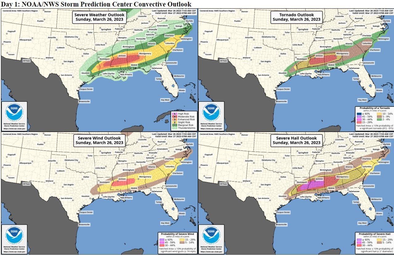
It currently appears the highest strong tornado risk and largest hail risk will occur in-between the I-20 and I-10 corridors. All areas in the severe risk areas have the potential to see severe storms and even tornadoes.
Area of greatest concern
If you live anywhere within this severe risk or near the severe risk, please make sure you keep a close eye on the forecast today. Have a plan in place in case a severe thunderstorm or tornado warning is issued for your location, and have a couple reliable sources to receive accurately, timely warnings from.