Significant damaging wind event possible from Texas to Mississippi late today
It’s been a hyper-active spring storm season and the trend continues this afternoon & evening with the potential for severe thunderstorms. Isolated to scattered severe thunderstorms are expected to develop in northern Texas this afternoon before accelerating east-southeast into eastern Texas, Louisiana, and Mississippi this evening into the overnight hours. The thunderstorm complex will travel along the I-20 corridor. This complex of thunderstorms will have the capability to produce damaging winds, isolated tornadoes, and hail.
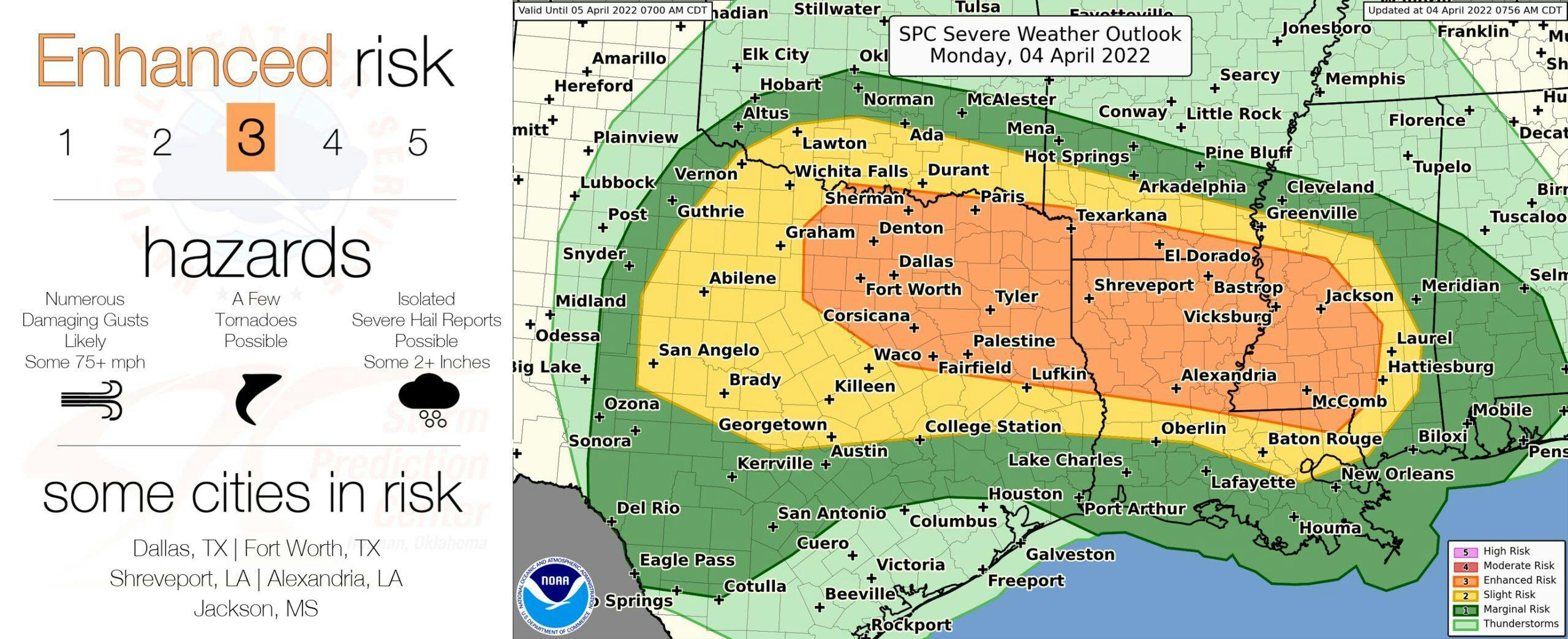
In fact, the damaging wind threat looks elevated along the I-20 corridor from northern Texas to central Mississippi with some significant wind gusts potentially up to 80 mph in some cases. A good number of quick-hitting tornado warnings within this line of storms is also possible this evening and tonight. Because of the numerous severe storms expected within this line of storms, an enhanced (orange – level 3/5) severe risk exists for the aforementioned areas with a slight (yellow – level 2/5) and marginal (dark green – level 1/5) severe risk surrounding the enhanced severe risk area.
If you live within the severe risk area, please stay weather aware!