Significant Winter Storm Looking More Likely For The South Next Week
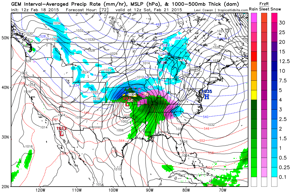
We have a very interesting week coming up!! As many of you know, we’re currently keeping a close watch on a system that could end up becoming a significant winter storm, giving parts of the South another round of wintry weather. At this point, the track of this system is going to be quite important, which will ultimately determine what type of precipitation certain areas get. As promised, I’m going to do a little bit of a model comparison and explain why certain forecast models are making sense and why some are not.
If you look at the GFS deterministic model, it has kept this system drier in comparison to its ensemble and other forecast models. It’s important to note that the GFS ensemble has been much wetter with this system, and given that the NAM and European models are predicting this system to have ample moisture gives me enough reason to believe that moisture will not be an issue. Another thing that the GFS has had a difficult time picking up on is the amount of cold air that is going to be pulled south as a result of a high pressure that will be over the Northeast. Because of the heavy snowpack that is currently over the Northeast, that will make the cold air even more potent. Forecast models are designed to model the atmosphere, but when it comes to taking into account the influence of current snow cover, models often handle that poorly, some more than others.
The European model has definitely been the most aggressive on the snowfall accumulations across portions of the Deep South. It’s actually not uncommon for the Euro to be too aggressive with snowfall totals, but what is remarkable is the consistency that this model has been showing with this system. The Euro has been really good this winter about picking up on these systems early on, but you then have to refine the snowfall totals on your own. One reason that the Euro comes off too aggressive is because it adds in sleet/freezing rain to its snowfall accumulations, which can make those numbers much higher than they really are. That’s why I am always saying to be careful with the weather sources that you choose, because they will share these maps, not even knowing how these forecast models work.
The NAM and Canadian models have also been predicting accumulation snowfall across portions of the Deep South, but it is not nearly as significant with snowfall totals and is not as far south with accumulating snowfall. I still haven’t had a chance to look at the projected Skew-T diagrams (I don’t expect you to know what that is), but once I do that, that will help me to have a better understanding of how much cold air could be in place and how deep the cold layer will be. That could be the difference between a big snowstorm or a significant ice storm. Remember storm track will play a major role in this also.
After this system pushes out of the Southern Plains, areas from northern Mississippi, northern Alabama and Tennessee need to keep a close watch on this. As this system begins to pull in more moisture, areas from northern Georgia, Upstate SC, eastern Tennessee, and on up through North Carolina and Virginia need to watch this system VERY closely. If everything comes together just right, those areas could be dealing with a significant winter storm. I do think that the European model is currently a little too far south with its higher accumulations into midlands SC, but like I said, it has done a phenomenal job in picking up on this storm early. I do need to do further study on who will get ice and who will get all snow, but several of the models suggest an all-snow event for the areas that I just mentioned and then possibly ice to the south of that.
Please note that this system is very complex, and that I will have to do an updated article in a couple of days to really nail down the specifics of this forecast. I’ve posted some of the different snowfall accumulation maps from various forecast models, but please understand that those models are not a forecast but only a possible scenario. Please continue to follow me on Facebook, and if you don’t already, be sure to give our page a like!
Latest Snowfall Totals Projected By The European Model
Latest Snowfall Totals Projected By The NAM
Latest Snowfall Totals Projected By The Canadian Model
All of these forecast models are courtesy of WxBell.


