Snow chances for parts of Georgia, South Carolina, Alabama, North Carolina, and Tennessee
A strong late-week cold front will race through the Southeast from late Thanksgiving into Friday. This cold front will drive temperatures down toward freezing by Friday morning for many areas north of I-20 in the South and Southeast. Join the Firsthand Weather Supporter Group.
The moisture return ahead of this front will be quite meager but enough lift with the cold front and an upper-level system farther north should be enough to generate a few spot rain showers along and just behind the cold front. With the cold air rushing in behind the front, the meager moisture in place will be quick to depart shortly after the cold front passes through. However, there could be a brief window for the cold air and moisture to overlap for a couple of hour window for the possibility of a few snowflakes mixing in with the rain early Friday morning for parts of far northeastern Alabama, eastern Tennessee, far northern Georgia, western North Carolina, and the northern periphery of Upstate South Carolina. Join the Firsthand Weather Supporter Group.
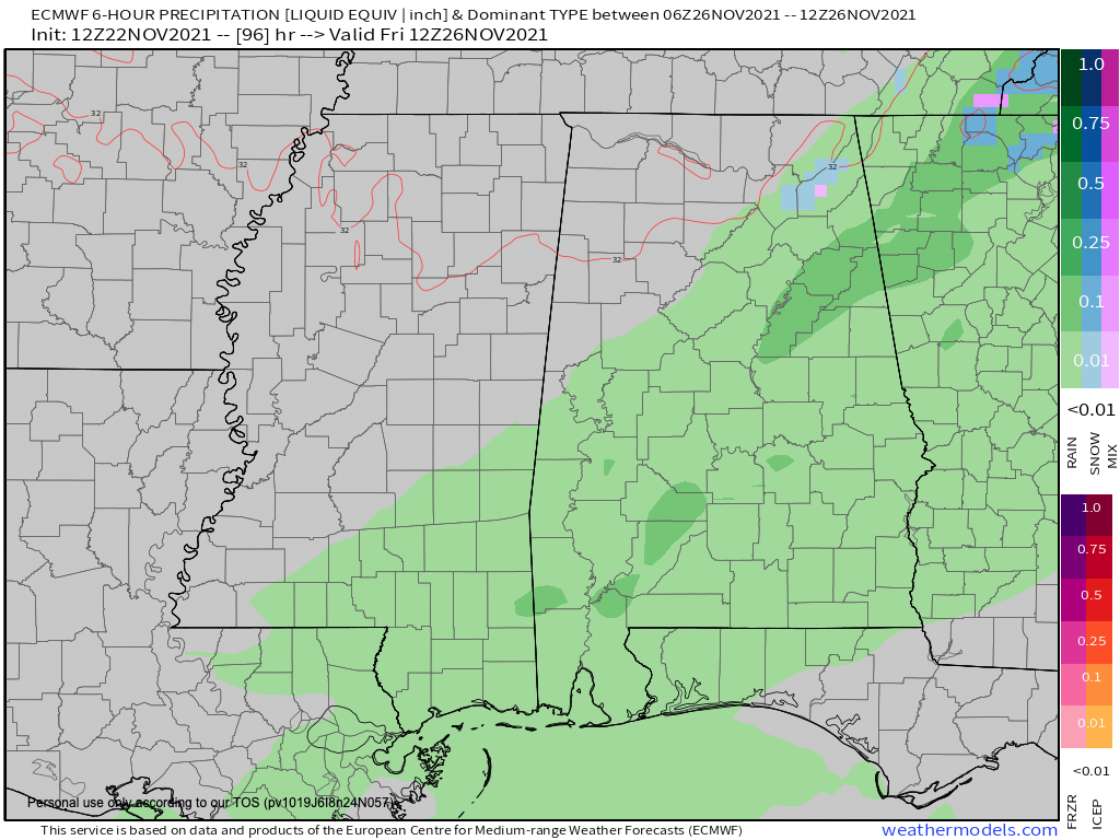
Future radar early Friday morning: Alabama
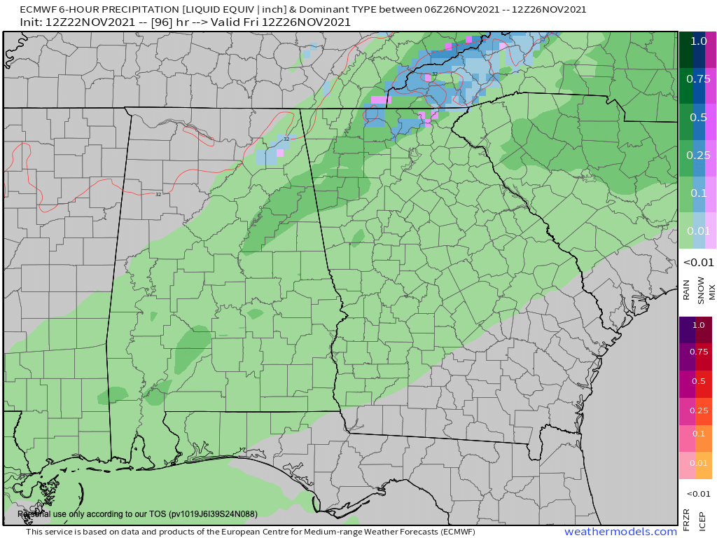
Future radar early Friday morning: Georgia
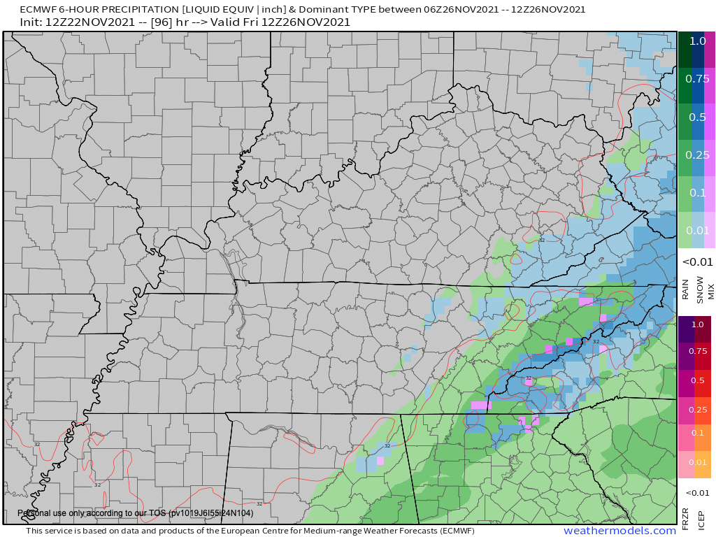
Future radar early Friday morning: Tennessee
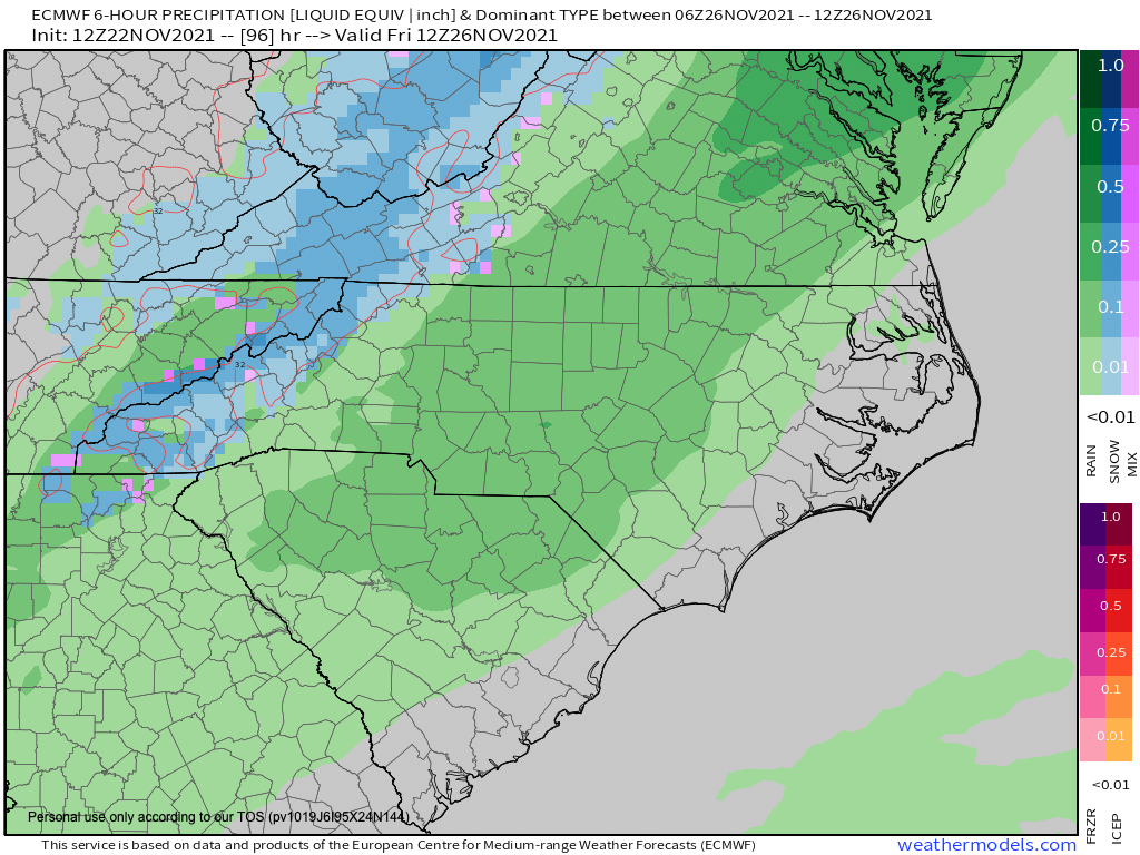
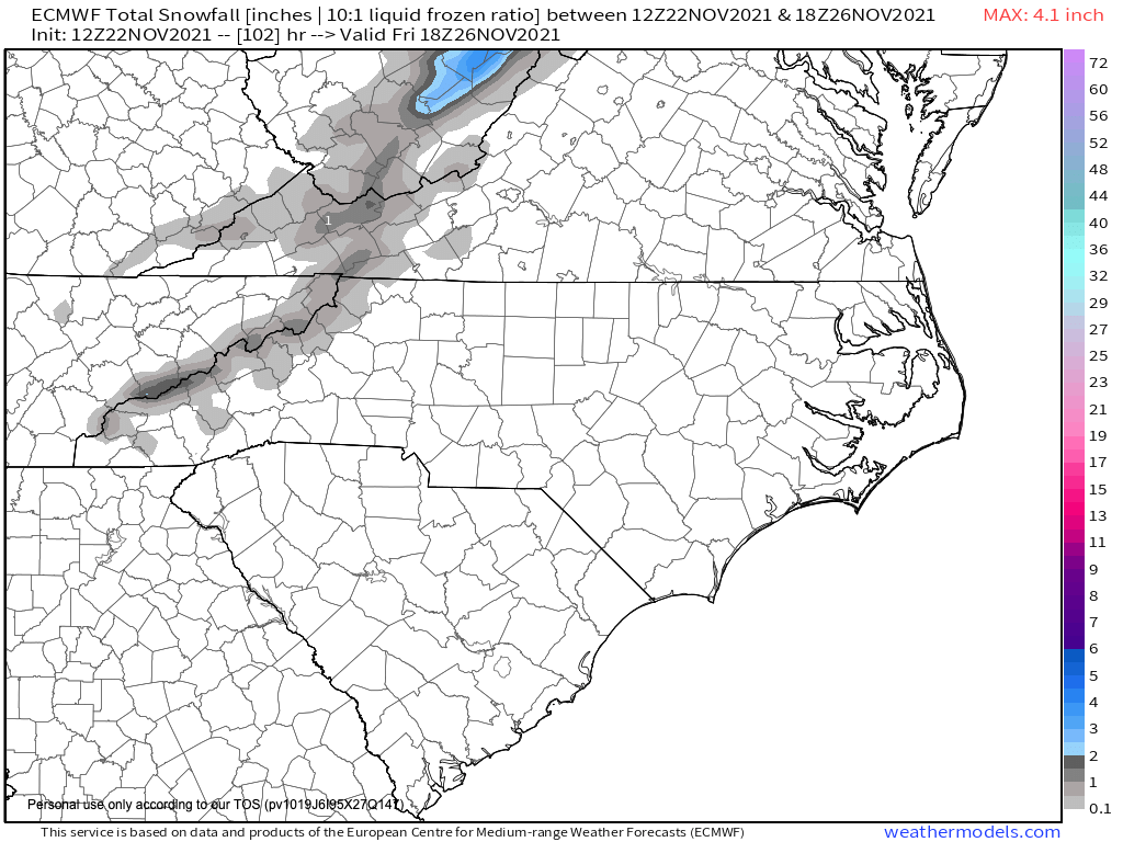
Future radar early Friday morning: North Carolina and South Carolina
It should be noted: if the air “dries out” faster than currently forecast or the cold air is a little slower, the already small snow chances will diminish further. Keep checking back for updates on this forecast that will be likely to change over the coming days.
Again, this is a small window for a few flakes to mix in with the rain and most areas won’t see snow. If you are lucky enough to see a few of the flakes, don’t expect accumulations. The only areas that will see accumulations are the higher peaks of the Great Smoky Mountains in Tennessee and the Blue Ridge Mountains in North Carolina. A dusting to 1 inch is possible above 3,500 feet with 1-3 inches above 4,000 feet. Join the Firsthand Weather Supporter Group.
See the latest winter outlooks below.
Read the NOAA Winter Outlook here.
Read the AccuWeather Winter Outlook here.