Snow possible across the Southeast overnight into Saturday
All eyes are on an upper-level low over the Southern Plains. This upper-level low will race to the east overnight into Saturday and begin to open into a shortwave over the Mid-South tonight. Despite the upper-level system opening into a shortwave, it will be rather vigorous as it moves into the Southeast on Saturday.
Join the Firsthand Weather Supporter Group for exclusive weather content including a detailed video on this event.
https://www.facebook.com/becomesupporter/136842186352541/
As the shortwave treks over the Southeast, strong lift, and a gradual moistening of the atmosphere will occur. This will lead to an uptick in cloud cover across the South & Southeast beginning tonight and continuing through Saturday morning. A light band of precipitation should develop with the increased lift ahead of the shortwave overnight into early-Saturday morning across northeastern Alabama, northern Georgia, far southeastern Tennessee, southeastern North Carolina, and far western Upstate South Carolina.
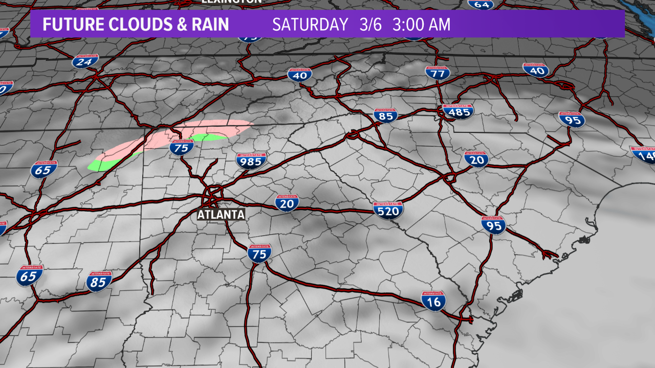
Future radar 3:00 am Saturday
Initially, the precipitation from this band will fall into dry air at the surface; thus, the majority of the precipitation will evaporate before reaching the surface. This evaporation process will lead to a gradual moistening of the atmosphere, leading to precipitation reaching the ground Saturday morning. The precipitation band will increase in coverage and intensity throughout the morning hours Saturday. Here is where the forecast gets interesting. The temperature profile of the atmosphere is supportive of a rain/snow mixture. Almost the entire column of the atmosphere, from the ground to where the jets fly, will be below freezing. This will allow snow or a rain/snow to fall across the aforementioned regions.
Make sure you follow the Firsthand Weather YouTube Channel for the latest weather videos.
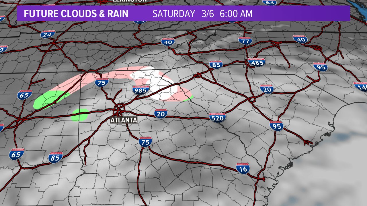
Future radar 6:00 am Saturday
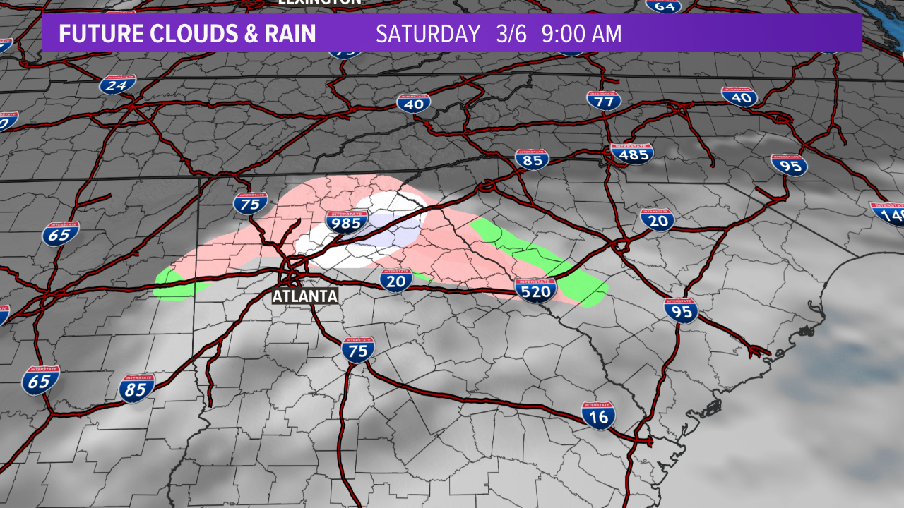
Future radar 9:00 am Saturday
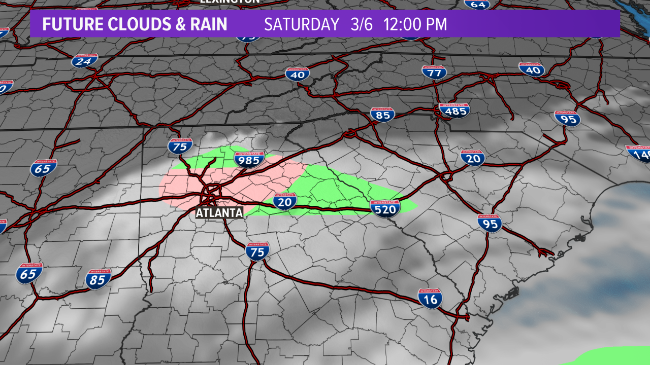
Future radar 12:00 pm Saturday
High-resolution models are suggesting .05″ to .20″ of precipitation falling across northeastern Alabama, northern Georgia, far southeastern Tennessee, southeastern North Carolina, and far western Upstate South Carolina.
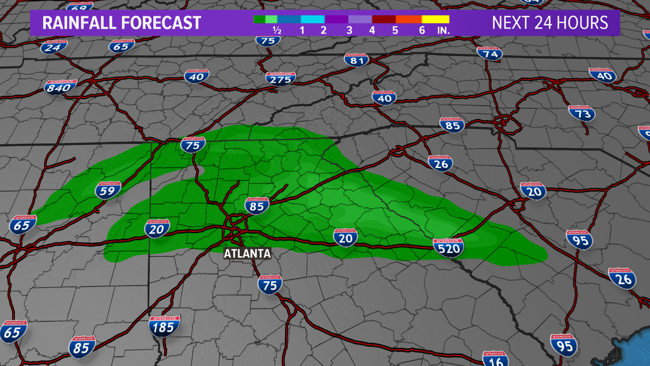
Precipitation accumulation forecast
With temperatures supporting wintry weather, precipitation amounts of .05″ to .20″ would equate to a few areas seeing accumulating snow. Models are suggesting up to 1″ of snow possible.
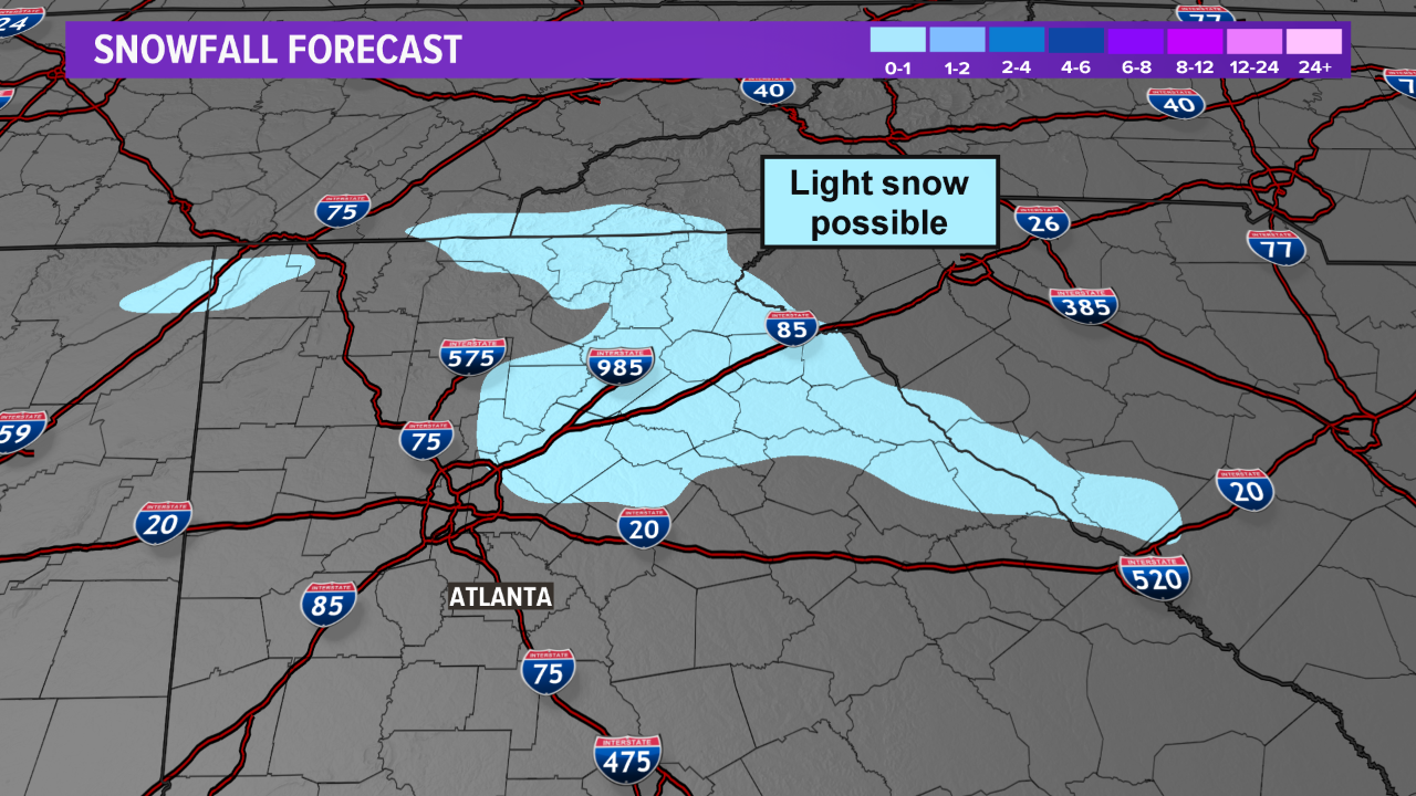
Snow accumulation forecast
Firsthand Weather is forecasting flurries from northeastern Alabama, northern Georgia, far southeastern Tennessee, southeastern North Carolina, and far western Upstate South Carolina Saturday morning with light accumulations possible across the higher terrain of northeastern Georgia. Within this area of accumulations, due to banding, isolated 2″ amounts cannot be ruled out but most areas will see lesser accumulations.
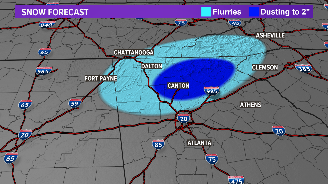
It should be noted: this event is marginal. Slight deviations in weather variables may significantly change the forecast so keep checking back for updates.