South & Southeast: a wetter, cooler weather pattern
A strong summer-like ridge is controlling the weather across the South & Southeast. This ridge is allowing temperatures to skyrocket well above average into the 90s and this is expected to stick around through the end of the workweek into the first half of the weekend, but there are changes in store with a changing weather pattern.
Guidance suggests this ridge will weaken and move eastward off the Southeast coast with a trough digging into central parts of the country. This changing weather pattern will help increase moisture on the western periphery of the ridge along with sending a cold front into the region for the second half of the weekend.
Temperatures will stay in the 90s through Saturday but the cold front arrives overnight Saturday into Sunday, which will significantly drop temperatures. Temperatures will fall from highs in the 90s with a few 100s (Wednesday through Saturday), down into the 70s & lower 80s (Sunday through Tuesday). Low temperatures will fall into the 50s & lower 60s, which will be quite refreshing.
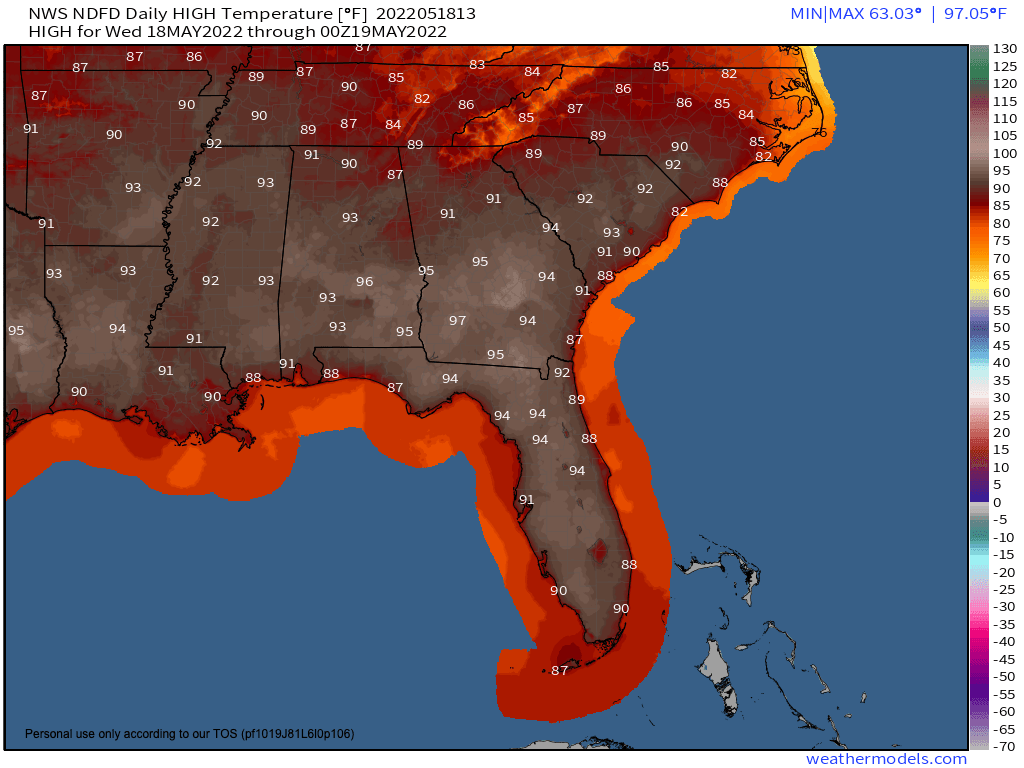
Wednesday’s forecast highs
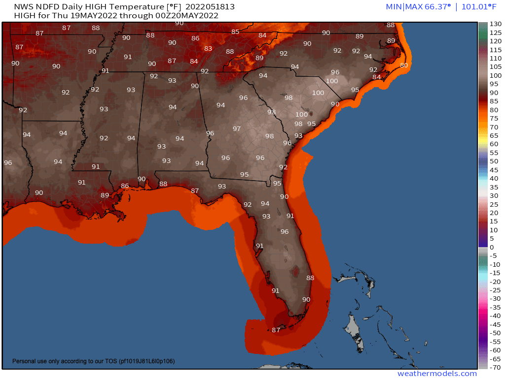
Thursday’s forecast highs
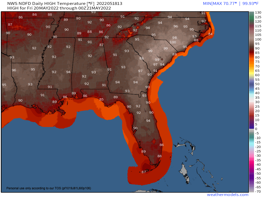
Friday’s forecast highs
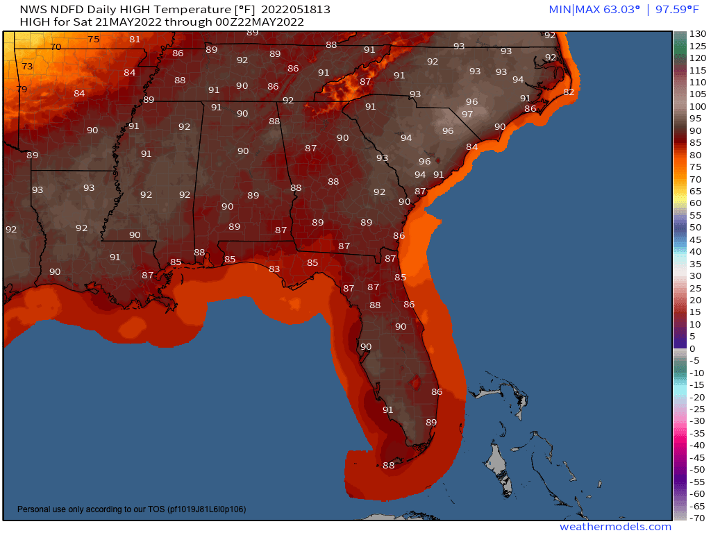
Saturday’s forecast highs
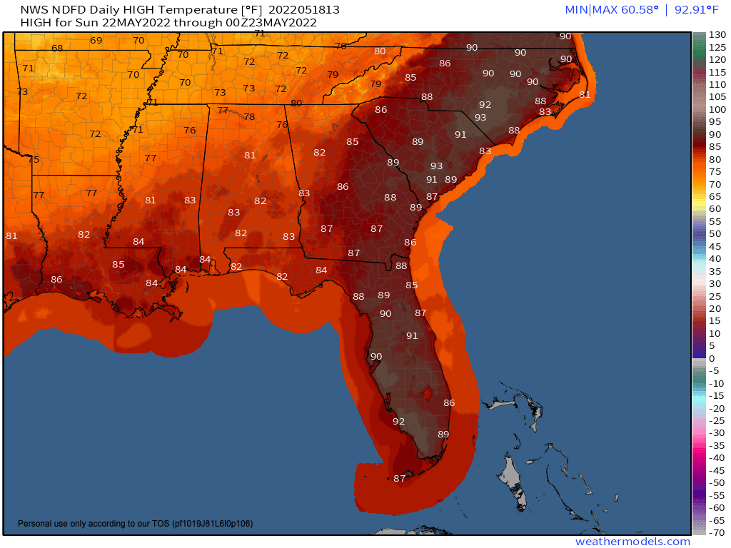
Sunday’s forecast highs
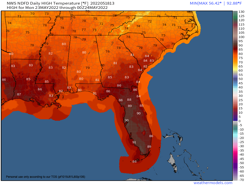
Monday’s forecast highs
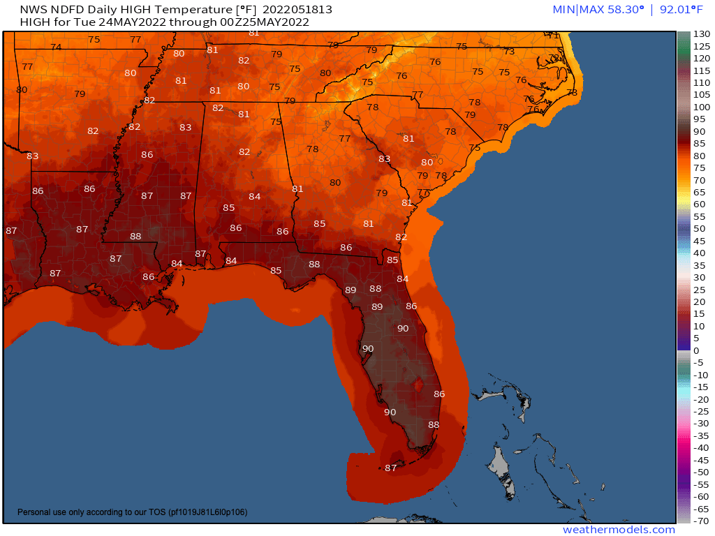
Tuesday’s forecast highs
Rain chances also increase over the weekend into early next week with this pattern change. Isolated to scattered showers and storms are expected, which is great news as some areas in the South & Southeast are beginning to slip into abnormally dry & drought conditions. Expect a widespread 0.75-1.25″ of rain with higher amounts possible. Widespread or organized severe weather is not expected.
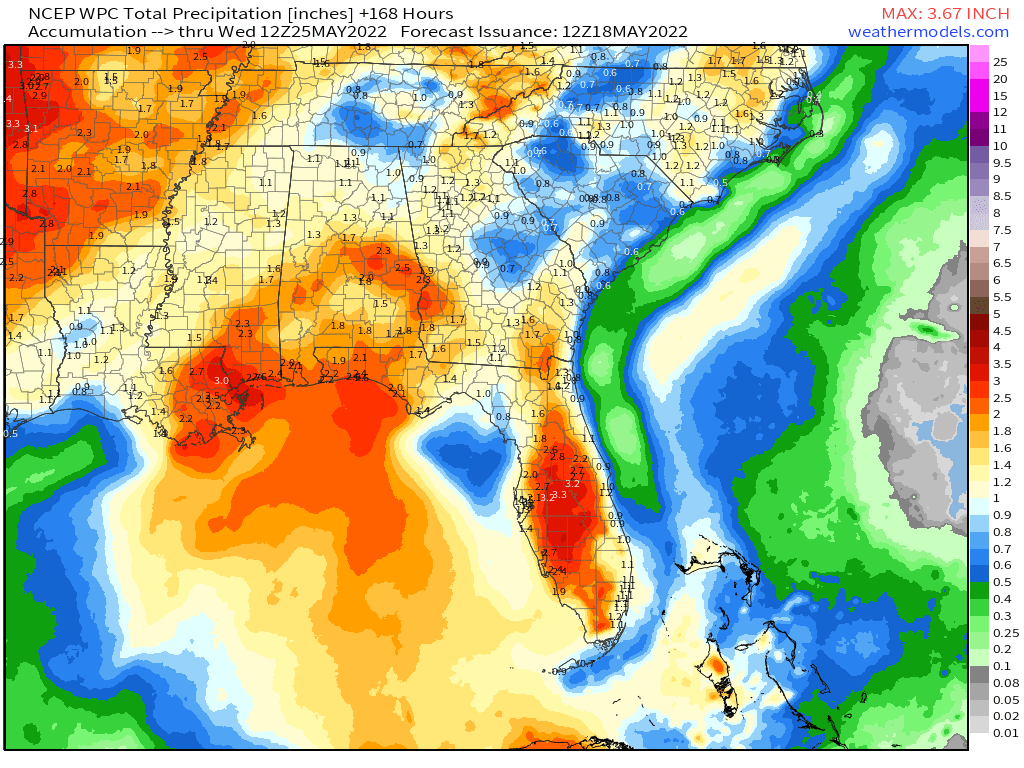
Rainfall forecast next 7-days