Strong cold front to deliver chilly mornings as far south as the Gulf Coast
A fall cold front will move across eastern parts of the country Wednesday and Thursday, delivering a chill to the air. Temperatures will fall well below average with a significant drop in humidity. The cooler air mass will be most noticeable overnight into the early morning hours from Thursday through Saturday.
Low temperatures across the South and Southeast will fall into the 40s & 50s Thursday through Saturday. Some 30s are also expected in parts of Tennesee, western North Carolina, and northeastern Georgia. These areas that fall into the upper 30s will have a chance to see a light frost Thursday night/Friday morning and Friday night/Saturday morning under clear skies and light winds. Protect your plants if you live in far northeast Georgia, western North Carolina, and central Tennessee.
Join the Firsthand Weather Supporter Group today.
Thursday morning low temperatures South & Southeast
Friday morning low temperatures South & Southeast
Saturday morning low temperatures South & Southeast
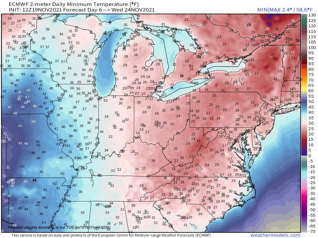
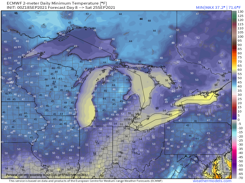
The colder air won’t be confined to the Southeast. Temperatures farther north will also be chilly during the overnight and early morning hours. Widespread 30s & 40s are forecast across the Great Lakes, extending into the Ohio Valley, and Northeast.
Thursday morning low temperatures South & Southeast
Friday morning low temperatures South & Southeast
Saturday morning low temperatures South & Southeast
Join the Firsthand Weather Supporter Group today.
High temperatures will run will below average, falling into the 60s & 70s for the South, Southeast, and Tennesee Valley with 50s & 60s farther north across the Great Lakes and Ohio Valley.