Tornado and severe outbreak expected Wednesday
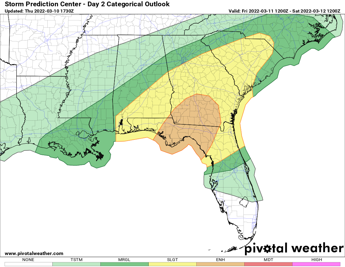
A high-impact severe weather outbreak is expected Wednesday. Severe storms are expected to produce numerous tornadoes and some could be strong. Because of the numerous severe storms expected and the intensity of the storms, Wednesday now has been upgraded to a moderate (level 4/5 – red) severe risk day. The Storm Prediction Center has a moderate severe risk for the lower and mid-Mississippi Valley. Surrounding the moderate severe risk area is an enhanced (level 3/5 – orange), slight (level 2/5 – yellow), and marginal (level 1/5 -dark green) severe risk on Wednesday. The severe risk extends from the Great Lakes south into the Deep South. While severe storms are possible Wednesday morning, an uptick in storms and intensity is expected around midday continuing into the afternoon and evening hours (storms will shift from west to east throughout the day).
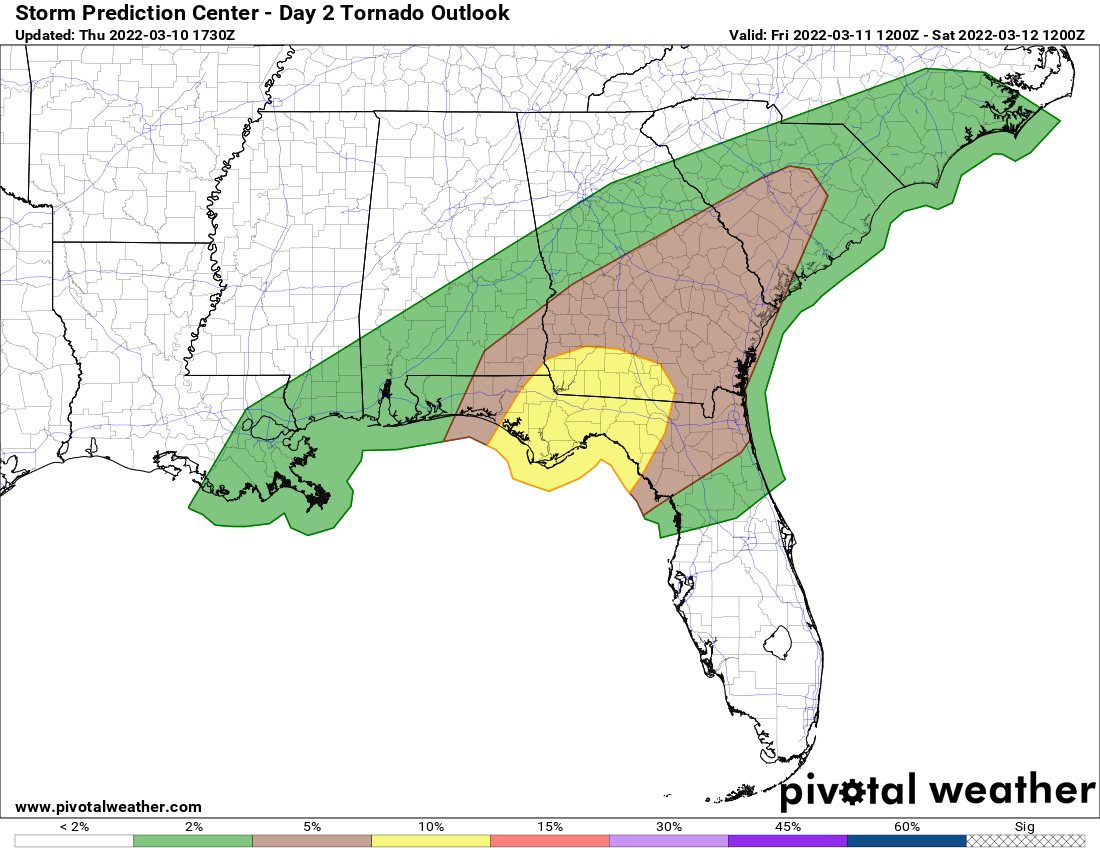
All modes of severe weather are possible including tornadoes. Numerous tornadoes are expected with several tornadoes becoming strong. The highest odds of tornadoes the lower Mississippi Valley but there’s still a substantial tornado risk extending into the mid-Mississippi Valley.
If you live in or near the severe risk areas, make sure you have reliable weather sources to receive weather warnings from and have a plan in place in case a warning is issued for your area.