Tropical Storm developing off the South Carolina/Georgia coasts
A well-defined low pressure is located off the coast of South Carolina. This low pressure has continued to organize with increased shower and thunderstorm activity.
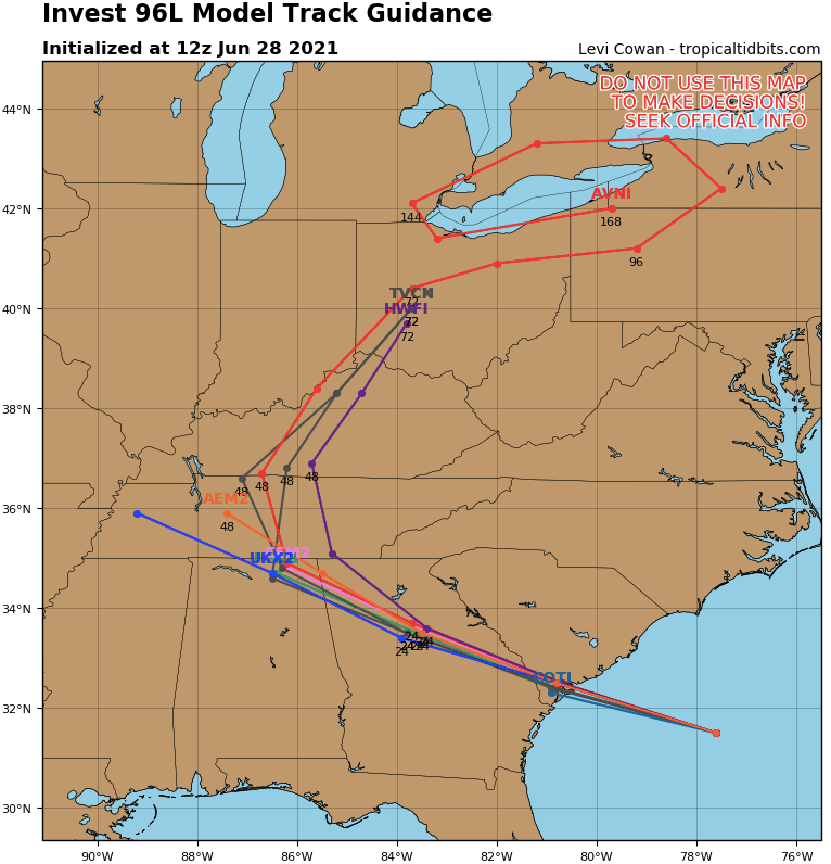
A Tropical Depression or Tropical Storm is likely to develop over the next few hours as the system continues to move west-northwest. The low has a 70% chance to develop into a Tropical Depression or Tropical Storm.
Tropical Storm Warnings are possible for the coasts of South Carolina and Georgia over the next few hours as the system makes landfall late Monday near the South Carolina/Georgia border. Models are in strong agreement the system will make landfall Monday evening just north of the Georgia/South Carolina line. The low pressure will then continue to move west-northwest into Georgia followed by a track into northeastern Alabama by mid-week.
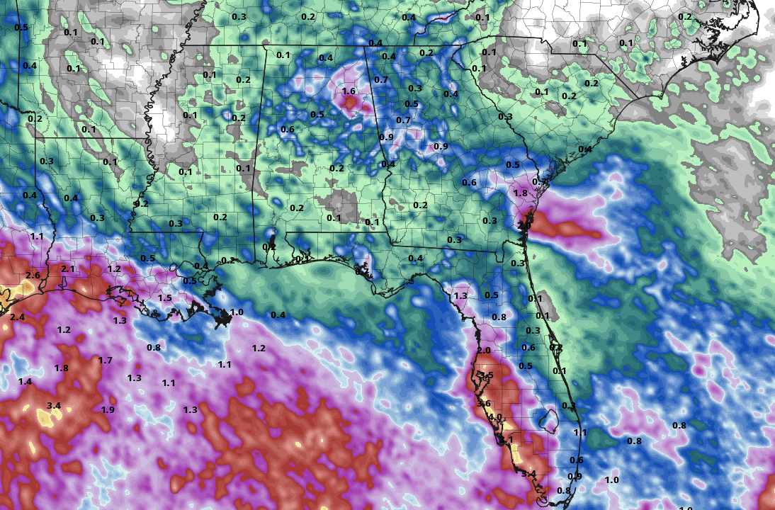
Coastal areas will experience rough seas, rip currents, and beach erosion. The main concern moving inland will be heavy rainfall. 2-5″ of rain can be expected from southeastern South Carolina, eastern Georgia, north and west into central Georgia, and northeastern Alabama over the next 48-hours. Areas of heavy rain will also move into southern Tennessee over the next 48-hours.
Winds gusting up to 35 mph are possible as the system moves west-northwest across the Southeast. The strongest winds will be located near the coast but 30 mph wind gusts are expected across all of South Carolina, Georgia, northeastern Alabama, and southeastern Tennessee Monday night into Tuesday.