Tropical Storm Fred strengthens before making landfall later today
Tropical Storm Fred has continued to organize over the past 24 hours. The organization process has led to an increase in the winds. Fred now has winds of 60 mph and further strengthening is possible. Fred may try to make a run at hurricane status over the next few hours.
Satellite image of Tropical Storm Fred
Fred is expected to make landfall this afternoon in the Florida Panhandle. A landfall near Panama City is most likely a strong tropical storm with winds of 65 to 70 mph. A weak hurricane cannot be ruled out. Fred will race north across eastern Alabama and western Georgia through Tuesday before making it north into eastern Tennessee and eastern Kentucky Wednesday.
Tropical Storm Fred forecast
Where Fred makes landfall, a 3 to 5 feet storm surge is expected for parts of coastal Florida Monday afternoon. A lower storm surge of 1 to 3 feet can be expected as far west as the Alabama coast.
Storm surge forecast
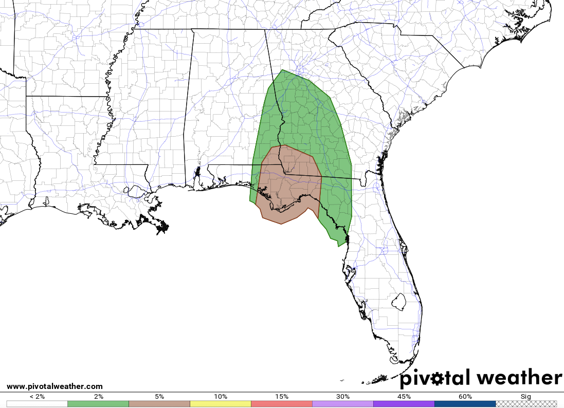
Landfalling tropical systems tend to increase the tornado threat to the north and east of the center and that will be the case with Fred. Isolated tornadoes are possible Monday afternoon and evening across the Florida Panhandle, northern Florida, eastern Alabama, southern Georgia, western Georgia, and central Georgia.
Monday’s tornado threat with Fred
The main concern with Fred is heavy rain that will move inland Monday, and continue Tuesday and Wednesday across the Southeast, Tennessee Valley, and Carolinas. Widespread 2 to 5 inches can be expected with isolated amounts up to 8 inches. This will lead to areas of flash flooding Monday through Wednesday from the Florida Panhandle, eastern Alabama, western Georgia, central Georgia, northern Alabama, eastern Tennessee, upstate South Carolina, central North Carolina, and western North Carolina.
Rainfall forecast
The heavy rain will move into the Mid-Atlantic beyond mid-week as the remnants for Fred continue to move northeast. This will increase the flood threat for this area from mid to late week.