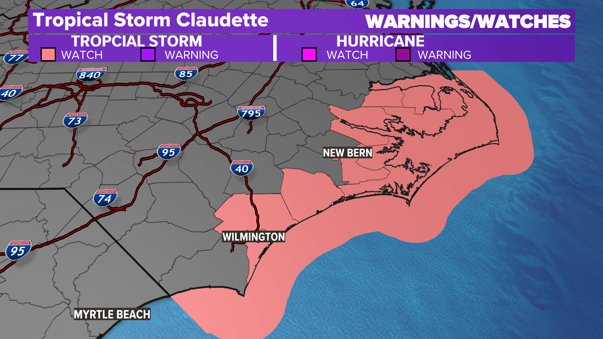
Tropical Storm Watches go up for parts of the Carolinas
Tropical Storm Claudette made landfall in Louisiana Saturday and continues to wreak havoc across parts of the South & Southeast with heavy rainfall, strong winds, and tornadoes.
The impacts from Tropical Storm Claudette are forecast to continue through the weekend into early next week as the system begins to undergo renewed strengthening over the Carolinas, and just off the coast of the Carolinas. The system is forecast to ramp up into a 40 to 45 mph storm near the Carolinas Monday.
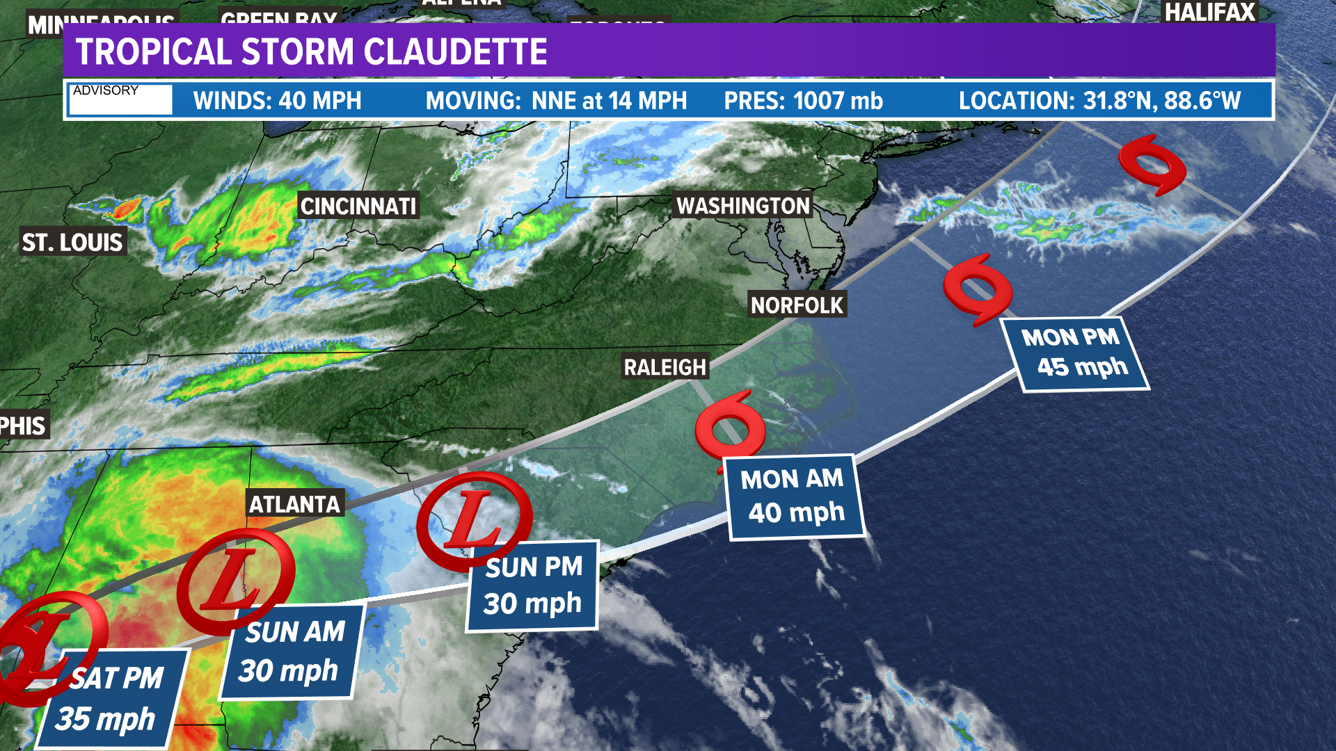
Because of the forecast strengthening, Tropical Storm Watches have been issued for eastern parts of North Carolina. This means Tropical Storm conditions are forecast within the next 48-hours in and near the Watch. These Watches will be upgraded to Warnings and may get expanded, over the next day. Expect Tropical Storm force winds in this area late-Sunday into Monday–winds will gust up to 60 mph.
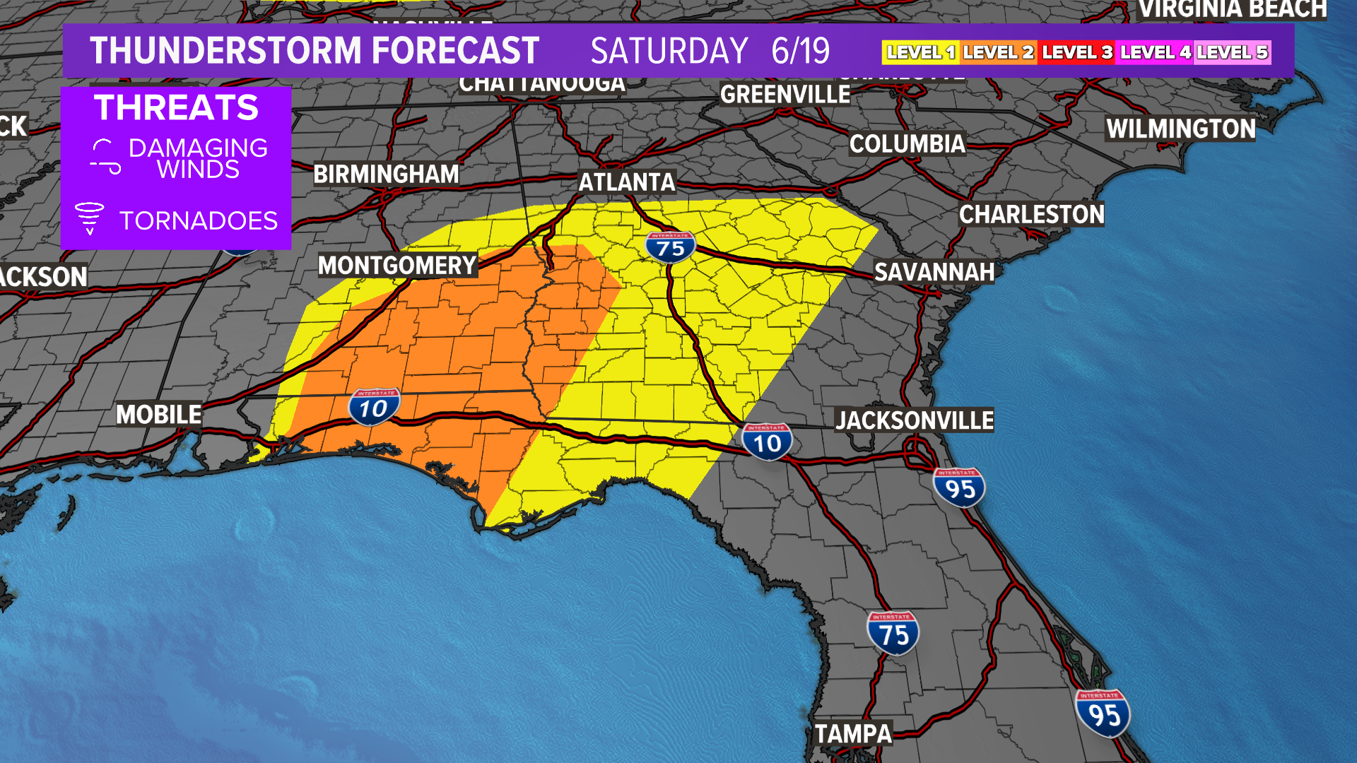
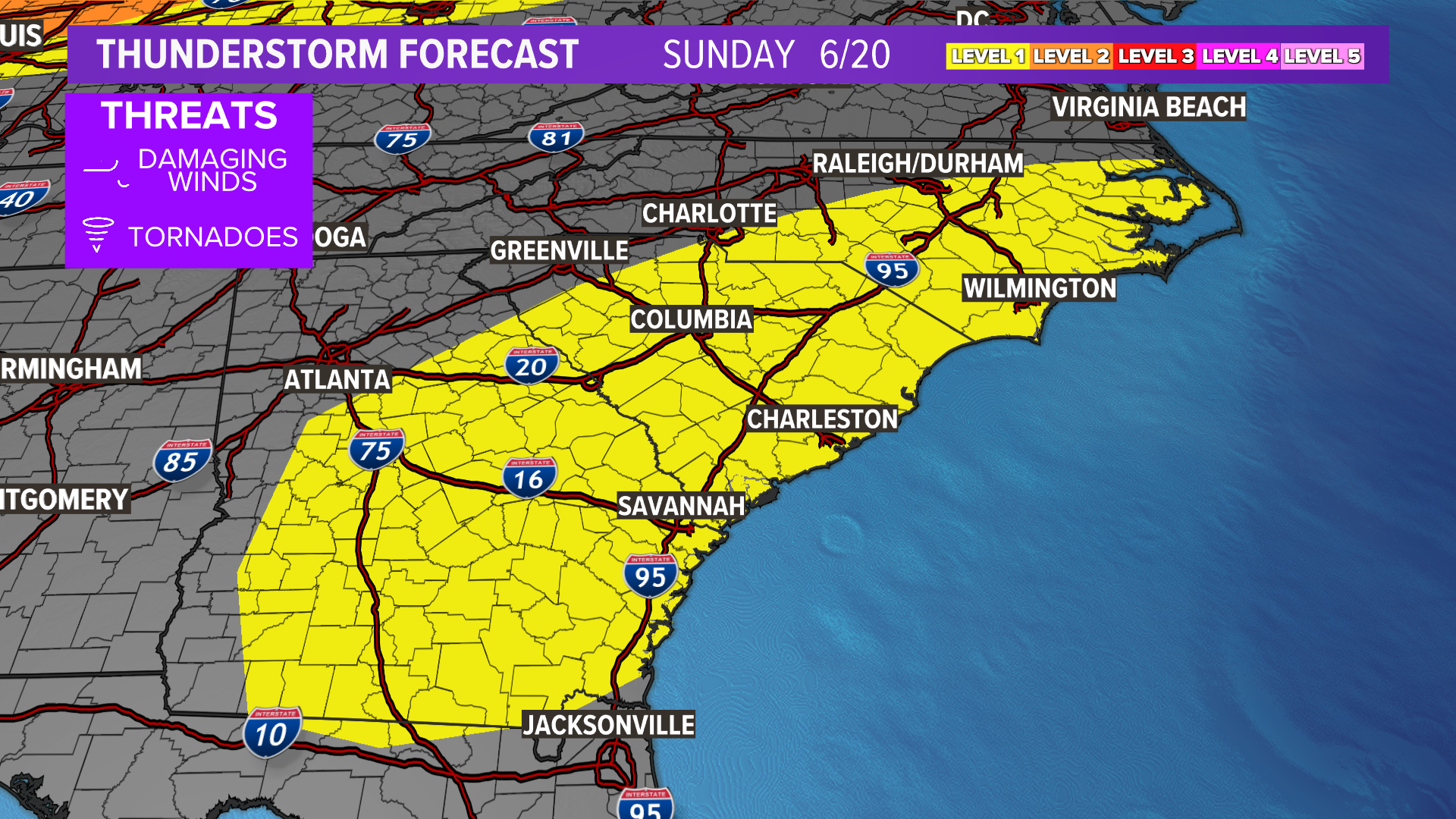
Along with the strong winds from Claudette, isolated tornadoes are expected Saturday and Sunday for parts of the South and Southeast. Tornadoes with the system have already caused substantial damage in parts of Alabama.
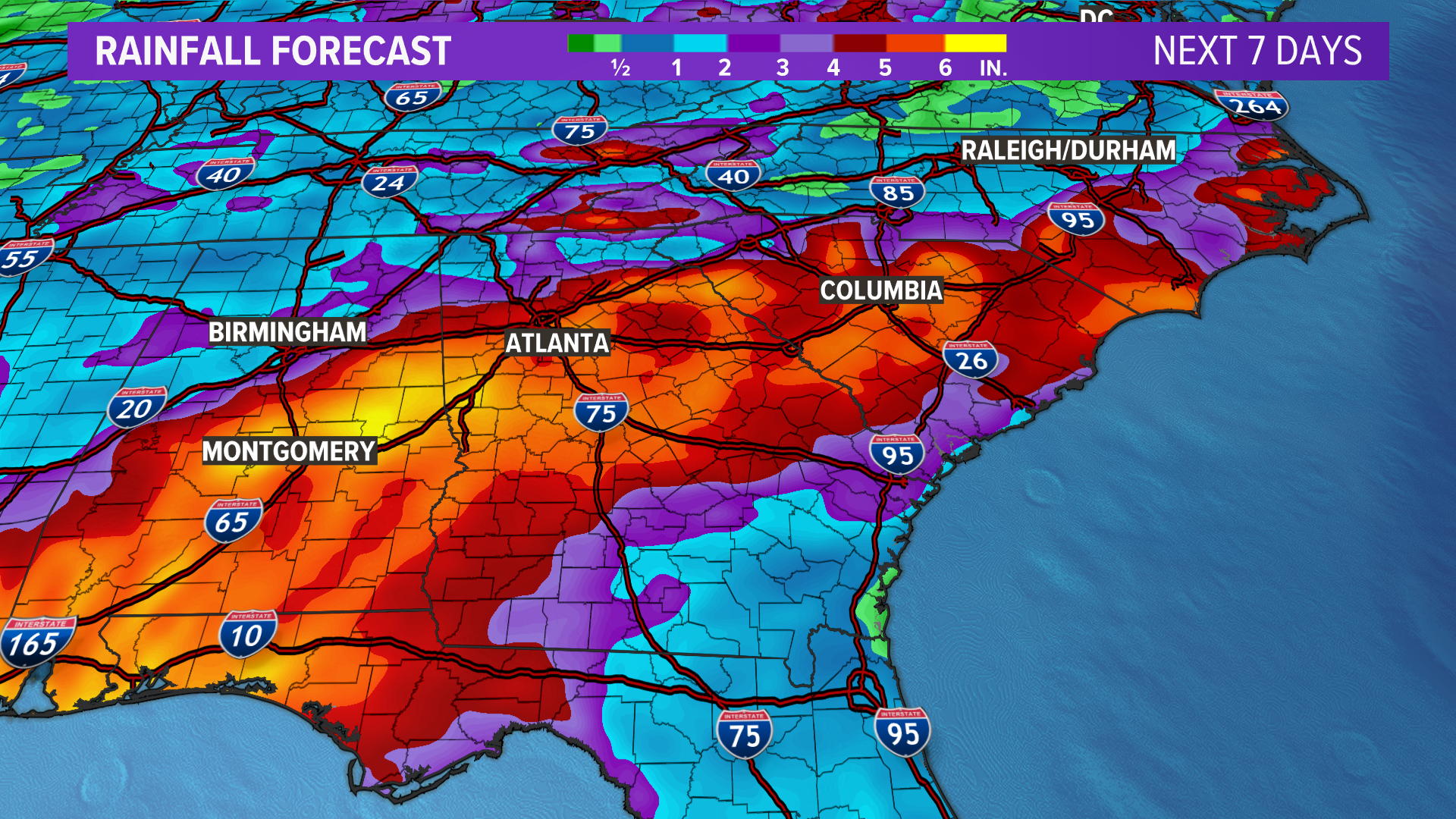
One of the main concerns will be the flood threat with heavy rain expected. The heavy rain threat will shift into the Southeast and Carolinas from Sunday into Monday. A widespread 3-6″ is expected with isolated 8″ amounts. Never cross a road covered by water and be vigilant if you live in a flood-prone area.