Fiona Forecast Becoming More Clear
Though we can never say anything is for certain in the world of weather, Fiona's projected track has become a bit more certain. Let's first discuss what Fiona is currently doing, and then we'll get into the actual forecast.
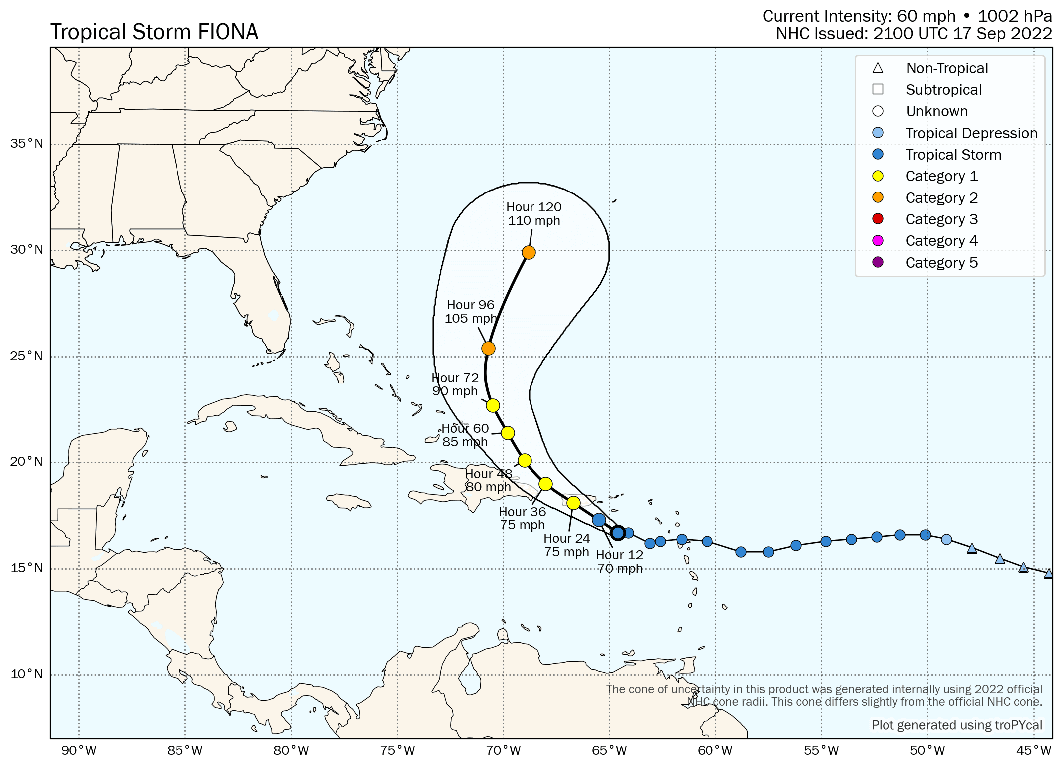
Fionia continues on a west-northwestward track toward Puerto Rico and will bring very heavy rain to the U.S. Territory over the remainder of the weekend. Most of Fiona's heavy thunderstorm activity has remained to the east of its low-level circulation, but currently there are signs Fiona could be strengthening. Microwave satellite imagery indicates that an eyewall may be trying to form, a sign of intensification. Regardless though, it's not unrealistic that rainfall totals could get uncomfortably close to 2 feet over parts of the island.
Many of our readers probably just want (or need) to know if Fiona will impact mainland U.S., and the short answer is not likely. We had some concern a few days ago that a heat ridge building over the central U.S. next week would extend far enough east that FIona would get trapped and steered into the Gulf of Mexico or southeastern U.S. coast. Luckily, a shortwave will pass across the Great Lakes region and New England early in the week. This wave will reinforce a trough that'll keep a pathway open for Fiona to escape between the U.S. heat ridge and a ridge to the storm's east.
If Fiona were to remain weaker into early next week, the system may stay on a northwesterly track for longer, but even still, a eventual turn northward should occur long before any threat to the U.S. occurs. Fiona will really begin to feel the effects of southwesterly or even westerly flow in the mid and upper-levels of the atmosphere early-to-mid week.
We also have strong agreement in the model guidance at this point that Fiona will be a miss for the U.S. In fact, today's guidance has even trended farther to the east. Bermuda should keep an eye on Fiona as a precautionary measure and watch for eastward trends in the forecast guidance.
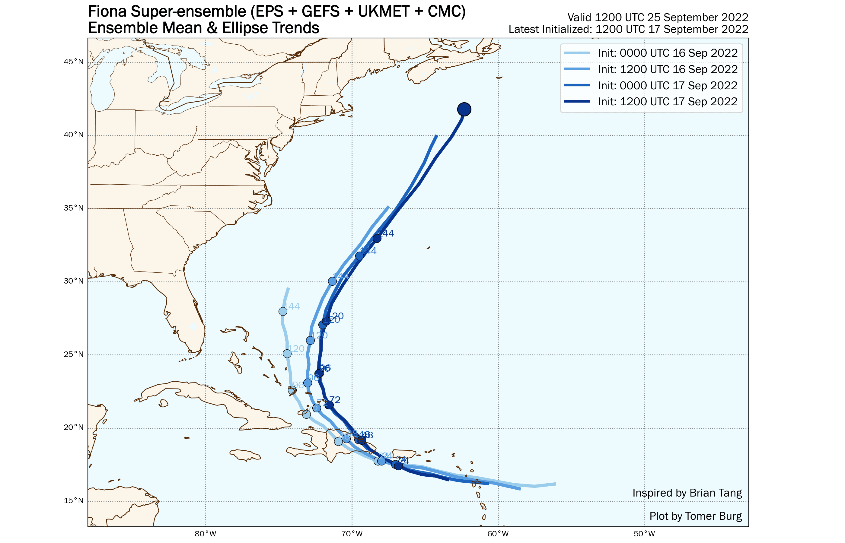
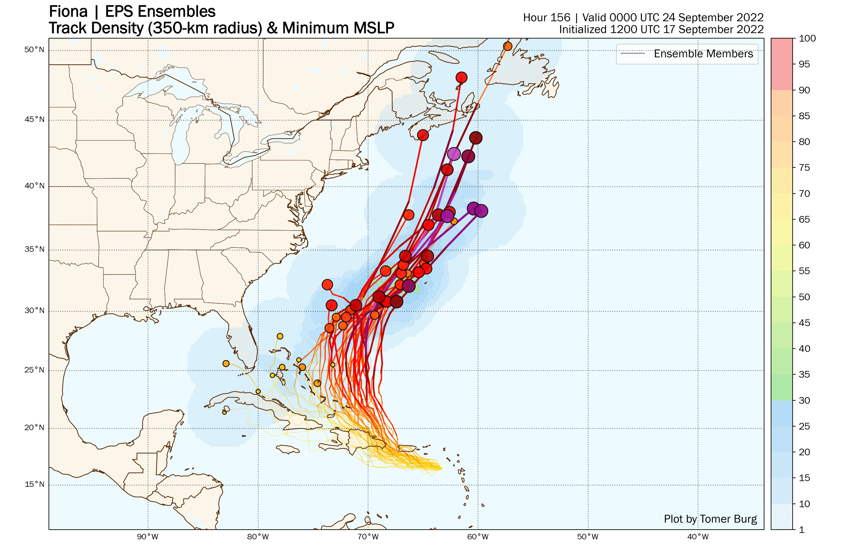
Also, Nova Scotia and Newfoundland should watch Fiona closely. A longwave trough will pass into the Midwest and Great Lakes region mid-week and then potentially dig into the eastern U.S. by late week/early next weekend. Fiona could interact with this trough in such a way that the storm may actually steer back toward eastern Canada. The timing and trough orientation would need to be just right, but model guidance has definitely jumped on this possibility. We'll certainly keep a watch as we approach next weekend.