Ian Likely To Hit Florida Panhandle Or Peninsula
We're still in the process of pinning down exactly where Ian will make landfall in the U.S. this upcoming week. Let me preface this article with a couple of important facts. As of September 25, 11 am ET, Ian remains a sloppy and unorganized tropical storm with 50 mph maximum sustained winds. Ian's low-level circulation is partially exposed, due to a lack of thunderstorm activity over its entire core. It's even possible that its low-level center re-locates under any region of deeper thunderstorm activity in the short term, which would affect Ian's eventual track this week. Thus, I would caution against becoming too fixated on any individual model run, especially over the next 24-36 hours until Ian becomes better organized.
Ian will soon move into an environment favorable for rapid intensification, and we'll probably be looking at a major hurricane in about 2 days. The system currently resides and will remain over sea surface temperatures around 86+°F, plenty warm for rapid strengthening. Also, light wind shear and favorable upper-level outflow will allow Ian to get its act together. I will note that some mid-level dry air exists to Ian's northwest over and near the Yucatan channel, which might delay rapid intensification onset but won't prevent it.
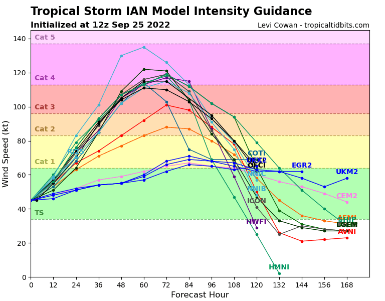
Figure 1: Latest Ian intensity forecast from various models
Will Ian hit the Florida Panhandle or Peninsula?
At the moment, I lean toward a Florida peninsula landfall, and we should eventually begin to see a shift eastward in the GFS guidance to align closer with what the European currently shows. We saw a noteworthy westward trend in the guidance earlier in the weekend, raising concerns that we should focus more on a Florida panhandle impact. However, we're already seeing a trend back eastward. The figure below shows the western trend we observed in yesterday's guidance, but we're seeing a shift back to the east today (the darkest blue line). The Florida peninsula certainly remains a high-risk area.
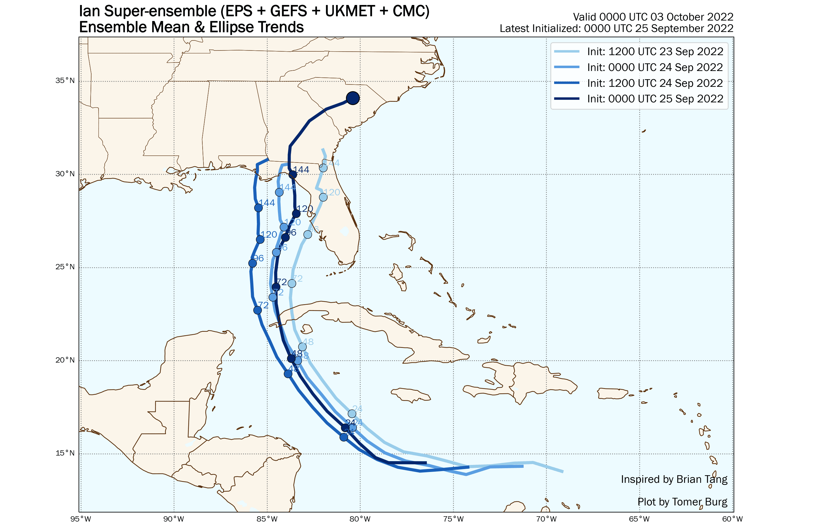
Figure 2: Model superblend forecast over the last four model runs
If we break this down between the GFS and European ensembles, notice the difference we currently see in the guidance. The GFS still favors a panhandle hit, while the European has remained persistent with a peninsula impact.
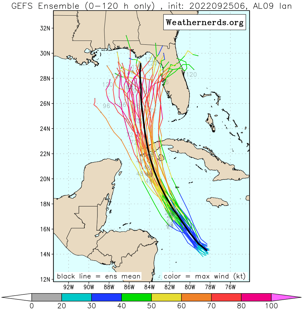
Figure 3: Latest GFS ensemble forecast for Ian with black line depicting ensemble mean
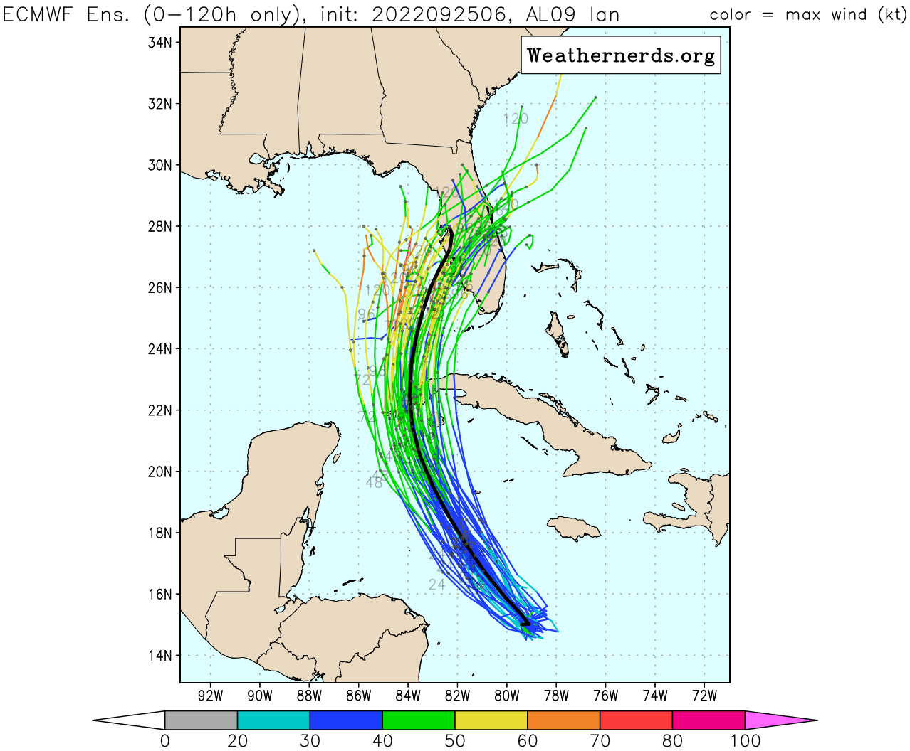
Figure 4: Latest European ensemble forecast for Ian with black line depicting ensemble mean
We're seeing these discrepancies in the guidance due to disagreements on the strength, timing, and exact placement of an eastern U.S. trough. The GFS has trended toward a weaker trough and depicts a quicker departure of an embedded shortwave feature mid-week. As a result, Ian would feel the effects of the trough less, allowing it to move farther northward and hit the panhandle late-week. On the other hand, the European has a more amplified and slower trough, so mid and upper-level southwesterly flow will tug more on Ian causing it to steer toward the Florida peninsula around mid-week. Again, I favor the latter scenario and believe most forecasts will follow suit.
A cold front, associated with the eastern U.S. shortwave, will reach the Gulf coast early in the week and afterward pass through the Florida peninsula. After Ian undergoes rapid intensification, dry air behind the front and heightened wind shear may weaken Ian before landfall but probably less so if Ian impacts the peninsula instead.
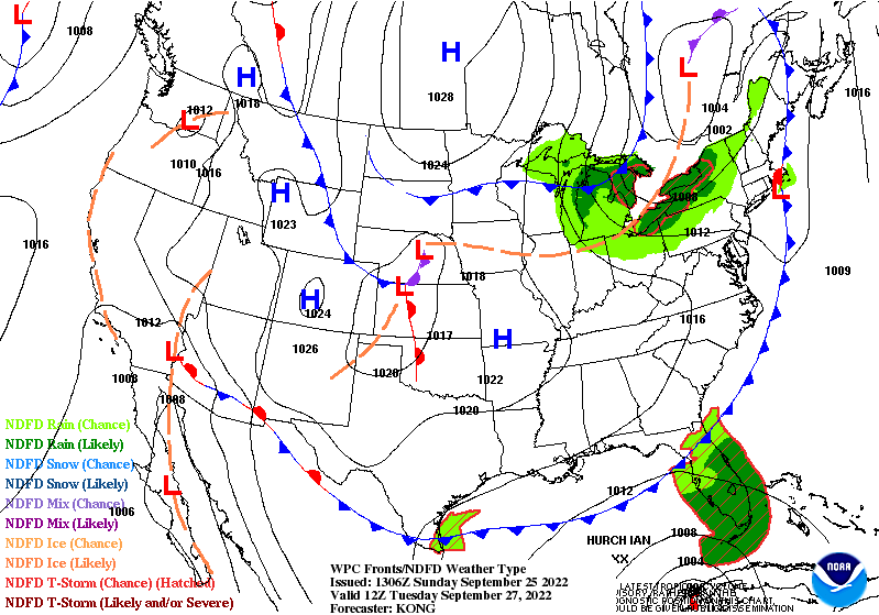
Figure 5: Forecast for Tuesday, September 27, depicting cold front placement
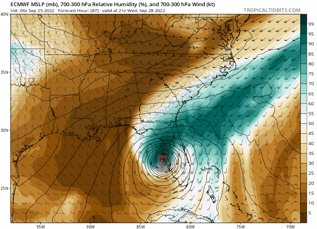
Figure 6: Latest operational European model forecast depicting a Florida peninsula impact with dry air wrapping around the system
We'll keep you updated on Firsthand Weather this upcoming week. Please keep in mind that meteorology is an inexact science, and we may conclude that we need to make significant modifications to our forecast and analysis. Regardless, please continue to prepare for an impactful event to Florida this upcoming week.