Low developing off the Southeast Coast to impact Memorial Day weekend
A developing area of low pressure off the Southeast Coast later this week will bring heavy rain, gusty winds, rough seas, and waterspouts to parts of the Southeast and Mid-Atlantic over Memorial Day weekend.
The low pressure, which is expected to remain non-tropical, is forecast to develop late this week off the coast of Georgia and the Carolinas. It is currently not expected to develop into a tropical cyclone over the coming days with only a 10% chance of development over the next 7 days according to the National Hurricane Center.
NHC 7-Day Tropical Outlook
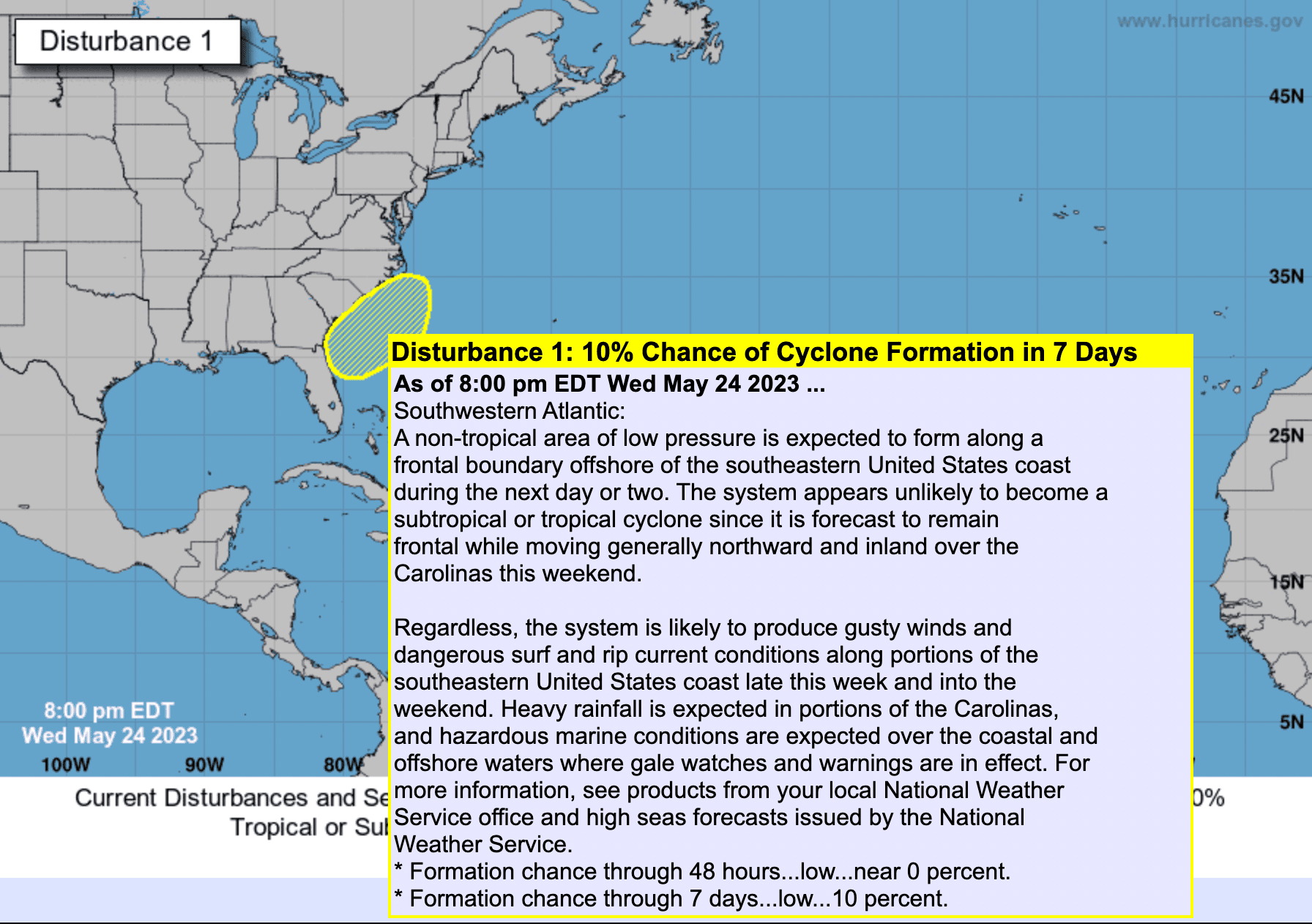
While water temperatures off the coast are unusually warm, wind shear and the development of this low along a frontal system are expected to hinder any potential transformation into a tropical entity.
Regardless of this system not becoming tropical in nature, it will still bring widespread impacts to the Southeast and Mid-Atlantic during a busy weekend as the low pressure just slowly meanders off the coast of the Carolinas before moving inland over the weekend.
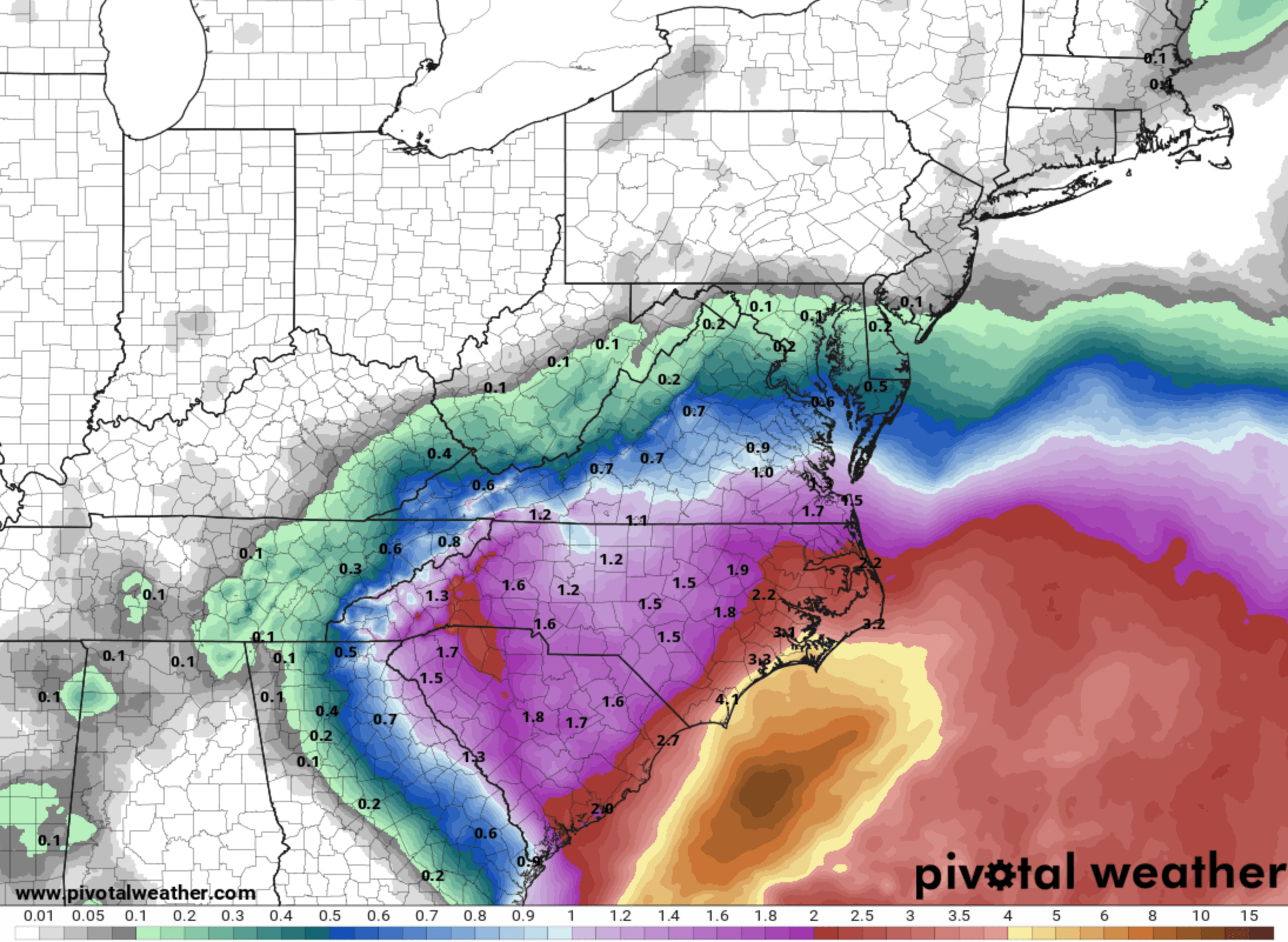
The heaviest rain looks to fall from northeast Georgia into the Carolinas and southern Virginia. This is where heavy downpours will impact Memorial Weekend plans, especially for coastal areas. Coastal areas will also see rough seas and rip currents and there's an increased risk for waterspouts. Gusty winds are also possible near the coast and the low pressure moves inland over the weekend.
7-Day Rainfall Forecast
Firsthand Weather will continue to monitor this developing system for any changes in the current forecast.