Tropical troubles brewing off the Carolina coast
The Atlantic is quiet right now but that could change over the next few days.
An upper-level trough will dig south across the East Coast of the lower-48 over the weekend, sending a cold front south into the Mid-Atlantic and Carolinas.
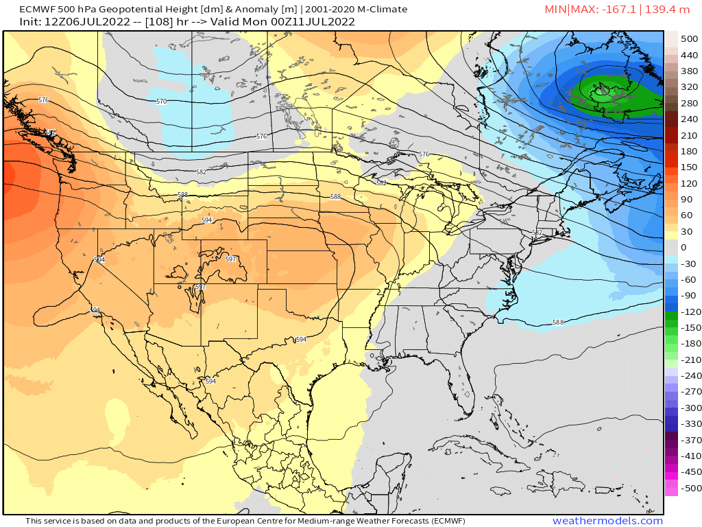
This trough and associated cold front placement could be the perfect tropical breeding environment as an area of low pressure develops near the Carolinas coast.
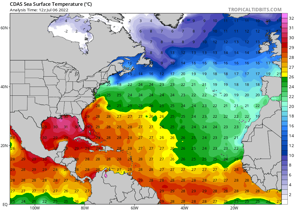
The developing area of low pressure could acquire tropical characteristics as it encounters the warm waters of the Gulf Stream and an environment with minimal shear.
There's increased support from the guidance of the low pressure becoming tropical as it moves off the coast of the Carolinas late weekend into early next week.
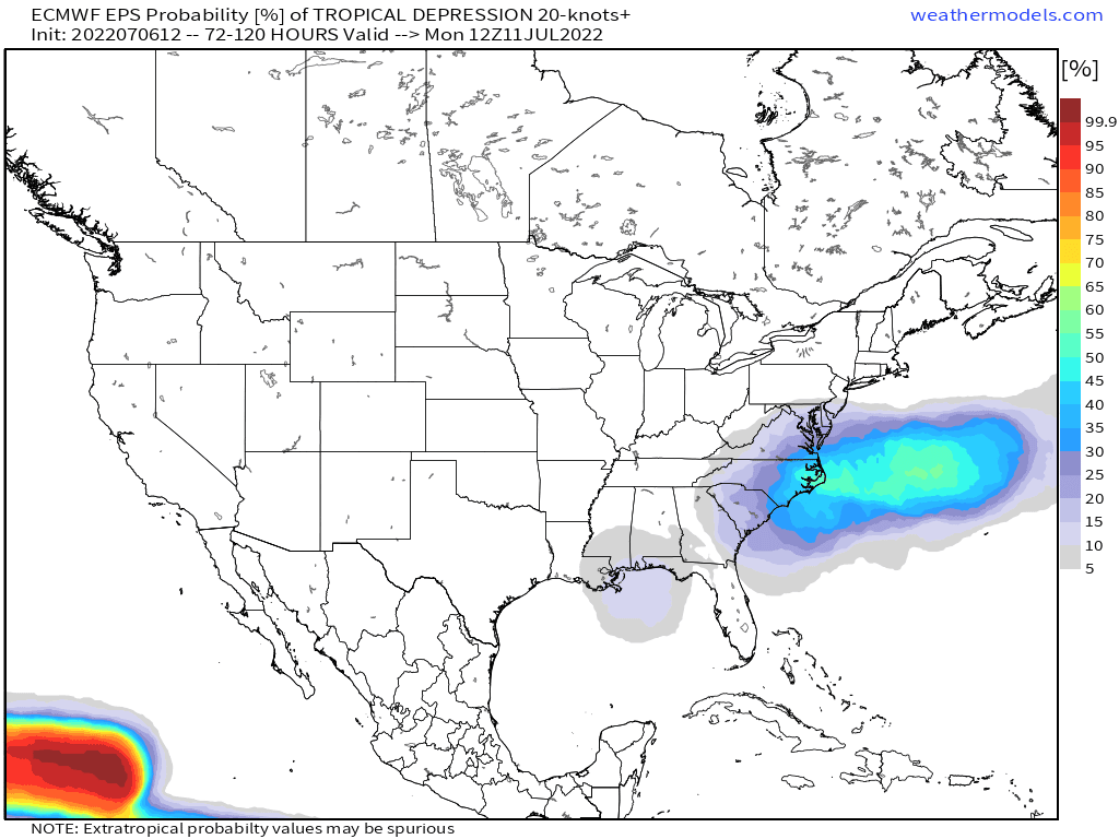
If this system develops into a tropical cyclone, it'll likely remain weak and move away from the U.S.
Regardless of the system moving away from the Carolinas coast, increased rain chances are expected this weekend for the Mid-Atlantic and Carolinas as the aforementioned cold front moves through the region.