A potent nor'easter will slam New England this week
A potent winter storm will slam the Northeast beginning Monday with impacts continuing Tuesday and into Wednesday bringing heavy snow, strong winds, and coastal flooding.
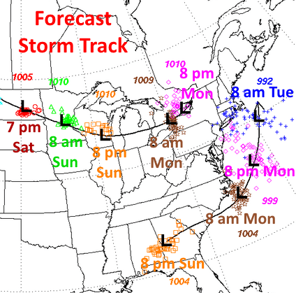
The nor'easter will have the biggest impacts late Monday and throughout the day Tuesday across the Northeast. While there are still some questions about the track of the system and the timing of the intensity, extreme impacts are forecast for parts of New England. The exact track will be crucial in just how big the impacts are for the I-95 corridor. The closer the storm track to the coast, the farther west away from I-95 the worst impacts will be; whereas, if the storm tracks a little farther away from the coast, it'll shift the bigger impacts east toward the I-95 corridor across the Northeast.
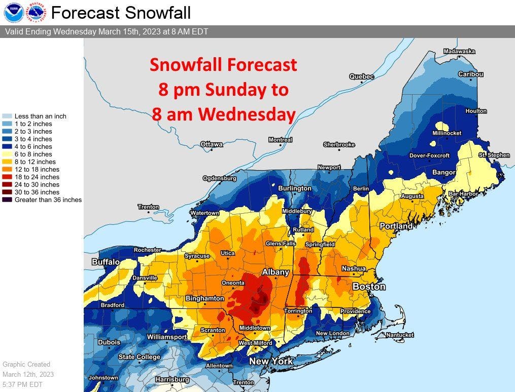
The current forecast calls for significant, widespread wet snow accumulations from New York into New England. This is where a widespread half a foot to a foot of snow is expected with some isolated areas receiving two feet or more of snow. The current forecast track would allow for New York City to get 1 to 3 inches of snow and Boston to see 4 to 8 inches of snow.
Snowfall forecast through Wednesday morning
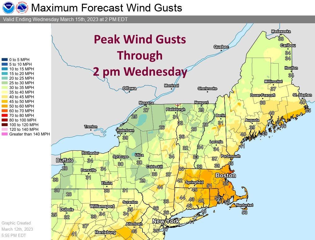
Strong wind gusts are also possible as the system intensifies off the coast of New England. Wind gusts could approach 40 mph in New York City and potentially 55 mph in Boston with coastal areas approaching 60 mph. Gusts this high will cause power outages and help contribute to coastal flooding due to the strong onshore winds and lower atmospheric pressure over the region.
Numerous weather alerts are in effect for the region including Winter Storm Warnings, High Wind Watches, and Coastal Flood Advisories.